TopoQuest Logo
Do you find TopoQuest useful?
Help keep TopoQuest running and adding new maps/features by donating!
Bitcoin:  19c7KJd3qBynnjoSw5npx9KScwjBe4ifkT
Litecoin:  LXs6TkuXGGXo1vDsWCkWVdjQX94eUKd6ui
Home View Maps Find Maps Find Places Resources & Links


Viburnum West, Missouri Topographic Map

USGS Map Title: Viburnum West, MO
USGS Map MRC: 37091F2
DRG (GeoTIFF) Download: o37091f2.tif


Neighboring USGS Topographic Map Quads:


  Cherryville, MO  
37091G3
 

  Davisville, MO  
37091G2
 

  Courtois, MO  
37091G1
 

  Howes Mill Spring, MO  
37091F3
 

  Viburnum West, MO  
37091F2
 

  Viburnum East, MO  
37091F1
 

  Stone Hill, MO  
37091E3
 

  Greeley, MO  
37091E2
 

  Oates, MO  
37091E1


Map MRC Location:

N38°
W92°
N38°
W91°
H8 H7 H6 H5 H4 H3 H2 H1
G8 G7 G6 G5 G4 G3 G2 G1
F8 F7 F6 F5 F4 F3 F2 F1
E8 E7 E6 E5 E4 E3 E2 E1
D8 D7 D6 D5 D4 D3 D2 D1
C8 C7 C6 C5 C4 C3 C2 C1
B8 B7 B6 B5 B4 B3 B2 B1
A8 A7 A6 A5 A4 A3 A2 A1
N37°
W92°
N37°
W91°

Viburnum West, MO USGS 1:24K Topographic Map Preview:
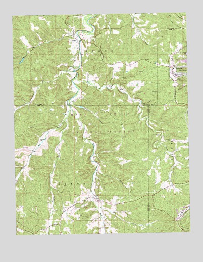
Viburnum West, MO USGS Topographic Map
Click on map above to begin viewing in our Map Viewer.

This topographic map contains these locations and features:
Feature Name Type Latitude Longitude GNIS ID View Map
Amax Impoundment A DamDamN37.6384°W91.1351°765497View Map
Barney CreekStreamN37.6909°W91.2124°748682View Map
Bates HollowValleyN37.6728°W91.2365°753288View Map
Beefsteak HollowValleyN37.7012°W91.2082°748766View Map
Big BranchStreamN37.6398°W91.1924°714133View Map
Bills HollowValleyN37.7062°W91.1718°748863View Map
BossPopulated PlaceN37.6431°W91.1893°748967View Map
Boss CemeteryCemeteryN37.6444°W91.1912°2725608View Map
Boss Post OfficePost OfficeN37.6453°W91.1935°2782923View Map
Cabin HollowValleyN37.7012°W91.1635°749151View Map
CCC Camp Boss (historical)LocaleN37.6334°W91.1629°735468View Map
Chandler HollowValleyN37.7267°W91.2421°753291View Map
City of ViburnumCivilN37.7149°W91.1295°2397133View Map
Crooked CreekStreamN37.7143°W91.2050°749527View Map
DillardPopulated PlaceN37.7367°W91.2043°749659View Map
Dillard CemeteryCemeteryN37.7200°W91.2046°749660View Map
Dillard CemeteryCemeteryN37.7395°W91.2071°749661View Map
Dillard HillSummitN37.7478°W91.2129°736603View Map
Dillard Mill State Historic SiteParkN37.7175°W91.2068°1901265View Map
Dillard School (historical)SchoolN37.7273°W91.2035°736604View Map
Dotson School (historical)SchoolN37.6714°W91.1926°747894View Map
East Fork Huzzah CreekStreamN37.6973°W91.2087°749775View Map
Fiebelman CemeteryCemeteryN37.6787°W91.2318°749914View Map
Hedrick CemeteryCemeteryN37.6806°W91.1460°750281View Map
Indian CreekStreamN37.7173°W91.2060°750452View Map
James BranchStreamN37.7392°W91.2032°750495View Map
Little BranchStreamN37.6987°W91.1593°750737View Map
Lost LakeLakeN37.7250°W91.2431°754380View Map
Lower Viburnum SchoolSchoolN37.7220°W91.1696°747893View Map
Maple Grove CemeteryCemeteryN37.7084°W91.1801°750922View Map
Maple Grove Missionary Baptist Church (historical)ChurchN37.7081°W91.1810°736602View Map
Moloc SmelterLocaleN37.6339°W91.1332°754381View Map
Mononame 352 DamDamN37.7250°W91.2418°764357View Map
Mononame 41 DamDamN37.6384°W91.1268°764703View Map
Mononame 807 DamDamN37.6367°W91.1351°764789View Map
Mononame 808 DamDamN37.6384°W91.1301°764790View Map
Powell HollowValleyN37.6959°W91.2490°753289View Map
Quad County Fire Protection District Boss StationBuildingN37.6436°W91.1895°2620586View Map
Quad County Fire Protection District Main StationBuildingN37.7108°W91.1339°2620381View Map
Red PointPopulated PlaceN37.6475°W91.1490°736605View Map
Reuben Smith Iron BankMineN37.7425°W91.2079°736601View Map
Richards CemeteryCemeteryN37.6770°W91.1379°751864View Map
Rocky Ford School (historical)SchoolN37.6689°W91.2387°747892View Map
Rooney HollowValleyN37.6637°W91.2443°753287View Map
Tinker HollowValleyN37.6609°W91.1904°752548View Map
Todd HollowValleyN37.6998°W91.2412°753290View Map
Township of OsageCivilN37.6444°W91.2325°766606View Map
ViburnumPopulated PlaceN37.7153°W91.1351°752704View Map
Viburnum AirportAirportN37.7191°W91.1313°758978View Map
Viburnum Police DepartmentBuildingN37.7141°W91.1354°2752547View Map
West Fork Huzzah CreekStreamN37.6973°W91.2087°752820View Map

Note: Coordinates in the location and feature list above are referenced to NAD83 datum.


Copyright (C) 2008-2025 Ryan Niemi / Sunset Dynamics ... All Rights Reserved