TopoQuest Logo
Do you find TopoQuest useful?
Help keep TopoQuest running and adding new maps/features by donating!
Bitcoin:  19c7KJd3qBynnjoSw5npx9KScwjBe4ifkT
Litecoin:  LXs6TkuXGGXo1vDsWCkWVdjQX94eUKd6ui
Home View Maps Find Maps Find Places Resources & Links


Vine Grove, Kentucky Topographic Map

USGS Map Title: Vine Grove, KY
USGS Map MRC: 37085G8
DRG (GeoTIFF) Download: o37085g8.tif


Neighboring USGS Topographic Map Quads:


  Rock Haven, KY  
37086H1
 

  Fort Knox, KY  
37085H8
 

  Pitts Point, KY  
37085H7
 

  Flaherty, KY  
37086G1
 

  Vine Grove, KY  
37085G8
 

  Colesburg, KY  
37085G7
 

  Howe Valley, KY  
37086F1
 

  Cecilia, KY  
37085F8
 

  Elizabethtown, KY  
37085F7


Map MRC Location:

N38°
W86°
N38°
W85°
H8 H7 H6 H5 H4 H3 H2 H1
G8 G7 G6 G5 G4 G3 G2 G1
F8 F7 F6 F5 F4 F3 F2 F1
E8 E7 E6 E5 E4 E3 E2 E1
D8 D7 D6 D5 D4 D3 D2 D1
C8 C7 C6 C5 C4 C3 C2 C1
B8 B7 B6 B5 B4 B3 B2 B1
A8 A7 A6 A5 A4 A3 A2 A1
N37°
W86°
N37°
W85°

Vine Grove, KY USGS 1:24K Topographic Map Preview:
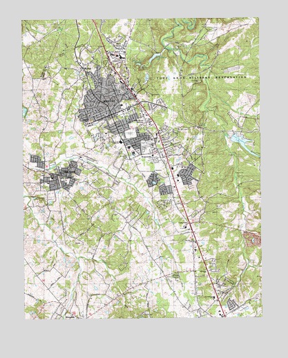
Vine Grove, KY USGS Topographic Map
Click on map above to begin viewing in our Map Viewer.

This topographic map contains these locations and features:
Feature Name Type Latitude Longitude GNIS ID View Map
Buffalo BranchStreamN37.8592°W85.9027°488303View Map
City of RadcliffCivilN37.8195°W85.9359°2404586View Map
City of Vine GroveCivilN37.8130°W85.9827°2405656View Map
Cowley CemeteryCemeteryN37.8609°W85.9222°490205View Map
Crutcher (historical)Populated PlaceN37.7902°W85.9058°2742462View Map
Dietz AcresPopulated PlaceN37.8656°W85.9500°490890View Map
Dorrets RunStreamN37.8442°W85.9011°491016View Map
Douglas BranchStreamN37.8262°W85.8939°491058View Map
DuganPopulated PlaceN37.7950°W85.9800°2742463View Map
Duvall ParkParkN37.8231°W85.9358°509525View Map
Falling SpringsSpringN37.8308°W85.9070°491957View Map
Gunning CemeteryCemeteryN37.8037°W85.9005°493500View Map
Ireland (historical)Populated PlaceN37.7858°W85.9571°2742465View Map
Kentucky Veterans Cemetery CentralCemeteryN37.8677°W85.9599°2775094View Map
Koinonia ChurchChurchN37.7692°W85.9044°509515View Map
Lincoln Memorial CemeteryCemeteryN37.8487°W85.9061°496554View Map
Lincoln Trail Behavioral SystemsHospitalN37.7878°W85.9148°2660334View Map
Long ViewPopulated PlaceN37.7895°W85.9130°508502View Map
Long View ChurchChurchN37.7820°W85.9105°497147View Map
Longview EstatesPopulated PlaceN37.7707°W85.9003°2742472View Map
Lower Douglas LakeReservoirN37.8228°W85.8848°509518View Map
McKendree CollegeSchoolN37.8317°W85.9661°509522View Map
Meadow View SchoolSchoolN37.8270°W85.9564°509524View Map
Mill Creek Baptist ChurchChurchN37.8287°W85.9178°498273View Map
Mill Creek BranchStreamN37.7717°W85.8822°498269View Map
Mount Zion ChurchChurchN37.7603°W85.8933°498940View Map
New Highlands SchoolSchoolN37.7587°W85.8991°509523View Map
New Hope ChurchChurchN37.8342°W85.9550°509516View Map
North Hardin High SchoolSchoolN37.8234°W85.9491°509520View Map
North Hardin Memorial GardensCemeteryN37.8192°W85.9461°509517View Map
Owens CemeteryCemeteryN37.8103°W85.8883°500069View Map
Parkway SchoolSchoolN37.8215°W85.9441°509521View Map
Pawley CreekStreamN37.7751°W85.9714°500281View Map
RadcliffPopulated PlaceN37.8403°W85.9491°501516View Map
Radcliff Fire Department HeadquartersBuildingN37.8338°W85.9353°2636613View Map
Radcliff Fire Department Station 2BuildingN37.7855°W85.9120°2636894View Map
Radcliff Police DepartmentBuildingN37.8391°W85.9445°2767790View Map
Radcliff SchoolSchoolN37.8267°W85.9294°501517View Map
Radcliff Square Shopping CenterLocaleN37.8427°W85.9366°2460282View Map
Red HillPopulated PlaceN37.8556°W85.9675°508912View Map
Red Hill ChurchChurchN37.8503°W85.9682°501659View Map
Rineyville CemeteryCemeteryN37.7551°W85.9805°501961View Map
Rineyville Census Designated PlaceCensusN37.7502°W85.9703°2629671View Map
Rineyville Fire DepartmentBuildingN37.7505°W85.9711°2636876View Map
RogersvillePopulated PlaceN37.8203°W85.9289°502283View Map
Saint Brigids CemeteryCemeteryN37.8001°W85.9875°502592View Map
Saint Brigids SchoolSchoolN37.8084°W85.9772°502593View Map
Saint Christophers ChurchChurchN37.8248°W85.9316°502604View Map
Sander Spring LakeLakeN37.8593°W85.9300°509519View Map
Sanders Spring ReservoirReservoirN37.8560°W85.9382°502953View Map
Shelton CemeteryCemeteryN37.8128°W85.9069°503336View Map
Shelton CemeteryCemeteryN37.8356°W85.9250°503337View Map
Stithon CemeteryCemeteryN37.8670°W85.9450°504435View Map
Stithon ChurchChurchN37.8453°W85.9422°504436View Map
Stovall ChurchChurchN37.8173°W85.9455°504538View Map
Sunset LakeLakeN37.8065°W85.9310°504805View Map
Twin LakesReservoirN37.8254°W85.9087°505717View Map
Valley View ChurchChurchN37.8142°W85.9669°509514View Map
Vine GrovePopulated PlaceN37.8101°W85.9814°506053View Map
Vine Grove AirportAirportN37.8158°W85.9654°517499View Map
Vine Grove Fire DepartmentBuildingN37.8150°W85.9722°2636669View Map
Vine Grove JunctionPopulated PlaceN37.8320°W85.9347°506054View Map
Vine Grove Police DepartmentBuildingN37.8098°W85.9844°2767617View Map
WASE-FM (Fort Knox)TowerN37.8517°W85.9458°517943View Map
WASE-FM (Fort Knox)TowerN37.7826°W85.9105°517944View Map
WBUL-AM (Fort Knox)TowerN37.8517°W85.9458°517808View Map

Note: Coordinates in the location and feature list above are referenced to NAD83 datum.


Copyright (C) 2008-2025 Ryan Niemi / Sunset Dynamics ... All Rights Reserved