TopoQuest Logo
Do you find TopoQuest useful?
Help keep TopoQuest running and adding new maps/features by donating!
Bitcoin:  19c7KJd3qBynnjoSw5npx9KScwjBe4ifkT
Litecoin:  LXs6TkuXGGXo1vDsWCkWVdjQX94eUKd6ui
Home View Maps Find Maps Find Places Resources & Links


Waldron, Indiana Topographic Map

USGS Map Title: Waldron, IN
USGS Map MRC: 39085D6
DRG (GeoTIFF) Download: o39085d6.tif


Neighboring USGS Topographic Map Quads:


  Shelbyville, IN  
39085E7
 

  Rays Crossing, IN  
39085E6
 

  Manilla, IN  
39085E5
 

  Lewis Creek, IN  
39085D7
 

  Waldron, IN  
39085D6
 

  Adams, IN  
39085D5
 

  Hope, IN  
39085C7
 

  Hartsville, IN  
39085C6
 

  Forest Hill, IN  
39085C5


Map MRC Location:

N40°
W86°
N40°
W85°
H8 H7 H6 H5 H4 H3 H2 H1
G8 G7 G6 G5 G4 G3 G2 G1
F8 F7 F6 F5 F4 F3 F2 F1
E8 E7 E6 E5 E4 E3 E2 E1
D8 D7 D6 D5 D4 D3 D2 D1
C8 C7 C6 C5 C4 C3 C2 C1
B8 B7 B6 B5 B4 B3 B2 B1
A8 A7 A6 A5 A4 A3 A2 A1
N39°
W86°
N39°
W85°

Waldron, IN USGS 1:24K Topographic Map Preview:
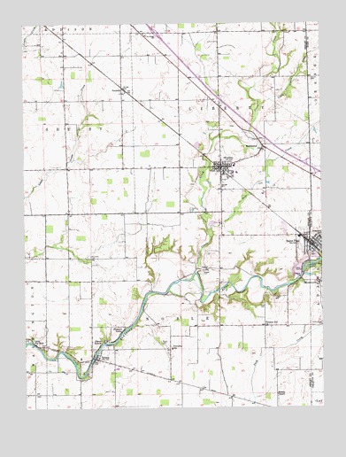
Waldron, IN USGS Topographic Map
Click on map above to begin viewing in our Map Viewer.

This topographic map contains these locations and features:
Feature Name Type Latitude Longitude GNIS ID View Map
Blue RidgeLocaleN39.4967°W85.6991°449851View Map
Blue Ridge Post Office (historical)Post OfficeN39.4967°W85.6991°452987View Map
Camp Flat RockPopulated PlaceN39.3970°W85.7472°432032View Map
Conns CreekStreamN39.4189°W85.6783°432891View Map
Deer CreekStreamN39.4334°W85.6728°433425View Map
Fischer FieldAirportN39.4655°W85.7052°2676969View Map
Floyd CemeteryCemeteryN39.3949°W85.7428°434616View Map
GenevaPopulated PlaceN39.3917°W85.7200°435013View Map
GermantownPopulated PlaceN39.4153°W85.6264°447643View Map
Little Conns CreekStreamN39.4728°W85.6503°438018View Map
Means CemeteryCemeteryN39.3960°W85.6915°438952View Map
MiddletownPopulated PlaceN39.4600°W85.6489°439116View Map
MorvenPopulated PlaceN39.4228°W85.6611°449037View Map
Pleasant Hill ChurchChurchN39.4014°W85.6486°441278View Map
Pleasure ValleyPopulated PlaceN39.4009°W85.7086°441357View Map
PrescottPopulated PlaceN39.4792°W85.7083°441576View Map
Reed CemeteryCemeteryN39.4088°W85.6494°441848View Map
Saint PaulPopulated PlaceN39.4281°W85.6283°442758View Map
Saint Paul Police DepartmentBuildingN39.4282°W85.6285°2758412View Map
Saint Paul QuarryMineN39.4350°W85.6431°2649693View Map
Saint Paul Volunteer Fire DepartmentBuildingN39.4283°W85.6285°2625660View Map
Saint Vincent SchoolSchoolN39.4964°W85.6980°442858View Map
Simmons CemeteryCemeteryN39.4246°W85.7220°443521View Map
Sleepy HollowPopulated PlaceN39.3967°W85.7175°443601View Map
Town of Saint PaulCivilN39.4279°W85.6287°2396900View Map
Township of LibertyCivilN39.4819°W85.6668°453561View Map
Township of NobleCivilN39.3943°W85.6859°453674View Map
Valley ChurchChurchN39.4198°W85.6725°445194View Map
Van Pelt CemeteryCemeteryN39.4191°W85.6753°445233View Map
Vienna CemeteryCemeteryN39.4824°W85.6294°445286View Map
WaldronPopulated PlaceN39.4537°W85.6669°445366View Map
Waldron Census Designated PlaceCensusN39.4536°W85.6629°2629854View Map
Waldron Elementary SchoolSchoolN39.4537°W85.6614°447111View Map
Waldron Junior-Senior High SchoolSchoolN39.4514°W85.6605°447112View Map
Waldron Volunteer Fire DepartmentBuildingN39.4537°W85.6662°2625505View Map
Wesley ChapelChurchN39.3795°W85.6436°445698View Map
Whelen AirportAirportN39.4915°W85.6481°2676968View Map

Note: Coordinates in the location and feature list above are referenced to NAD83 datum.


Copyright (C) 2008-2025 Ryan Niemi / Sunset Dynamics ... All Rights Reserved