TopoQuest Logo
Do you find TopoQuest useful?
Help keep TopoQuest running and adding new maps/features by donating!
Bitcoin:  19c7KJd3qBynnjoSw5npx9KScwjBe4ifkT
Litecoin:  LXs6TkuXGGXo1vDsWCkWVdjQX94eUKd6ui
Home View Maps Find Maps Find Places Resources & Links


Shelbyville, Indiana Topographic Map

USGS Map Title: Shelbyville, IN
USGS Map MRC: 39085E7
DRG (GeoTIFF) Download: o39085e7.tif


Neighboring USGS Topographic Map Quads:


  Acton, IN  
39085F8
 

  Fountaintown, IN  
39085F7
 

  Morristown, IN  
39085F6
 

  Boggstown, IN  
39085E8
 

  Shelbyville, IN  
39085E7
 

  Rays Crossing, IN  
39085E6
 

  Marietta, IN  
39085D8
 

  Lewis Creek, IN  
39085D7
 

  Waldron, IN  
39085D6


Map MRC Location:

N40°
W86°
N40°
W85°
H8 H7 H6 H5 H4 H3 H2 H1
G8 G7 G6 G5 G4 G3 G2 G1
F8 F7 F6 F5 F4 F3 F2 F1
E8 E7 E6 E5 E4 E3 E2 E1
D8 D7 D6 D5 D4 D3 D2 D1
C8 C7 C6 C5 C4 C3 C2 C1
B8 B7 B6 B5 B4 B3 B2 B1
A8 A7 A6 A5 A4 A3 A2 A1
N39°
W86°
N39°
W85°

Shelbyville, IN USGS 1:24K Topographic Map Preview:
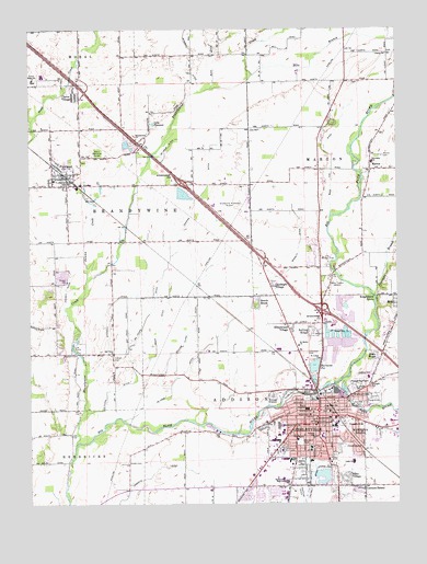
Shelbyville, IN USGS Topographic Map
Click on map above to begin viewing in our Map Viewer.

This topographic map contains these locations and features:
Feature Name Type Latitude Longitude GNIS ID View Map
Bass Fox DitchCanalN39.5909°W85.7719°430559View Map
Bassett DitchCanalN39.5684°W85.7830°430568View Map
Beech BrookPopulated PlaceN39.5523°W85.7978°430711View Map
Bowman DitchCanalN39.6173°W85.8205°431411View Map
Brandywine ChurchChurchN39.5962°W85.8386°431447View Map
Brandywine CreekStreamN39.5162°W85.8594°431448View Map
Brent WoodsPopulated PlaceN39.5384°W85.7569°431483View Map
Buck DitchCanalN39.6184°W85.8122°431732View Map
Burnside PitReservoirN39.5361°W85.7788°452434View Map
Campbell CemeteryCemeteryN39.5399°W85.7809°432078View Map
Candleglo VillagePopulated PlaceN39.5575°W85.7919°432102View Map
Center CemeteryCemeteryN39.5380°W85.8464°432310View Map
Charles Major Education CenterSchoolN39.5253°W85.7741°438493View Map
City of ShelbyvilleCivilN39.5325°W85.7762°2395864View Map
Clover VillagePopulated PlaceN39.6075°W85.8591°432687View Map
Coulston Elementary SchoolSchoolN39.5334°W85.7600°433026View Map
CrestmoorPopulated PlaceN39.5139°W85.7639°433115View Map
De Heur DitchCanalN39.5942°W85.8275°433382View Map
De Prez DitchCanalN39.5409°W85.8155°433384View Map
Ed Clark DitchCanalN39.5520°W85.8328°433997View Map
Elks Country ClubLocaleN39.5645°W85.7750°452315View Map
Emergency Medical Ambulance Service of Shelby CountyBuildingN39.5244°W85.7941°2719349View Map
FairlandPopulated PlaceN39.5859°W85.8636°434301View Map
Fairland Census Designated Place (historical)CensusN39.5949°W85.8577°2392994View Map
Fairland Volunteer Fire DepartmentBuildingN39.5842°W85.8655°2626244View Map
Foreman BranchStreamN39.5545°W85.7578°434643View Map
Forest Hill CemeteryCemeteryN39.5311°W85.7627°434653View Map
Fortune DitchCanalN39.5048°W85.7836°434691View Map
Goodrich DitchCanalN39.5514°W85.8480°435172View Map
Hankins DitchCanalN39.5817°W85.8158°435681View Map
Harrell DitchCanalN39.5567°W85.8630°435774View Map
Hildebrand VillagePopulated PlaceN39.5467°W85.7861°436180View Map
Hills BranchStreamN39.6128°W85.7989°453060View Map
Kennedy ParkParkN39.5262°W85.7633°437246View Map
Knighthood GrovePopulated PlaceN39.5537°W85.7566°437390View Map
Lake PleasantLakeN39.6001°W85.8325°441353View Map
Lantana EstatePopulated PlaceN39.5042°W85.7625°437625View Map
Lee CampParkN39.5414°W85.8603°437731View Map
Liberty ChurchChurchN39.6184°W85.7530°437835View Map
Little Blue RiverStreamN39.5312°W85.7714°437994View Map
Lora B Pearson Elementary SchoolSchoolN39.5173°W85.7789°440963View Map
Major Health Partners / Major HospitalHospitalN39.5608°W85.7854°438492View Map
MarionPopulated PlaceN39.5917°W85.7550°438610View Map
Marion CemeteryCemeteryN39.5912°W85.7552°438613View Map
Marion Elementary SchoolSchoolN39.5900°W85.7583°447114View Map
MeiksPopulated PlaceN39.5531°W85.7503°438970View Map
Mohr DitchCanalN39.5470°W85.8305°439314View Map
Morrison ParkParkN39.5162°W85.7836°439465View Map
Old Union ChurchChurchN39.5395°W85.8469°440619View Map
Riley VillagePopulated PlaceN39.5064°W85.7680°442040View Map
Rolling RidgePopulated PlaceN39.5448°W85.7780°442266View Map
Saint Joseph's CemeteryCemeteryN39.5301°W85.7649°442631View Map
Saint Lukes ChurchChurchN39.5381°W85.7766°442665View Map
Saint Marks ChurchChurchN39.5414°W85.7836°442679View Map
Shelby CountyCivilN39.5237°W85.7917°450387View Map
Shelby County CourthouseBuildingN39.5211°W85.7778°2710159View Map
Shelby County Sheriff's OfficeBuildingN39.5206°W85.7784°2758088View Map
ShelbyvillePopulated PlaceN39.5214°W85.7769°443347View Map
Shelbyville Fire Department Station 1 HeadquartersBuildingN39.5232°W85.7785°2625958View Map
Shelbyville Fire Department Station 3BuildingN39.5050°W85.7967°2625706View Map
Shelbyville Municipal AirportAirportN39.5774°W85.8000°449342View Map
Shelbyville Police DepartmentBuildingN39.5206°W85.7785°2758104View Map
Shelbyville Senior High SchoolSchoolN39.5059°W85.7880°443348View Map
Sunset ParkParkN39.5281°W85.7869°444430View Map
Swain Memorial ForestForestN39.5925°W85.8514°444451View Map
Swamp CreekStreamN39.5589°W85.8558°444455View Map
Thomas A Hendricks Elementary SchoolSchoolN39.5206°W85.7839°436021View Map
Town of FairlandCivilN39.5849°W85.8627°2508767View Map
Township of AddisonCivilN39.5259°W85.7703°453083View Map
Township of BrandywineCivilN39.5780°W85.8398°453134View Map
Township of MarionCivilN39.5903°W85.7521°453613View Map
Township SchoolSchoolN39.5206°W85.7622°444841View Map
Triangle SchoolSchoolN39.5314°W85.7591°444880View Map
Triton Central High SchoolSchoolN39.6117°W85.8736°444915View Map
Van Pelt DitchCanalN39.5025°W85.7805°445216View Map
WalkervillePopulated PlaceN39.5278°W85.7630°445383View Map
Wellington HeightsPopulated PlaceN39.5175°W85.7633°445662View Map
WENS-FM (Shelbyville)TowerN39.5856°W85.8533°448945View Map
William Clark DitchCanalN39.5453°W85.8211°446050View Map
William F Loper Elementary SchoolSchoolN39.5109°W85.7650°451173View Map
WSLV-AM (Shelbyville)TowerN39.5570°W85.7716°448456View Map

Note: Coordinates in the location and feature list above are referenced to NAD83 datum.


Copyright (C) 2008-2024 Ryan Niemi / Sunset Dynamics ... All Rights Reserved