TopoQuest Logo
Do you find TopoQuest useful?
Help keep TopoQuest running and adding new maps/features by donating!
Bitcoin:  19c7KJd3qBynnjoSw5npx9KScwjBe4ifkT
Litecoin:  LXs6TkuXGGXo1vDsWCkWVdjQX94eUKd6ui
Home View Maps Find Maps Find Places Resources & Links


Walnut Grove, Missouri Topographic Map

USGS Map Title: Walnut Grove, MO
USGS Map MRC: 37093D5
DRG (GeoTIFF) Download: o37093d5.tif


Neighboring USGS Topographic Map Quads:


  Bona, MO  
37093E6
 

  Aldrich, MO  
37093E5
 

  Bolivar, MO  
37093E4
 

  Dadeville, MO  
37093D6
 

  Walnut Grove, MO  
37093D5
 

  Morrisville, MO  
37093D4
 

  Everton, MO  
37093C6
 

  Ash Grove, MO  
37093C5
 

  Willard, MO  
37093C4


Map MRC Location:

N38°
W94°
N38°
W93°
H8 H7 H6 H5 H4 H3 H2 H1
G8 G7 G6 G5 G4 G3 G2 G1
F8 F7 F6 F5 F4 F3 F2 F1
E8 E7 E6 E5 E4 E3 E2 E1
D8 D7 D6 D5 D4 D3 D2 D1
C8 C7 C6 C5 C4 C3 C2 C1
B8 B7 B6 B5 B4 B3 B2 B1
A8 A7 A6 A5 A4 A3 A2 A1
N37°
W94°
N37°
W93°

Walnut Grove, MO USGS 1:24K Topographic Map Preview:
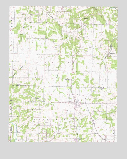
Walnut Grove, MO USGS Topographic Map
Click on map above to begin viewing in our Map Viewer.

This topographic map contains these locations and features:
Feature Name Type Latitude Longitude GNIS ID View Map
Buckley (historical)Populated PlaceN37.4234°W93.5319°755641View Map
City of Walnut GroveCivilN37.4112°W93.5480°2397183View Map
Clear CreekStreamN37.3756°W93.6174°715940View Map
Concord ChurchChurchN37.3906°W93.5896°732636View Map
EudoraPopulated PlaceN37.4825°W93.5377°735603View Map
Eudora School (historical)SchoolN37.4837°W93.5363°732782View Map
Eudora SpringSpringN37.4994°W93.5268°717642View Map
Fairview School (historical)SchoolN37.4112°W93.5299°732638View Map
Flint Hill School (historical)SchoolN37.4153°W93.5935°732635View Map
Graydon SpringsPopulated PlaceN37.4567°W93.5099°755550View Map
Green Lawn CemeteryCemeteryN37.4011°W93.5499°718797View Map
HaroldPopulated PlaceN37.3778°W93.5155°719125View Map
Harold ChurchChurchN37.3831°W93.5263°719126View Map
King CemeteryCemeteryN37.4706°W93.6052°720608View Map
King School (historical)SchoolN37.4775°W93.5924°732780View Map
KnoxPopulated PlaceN37.4745°W93.6105°740995View Map
Leeper CemeteryCemeteryN37.3928°W93.5794°720896View Map
Leith SpringSpringN37.4889°W93.5340°720904View Map
Lemmon CemeteryCemeteryN37.4323°W93.5188°720906View Map
McBee School (historical)SchoolN37.3834°W93.5913°732637View Map
Oak Grove School (historical)SchoolN37.4420°W93.5941°732781View Map
PhenixPopulated PlaceN37.3787°W93.5458°741150View Map
Rice School (historical)SchoolN37.4406°W93.5385°732783View Map
Township of JacksonCivilN37.4672°W93.5500°767215View Map
Township of Walnut GroveCivilN37.3948°W93.5593°766696View Map
Turkey Creek CemeteryCemeteryN37.4326°W93.5535°2702691View Map
Turkey Creek Missionary Baptist ChurchChurchN37.4328°W93.5527°727866View Map
Venable Spring BranchStreamN37.4620°W93.5002°728162View Map
Walnut GrovePopulated PlaceN37.4112°W93.5496°735899View Map
Walnut Grove Fire Protection District Station 1BuildingN37.4158°W93.5491°2620926View Map
Walnut Grove Fire Protection District Station 4BuildingN37.4800°W93.5407°2620377View Map
Walnut Grove Police DepartmentBuildingN37.4120°W93.5495°2752254View Map
Walnut Grove Post OfficePost OfficeN37.4068°W93.5494°2782570View Map
Williamson CemeteryCemeteryN37.3942°W93.5655°728907View Map

Note: Coordinates in the location and feature list above are referenced to NAD83 datum.


Copyright (C) 2008-2024 Ryan Niemi / Sunset Dynamics ... All Rights Reserved