TopoQuest Logo
Do you find TopoQuest useful?
Help keep TopoQuest running and adding new maps/features by donating!
Bitcoin:  19c7KJd3qBynnjoSw5npx9KScwjBe4ifkT
Litecoin:  LXs6TkuXGGXo1vDsWCkWVdjQX94eUKd6ui
Home View Maps Find Maps Find Places Resources & Links


Bull of the Woods, Oregon Topographic Map

USGS Map Title: Bull of the Woods, OR
USGS Map MRC: 44122H1
DRG (GeoTIFF) Download: o44122h1.tif


Neighboring USGS Topographic Map Quads:


  Wanderers Peak, OR  
45122A2
 

  Fish Creek Mountain, OR  
45122A1
 

  Mount Mitchell, OR  
45121A8
 

  Bagby Hot Springs, OR  
44122H2
 

  Bull of the Woods, OR  
44122H1
 

  Mount Lowe, OR  
44121H8
 

  Battle Ax, OR  
44122G2
 

  Mother Lode Mountain, OR  
44122G1
 

  Breitenbush Hot Springs, OR  
44121G8


Map MRC Location:

N45°
W123°
N45°
W122°
H8 H7 H6 H5 H4 H3 H2 H1
G8 G7 G6 G5 G4 G3 G2 G1
F8 F7 F6 F5 F4 F3 F2 F1
E8 E7 E6 E5 E4 E3 E2 E1
D8 D7 D6 D5 D4 D3 D2 D1
C8 C7 C6 C5 C4 C3 C2 C1
B8 B7 B6 B5 B4 B3 B2 B1
A8 A7 A6 A5 A4 A3 A2 A1
N44°
W123°
N44°
W122°

Bull of the Woods, OR USGS 1:24K Topographic Map Preview:
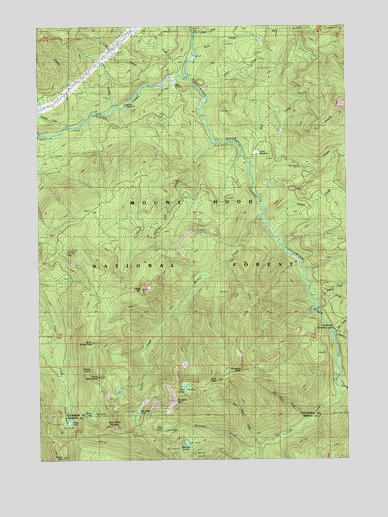
Bull of the Woods, OR USGS Topographic Map
Click on map above to begin viewing in our Map Viewer.

This topographic map contains these locations and features:
Feature Name Type Latitude Longitude GNIS ID View Map
Alder Swamp ShelterLocaleN44.9823°W122.0709°1137114View Map
Bagby TrailTrailN44.9912°W122.0523°1157840View Map
Big Slide LakeLakeN44.8891°W122.0861°1138067View Map
Big Slide MountainSummitN44.8921°W122.0712°1138068View Map
Blitzen CreekStreamN44.9251°W122.0159°1162845View Map
Buckeye CreekStreamN44.9598°W122.0404°1138846View Map
Bull of the WoodsSummitN44.8860°W122.0873°1162862View Map
Bull of the Woods TrailTrailN44.9329°W122.0809°1138910View Map
Bull of the Woods WildernessReserveN44.8846°W122.0859°1166780View Map
Calog QuarryMineN44.9972°W122.1074°2754431View Map
Cat CreekStreamN44.9835°W122.0745°1139455View Map
Dickey CreekStreamN44.9476°W122.0354°1162942View Map
Dickey LakeLakeN44.8880°W122.1043°1166771View Map
Dunno CreekStreamN44.9104°W122.0067°1141415View Map
Dutch CreekStreamN44.9710°W122.1092°1162956View Map
Dutch Creek ShelterLocaleN44.9701°W122.1098°1141429View Map
East Fork Collawash RiverStreamN44.8954°W122.0051°1141546View Map
Elk Lake CreekStreamN44.8951°W122.0048°1141781View Map
Fan CreekStreamN44.9896°W122.0656°1142008View Map
Farm CreekStreamN44.9660°W122.0559°1142020View Map
Farm TrailTrailN44.9535°W122.0884°1142021View Map
Granite PeaksRidgeN44.9796°W122.0037°1142930View Map
Happy CreekStreamN44.9429°W122.0348°1143280View Map
Happy QuarryMineN44.9393°W122.0103°2754433View Map
Hot Springs ForkStreamN44.9857°W122.0651°1157852View Map
Jazz CreekStreamN44.9110°W122.0067°1144234View Map
Kingfisher Recreation SiteLocaleN44.9762°W122.0929°1156743View Map
Knob PeakSummitN44.8982°W122.0540°1144689View Map
Knob Rock CreekStreamN44.8790°W122.0362°1144691View Map
Lake LenoreReservoirN44.8953°W122.0670°1144947View Map
Lily Pad LakeLakeN44.9354°W122.1148°1145015View Map
Lily Pad QuarryMineN44.9313°W122.1122°2754432View Map
Little Fan Creek CampgroundLocaleN44.9918°W122.0631°1166776View Map
North Dickey PeakSummitN44.9090°W122.1040°1158393View Map
Ogre CreekStreamN44.8940°W122.0001°1147169View Map
Oh Boy Forest CampLocaleN44.8998°W122.0042°1147170View Map
Pansy BasinBasinN44.8871°W122.1120°1147383View Map
Pansy LakeReservoirN44.8856°W122.1143°1148049View Map
Pansy MountainSummitN44.8757°W122.1171°1147384View Map
Pasola MountainSummitN44.9243°W122.0842°1147477View Map
Paste CreekStreamN44.9804°W122.0590°1147483View Map
Peat CreekStreamN44.9651°W122.0445°1147537View Map
Pine Cone CreekStreamN44.8868°W122.0181°1147682View Map
Pink CreekStreamN44.9765°W122.0934°1147741View Map
Russ CreekStreamN44.9229°W122.0170°1148854View Map
Russ Creek QuarryMineN44.9262°W122.0129°2754434View Map
Sand CreekStreamN44.9826°W122.0806°1149028View Map
Schreiner PeakSummitN44.9010°W122.0434°1149146View Map
Slide CreekStreamN44.9935°W122.0615°1149705View Map
South Dickey PeakSummitN44.8993°W122.1026°1166772View Map
Terrace SpringSpringN44.9012°W122.1051°1166773View Map
Thunder CreekStreamN44.9710°W122.1140°1157872View Map
Thunder Mountain TrailTrailN44.9723°W122.1198°1151205View Map
Toms MeadowFlatN44.9634°W122.0381°1151321View Map
Van Cleve CreekStreamN44.9493°W122.0717°1151723View Map
Welcome CreekStreamN44.8787°W122.0379°1152004View Map
Welcome LakesLakeN44.8796°W122.0659°1152005View Map
Welcome Lakes TrailTrailN44.8801°W122.0576°1152007View Map
West LakeReservoirN44.8841°W122.0759°1158547View Map

Note: Coordinates in the location and feature list above are referenced to NAD83 datum.


Copyright (C) 2008-2025 Ryan Niemi / Sunset Dynamics ... All Rights Reserved