TopoQuest Logo
Do you find TopoQuest useful?
Help keep TopoQuest running and adding new maps/features by donating!
Bitcoin:  19c7KJd3qBynnjoSw5npx9KScwjBe4ifkT
Litecoin:  LXs6TkuXGGXo1vDsWCkWVdjQX94eUKd6ui
Home View Maps Find Maps Find Places Resources & Links


Bolivia, North Carolina Topographic Map

USGS Map Title: Bolivia, NC
USGS Map MRC: 34078A2
DRG (GeoTIFF) Download: o34078a2.tif


Neighboring USGS Topographic Map Quads:


  Honey Island, NC  
34078B3
 

  Lewis Swamp, NC  
34078B2
 

  Winnabow, NC  
34078B1
 

  Supply, NC  
34078A3
 

  Bolivia, NC  
34078A2
 

  Funston, NC  
34078A1
 

  Holden Beach, NC  
33078H3
 

  Lockwoods Folly, NC  
33078H2
 

  Southport, NC  
33078H1


Map MRC Location:

N35°
W79°
N35°
W78°
H8 H7 H6 H5 H4 H3 H2 H1
G8 G7 G6 G5 G4 G3 G2 G1
F8 F7 F6 F5 F4 F3 F2 F1
E8 E7 E6 E5 E4 E3 E2 E1
D8 D7 D6 D5 D4 D3 D2 D1
C8 C7 C6 C5 C4 C3 C2 C1
B8 B7 B6 B5 B4 B3 B2 B1
A8 A7 A6 A5 A4 A3 A2 A1
N34°
W79°
N34°
W78°

Bolivia, NC USGS 1:24K Topographic Map Preview:
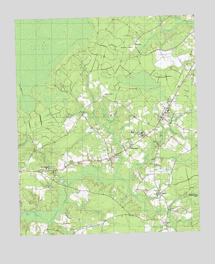
Bolivia, NC USGS Topographic Map
Click on map above to begin viewing in our Map Viewer.

This topographic map contains these locations and features:
Feature Name Type Latitude Longitude GNIS ID View Map
AntiochPopulated PlaceN34.0229°W78.1517°1006116View Map
Antioch ChurchChurchN34.0055°W78.1478°1004678View Map
Beaverdam BaySwampN34.0718°W78.2194°980818View Map
Boggy BranchStreamN34.0716°W78.2042°981680View Map
BoliviaPopulated PlaceN34.0677°W78.1483°981697View Map
Bolivia BranchStreamN34.0599°W78.1444°981698View Map
Bolivia Lookout TowerTowerN34.0418°W78.2119°1023626View Map
Bolivia Post OfficePost OfficeN34.0666°W78.1485°2505335View Map
Bolivia Volunteer Fire DepartmentBuildingN34.0644°W78.1448°2638447View Map
Brunswick Community CollegeSchoolN34.0389°W78.2307°1004674View Map
Brunswick CountyCivilN34.0389°W78.2274°1026340View Map
Brunswick County Criminal JusticeBuildingN34.0598°W78.1620°2130884View Map
Brunswick County District CriminalBuildingN34.0579°W78.1619°2130889View Map
Brunswick County Sheriff's OfficeBuildingN34.0590°W78.1638°2130940View Map
Brunswick Emergency ServiceBuildingN34.0542°W78.1653°2720375View Map
Buck BranchStreamN34.0627°W78.1900°1004680View Map
Cherry Tree SwampStreamN34.1218°W78.1331°983091View Map
Clark BranchStreamN34.0277°W78.2178°983210View Map
Clements CurveLocaleN34.0799°W78.1894°983270View Map
Faith ChurchChurchN34.0829°W78.1372°1004676View Map
Fawnbrook Circle Mobile HomePopulated PlaceN34.0410°W78.2098°2505470View Map
Ford BranchStreamN34.0266°W78.2189°985265View Map
Forest Lawn CemeteryCemeteryN34.0966°W78.1317°1004673View Map
Friendship ChurchChurchN34.0441°W78.1836°1004677View Map
Gap BranchStreamN34.0424°W78.1617°1024892View Map
Half HellPopulated PlaceN34.0404°W78.1553°1020587View Map
Half Hell SwampStreamN34.0082°W78.1428°1003788View Map
Hog BranchStreamN34.0160°W78.1458°1004682View Map
Holden CreekStreamN34.0632°W78.1908°986918View Map
Mercer CemeteryCemeteryN34.0563°W78.1514°1004672View Map
Middle BranchStreamN34.0541°W78.1811°1004681View Map
Middle SwampStreamN34.0307°W78.1753°989802View Map
Mount Olive ChurchChurchN34.0374°W78.2300°990461View Map
New HopePopulated PlaceN34.1088°W78.1667°1021629View Map
Nucitt BranchStreamN34.0193°W78.2197°991324View Map
Pinch Gut CreekStreamN34.0674°W78.1964°992222View Map
Pine Log BranchStreamN34.0557°W78.1786°1004679View Map
Piney GrovePopulated PlaceN34.0491°W78.1733°1021946View Map
Ramshead BranchStreamN34.0591°W78.1856°993022View Map
Randolph CemeteryCemeteryN34.0685°W78.1830°1004671View Map
Rattlesnake BranchStreamN34.0216°W78.1703°993046View Map
Red RunStreamN34.0674°W78.1964°993133View Map
River SwampStreamN34.0324°W78.1822°1004829View Map
Rutland ChapelChurchN34.0229°W78.1517°1004675View Map
Saint Johns ChurchChurchN34.0443°W78.1803°993928View Map
Sarah HoleStreamN34.0060°W78.1439°994344View Map
Scotts BranchStreamN34.0074°W78.2297°994433View Map
SuburbPopulated PlaceN34.0060°W78.1486°1006384View Map
Sullivan IslandIslandN34.1066°W78.1725°995674View Map
Town of BoliviaCivilN34.0699°W78.1474°2405298View Map

Note: Coordinates in the location and feature list above are referenced to NAD83 datum.


Copyright (C) 2008-2025 Ryan Niemi / Sunset Dynamics ... All Rights Reserved