TopoQuest Logo
Do you find TopoQuest useful?
Help keep TopoQuest running and adding new maps/features by donating!
Bitcoin:  19c7KJd3qBynnjoSw5npx9KScwjBe4ifkT
Litecoin:  LXs6TkuXGGXo1vDsWCkWVdjQX94eUKd6ui
Home View Maps Find Maps Find Places Resources & Links


Robie Creek, Idaho Topographic Map

USGS Map Title: Robie Creek, ID
USGS Map MRC: 43116F1
DRG (GeoTIFF) Download: o43116f1.tif


Neighboring USGS Topographic Map Quads:


  Cartwright Canyon, ID  
43116G2
 

  Shafer Butte, ID  
43116G1
 

  Warm Springs Point, ID  
43115G8
 

  Boise North, ID  
43116F2
 

  Robie Creek, ID  
43116F1
 

  Dunnigan Creek, ID  
43115F8
 

  Boise South, ID  
43116E2
 

  Lucky Peak, ID  
43116E1
 

  Arrowrock Dam, ID  
43115E8


Map MRC Location:

N44°
W117°
N44°
W116°
H8 H7 H6 H5 H4 H3 H2 H1
G8 G7 G6 G5 G4 G3 G2 G1
F8 F7 F6 F5 F4 F3 F2 F1
E8 E7 E6 E5 E4 E3 E2 E1
D8 D7 D6 D5 D4 D3 D2 D1
C8 C7 C6 C5 C4 C3 C2 C1
B8 B7 B6 B5 B4 B3 B2 B1
A8 A7 A6 A5 A4 A3 A2 A1
N43°
W117°
N43°
W116°

Robie Creek, ID USGS 1:24K Topographic Map Preview:
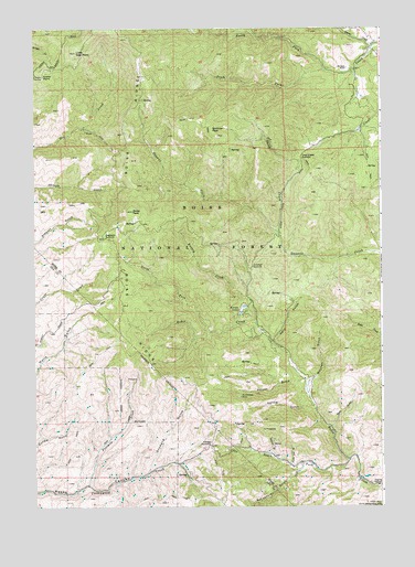
Robie Creek, ID USGS Topographic Map
Click on map above to begin viewing in our Map Viewer.

This topographic map contains these locations and features:
Feature Name Type Latitude Longitude GNIS ID View Map
Aldape SummitSummitN43.6402°W116.0629°376500View Map
Ashton GulchValleyN43.6579°W116.0293°376748View Map
Bare GulchValleyN43.6460°W116.0184°376949View Map
Beaver CreekStreamN43.7454°W116.0029°377250View Map
Boise PeakSummitN43.7024°W116.0907°378005View Map
Bumblebee MineMineN43.6535°W116.0521°378498View Map
Clear Creek SummitSummitN43.7163°W116.0296°397554View Map
Clear Creek Volunteer Fire DepartmentBuildingN43.7458°W116.0031°2619077View Map
Crooked SummitSummitN43.6877°W116.0473°397595View Map
Davidson RanchLocaleN43.7396°W116.0126°380267View Map
Eagleson SummitSummitN43.6952°W116.1007°381003View Map
Fivemile CreekStreamN43.6302°W116.1076°381801View Map
Harrington AirportAirportN43.7212°W116.0058°2443832View Map
Karney CreekStreamN43.6721°W116.0459°384099View Map
Karney LakesLakeN43.6755°W116.0512°384100View Map
Kelly GulchValleyN43.6685°W116.0396°384142View Map
Little Deer PointCapeN43.7438°W116.1104°384807View Map
Lower PointCapeN43.7377°W116.1221°386240View Map
McCarty GulchValleyN43.6385°W116.0396°386573View Map
Mitchell GulchValleyN43.6574°W116.0265°397920View Map
North Fork Clear CreekStreamN43.7396°W116.0096°387674View Map
North Fork Robie CreekStreamN43.6704°W116.0626°387765View Map
North Star GulchValleyN43.6357°W116.0340°387845View Map
Orchard GulchValleyN43.6341°W116.0848°387983View Map
Robie Creek Census Designated PlaceCensusN43.6680°W116.0209°2585586View Map
Robie Creek Volunteer Fire Department Station 1BuildingN43.6375°W116.0125°2619111View Map
Schoonover GulchValleyN43.6349°W116.0284°390031View Map
Sheep CreekStreamN43.6963°W116.0373°390182View Map
South Fork Robie CreekStreamN43.6368°W116.0123°391007View Map
Spring GulchValleyN43.6504°W116.0257°391218View Map

Note: Coordinates in the location and feature list above are referenced to NAD83 datum.


Copyright (C) 2008-2025 Ryan Niemi / Sunset Dynamics ... All Rights Reserved