TopoQuest Logo
Do you find TopoQuest useful?
Help keep TopoQuest running and adding new maps/features by donating!
Bitcoin:  19c7KJd3qBynnjoSw5npx9KScwjBe4ifkT
Litecoin:  LXs6TkuXGGXo1vDsWCkWVdjQX94eUKd6ui
Home View Maps Find Maps Find Places Resources & Links


Warner Robins SE, Georgia Topographic Map

USGS Map Title: Warner Robins SE, GA
USGS Map MRC: 32083E5
DRG (GeoTIFF) Download: o32083e5.tif


Neighboring USGS Topographic Map Quads:


  Warner Robins NW, GA  
32083F6
 

  Warner Robins NE, GA  
32083F5
 

  Marion, GA  
32083F4
 

  Warner Robins SW, GA  
32083E6
 

  Warner Robins SE, GA  
32083E5
 

  Tarversville, GA  
32083E4
 

  Perry East, GA  
32083D6
 

  Hayneville, GA  
32083D5
 

  Westlake, GA  
32083D4


Map MRC Location:

N33°
W84°
N33°
W83°
H8 H7 H6 H5 H4 H3 H2 H1
G8 G7 G6 G5 G4 G3 G2 G1
F8 F7 F6 F5 F4 F3 F2 F1
E8 E7 E6 E5 E4 E3 E2 E1
D8 D7 D6 D5 D4 D3 D2 D1
C8 C7 C6 C5 C4 C3 C2 C1
B8 B7 B6 B5 B4 B3 B2 B1
A8 A7 A6 A5 A4 A3 A2 A1
N32°
W84°
N32°
W83°

Warner Robins SE, GA USGS 1:24K Topographic Map Preview:
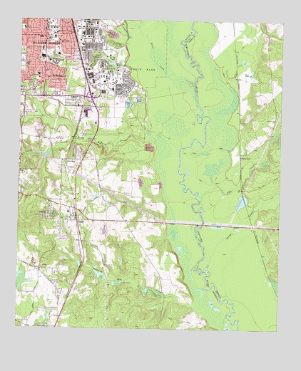
Warner Robins SE, GA USGS Topographic Map
Click on map above to begin viewing in our Map Viewer.

This topographic map contains these locations and features:
Feature Name Type Latitude Longitude GNIS ID View Map
Adams ParkLocaleN32.5701°W83.5188°354260View Map
Bay Gall CreekStreamN32.5851°W83.6130°310890View Map
BonairePopulated PlaceN32.5438°W83.5960°311634View Map
Bonaire Elementary SchoolSchoolN32.5471°W83.6007°1671624View Map
Bonaire HeightsPopulated PlaceN32.5424°W83.5993°1671625View Map
Browns ChapelChurchN32.5113°W83.6049°1671629View Map
Cainey BranchStreamN32.5776°W83.5991°312153View Map
Camp CreekStreamN32.5996°W83.5288°312212View Map
Christian Life ChurchChurchN32.5976°W83.6085°1671637View Map
Christian Life SchoolSchoolN32.5976°W83.6035°1671638View Map
ClaybedPopulated PlaceN32.5171°W83.5980°1671641View Map
CreeksidePopulated PlaceN32.5815°W83.6207°1671644View Map
DeerwoodPopulated PlaceN32.5735°W83.5885°1671651View Map
Dove PondLakeN32.6036°W83.5146°313599View Map
Duck LakeLakeN32.6075°W83.5813°313699View Map
Feagan Mill (historical)LocaleN32.5843°W83.6243°1671667View Map
First Baptist ChurchChurchN32.6179°W83.6149°1671673View Map
First United Methodist ChurchChurchN32.6210°W83.6135°1671674View Map
Flat CreekStreamN32.5496°W83.5366°314180View Map
Forest PointePopulated PlaceN32.5674°W83.5738°1671675View Map
Heritage Hills ParkParkN32.5993°W83.6180°1671687View Map
Hickory WoodsPopulated PlaceN32.5665°W83.6227°1671688View Map
Holly BluffPopulated PlaceN32.5732°W83.5813°1671691View Map
Horse CreekStreamN32.5988°W83.5410°315691View Map
Houston County Fire Department Station 2BuildingN32.5453°W83.6008°2603748View Map
Kings CrossingPopulated PlaceN32.5654°W83.6096°1671708View Map
Lake LunaReservoirN32.5926°W83.5681°317488View Map
LashleyPopulated PlaceN32.5460°W83.6113°332186View Map
Laurel Grove CemeteryCemeteryN32.5849°W83.5027°316671View Map
Linwood SchoolSchoolN32.6110°W83.6071°316918View Map
Magnolia Park CemeteryCemeteryN32.6130°W83.6248°317619View Map
Memorial ParkCemeteryN32.6051°W83.5966°318026View Map
Moore LakeReservoirN32.5701°W83.6249°340165View Map
Moore Lake DamDamN32.5701°W83.6249°340164View Map
Mount Pleasant CemeteryCemeteryN32.6005°W83.6192°1671718View Map
Museum of AviationBuildingN32.5904°W83.5899°1671720View Map
Perdue LakeReservoirN32.5395°W83.5835°340163View Map
Perdue Lake DamDamN32.5385°W83.5832°340162View Map
Piney Grove ChurchChurchN32.5238°W83.6141°1671745View Map
Piney Grove School (historical)SchoolN32.5232°W83.6138°1671746View Map
ReddingPopulated PlaceN32.5899°W83.5955°1671753View Map
River WestPopulated PlaceN32.5168°W83.5502°1671754View Map
Robins Air Force BaseMilitaryN32.6126°W83.5847°2511996View Map
Robins Air Force Base Census Designated PlaceCensusN32.6092°W83.5845°2403484View Map
Robins SchoolSchoolN32.5971°W83.5799°321684View Map
Rumble SchoolSchoolN32.6132°W83.6146°321999View Map
Sacred Heart Catholic ChurchChurchN32.6168°W83.6127°1671759View Map
Sacred Heart SchoolSchoolN32.6174°W83.6116°322035View Map
Sandy Run ChurchChurchN32.5765°W83.5916°1671763View Map
Sandy Run CreekStreamN32.5718°W83.5480°322500View Map
Sandy Run Golf ClubLocaleN32.5771°W83.6071°344337View Map
Sandy Run School (historical)SchoolN32.5760°W83.5913°1671764View Map
Savage CreekStreamN32.5254°W83.5341°322588View Map
Scout LakeReservoirN32.5910°W83.5733°322659View Map
Smith CemeteryCemeteryN32.5924°W83.5088°323105View Map
Stathams LandingPopulated PlaceN32.5710°W83.5735°1671780View Map
Stephens SchoolSchoolN32.6032°W83.6168°323579View Map
Sylvan Lake DamDamN32.5001°W83.6149°336230View Map
Thomas SchoolSchoolN32.6188°W83.6088°324089View Map
Thompson Mill CreekStreamN32.5054°W83.5338°324126View Map
Union Grove Baptist ChurchChurchN32.6054°W83.6138°1671785View Map
WallstonPopulated PlaceN32.6196°W83.5999°1671786View Map
Warner RobinsPopulated PlaceN32.6210°W83.5999°333366View Map
Warner Robins City HallBuildingN32.6201°W83.6074°1671788View Map
Warner Robins Fire Department Station 1BuildingN32.6202°W83.6228°2604543View Map
Warner Robins Fire Department Station 5BuildingN32.5788°W83.6232°1671670View Map
Warner Robins High SchoolSchoolN32.6101°W83.6143°1671789View Map
Warner Robins Industrial ParkLocaleN32.5868°W83.5930°1671790View Map
Warner Robins Police DepartmentBuildingN32.6216°W83.6082°2733511View Map
Warner Robins Post OfficePost OfficeN32.6215°W83.6124°1671791View Map
Waterford SouthPopulated PlaceN32.5279°W83.5582°1671792View Map
Watson SchoolSchoolN32.6085°W83.6107°324922View Map
West Side SchoolSchoolN32.6218°W83.6232°325070View Map
Williams DamDamN32.5585°W83.6082°340166View Map
Williams LakeReservoirN32.5579°W83.6076°340167View Map
Windsor ForestPopulated PlaceN32.5760°W83.6182°1671799View Map
Woodfield SubdivisionPopulated PlaceN32.5704°W83.5846°1671800View Map

Note: Coordinates in the location and feature list above are referenced to NAD83 datum.


Copyright (C) 2008-2024 Ryan Niemi / Sunset Dynamics ... All Rights Reserved