TopoQuest Logo
Do you find TopoQuest useful?
Help keep TopoQuest running and adding new maps/features by donating!
Bitcoin:  19c7KJd3qBynnjoSw5npx9KScwjBe4ifkT
Litecoin:  LXs6TkuXGGXo1vDsWCkWVdjQX94eUKd6ui
Home View Maps Find Maps Find Places Resources & Links


Wasola, Missouri Topographic Map

USGS Map Title: Wasola, MO
USGS Map MRC: 36092G5
DRG (GeoTIFF) Download: o36092g5.tif


Neighboring USGS Topographic Map Quads:


  Ava, MO  
36092H6
 

  Sweden, MO  
36092H5
 

  Brushyknob, MO  
36092H4
 

  Smallett, MO  
36092G6
 

  Wasola, MO  
36092G5
 

  Rockbridge, MO  
36092G4
 

  Thornfield, MO  
36092F6
 

  Willhoit, MO  
36092F5
 

  Gainesville NW, MO  
36092F4


Map MRC Location:

N37°
W93°
N37°
W92°
H8 H7 H6 H5 H4 H3 H2 H1
G8 G7 G6 G5 G4 G3 G2 G1
F8 F7 F6 F5 F4 F3 F2 F1
E8 E7 E6 E5 E4 E3 E2 E1
D8 D7 D6 D5 D4 D3 D2 D1
C8 C7 C6 C5 C4 C3 C2 C1
B8 B7 B6 B5 B4 B3 B2 B1
A8 A7 A6 A5 A4 A3 A2 A1
N36°
W93°
N36°
W92°

Wasola, MO USGS 1:24K Topographic Map Preview:
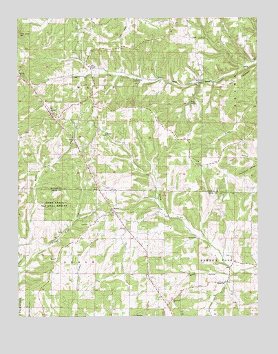
Wasola, MO USGS Topographic Map
Click on map above to begin viewing in our Map Viewer.

This topographic map contains these locations and features:
Feature Name Type Latitude Longitude GNIS ID View Map
AlmarthaPopulated PlaceN36.7642°W92.5171°748579View Map
Anchor School (historical)SchoolN36.8237°W92.5424°748585View Map
Cobb SchoolSchoolN36.8631°W92.6141°749397View Map
Devils BackboneRidgeN36.8498°W92.5093°749637View Map
Excelsior School (historical)SchoolN36.8662°W92.5538°749878View Map
GirdnerPopulated PlaceN36.8539°W92.5871°750044View Map
Herndon CemeteryCemeteryN36.7831°W92.5324°750301View Map
Hilo (historical)Populated PlaceN36.8131°W92.5324°733889View Map
Hilo CemeteryCemeteryN36.8139°W92.5327°750336View Map
Hilo RidgeRidgeN36.8223°W92.5368°753586View Map
Huckleberry School (historical)SchoolN36.8248°W92.5013°750411View Map
Loftin CemeteryCemeteryN36.8573°W92.5027°753588View Map
Loftin ChurchChurchN36.8567°W92.5032°750812View Map
Loftin School (historical)SchoolN36.8667°W92.5063°750813View Map
Murray ChurchChurchN36.8364°W92.6085°754140View Map
Noble CemeteryCemeteryN36.7501°W92.5640°751322View Map
North Ozark ChurchChurchN36.7564°W92.5443°753584View Map
Oak Grove ChurchChurchN36.7867°W92.5691°753585View Map
Oak Grove School (historical)SchoolN36.7878°W92.5682°733794View Map
Pleasant Hill SchoolSchoolN36.8287°W92.5954°751661View Map
SilvertonPopulated PlaceN36.8173°W92.5654°733888View Map
Smith HollowValleyN36.7689°W92.5141°752216View Map
Spicewood HollowValleyN36.8142°W92.5004°752284View Map
SquiresPopulated PlaceN36.8514°W92.6249°752331View Map
Strong SpringSpringN36.8389°W92.5354°753587View Map
Sweden Fork Natural BridgeArchN36.8656°W92.5003°2680500View Map
Township of NobleCivilN36.7599°W92.5899°767132View Map
Township of WallsCivilN36.8468°W92.5829°766632View Map
WasolaPopulated PlaceN36.7937°W92.5757°752773View Map
Wasola Census Designated PlaceCensusN36.7857°W92.5685°2587119View Map
Wasola Fire DepartmentBuildingN36.7696°W92.5569°2621187View Map
Wasola Post OfficePost OfficeN36.7903°W92.5688°2783032View Map

Note: Coordinates in the location and feature list above are referenced to NAD83 datum.


Copyright (C) 2008-2025 Ryan Niemi / Sunset Dynamics ... All Rights Reserved