TopoQuest Logo
Do you find TopoQuest useful?
Help keep TopoQuest running and adding new maps/features by donating!
Bitcoin:  19c7KJd3qBynnjoSw5npx9KScwjBe4ifkT
Litecoin:  LXs6TkuXGGXo1vDsWCkWVdjQX94eUKd6ui
Home View Maps Find Maps Find Places Resources & Links


Willhoit, Missouri Topographic Map

USGS Map Title: Willhoit, MO
USGS Map MRC: 36092F5
DRG (GeoTIFF) Download: o36092f5.tif


Neighboring USGS Topographic Map Quads:


  Smallett, MO  
36092G6
 

  Wasola, MO  
36092G5
 

  Rockbridge, MO  
36092G4
 

  Thornfield, MO  
36092F6
 

  Willhoit, MO  
36092F5
 

  Gainesville NW, MO  
36092F4
 

  Theodosia, MO  
36092E6
 

  Isabella, MO  
36092E5
 

  Gainesville, MO  
36092E4


Map MRC Location:

N37°
W93°
N37°
W92°
H8 H7 H6 H5 H4 H3 H2 H1
G8 G7 G6 G5 G4 G3 G2 G1
F8 F7 F6 F5 F4 F3 F2 F1
E8 E7 E6 E5 E4 E3 E2 E1
D8 D7 D6 D5 D4 D3 D2 D1
C8 C7 C6 C5 C4 C3 C2 C1
B8 B7 B6 B5 B4 B3 B2 B1
A8 A7 A6 A5 A4 A3 A2 A1
N36°
W93°
N36°
W92°

Willhoit, MO USGS 1:24K Topographic Map Preview:
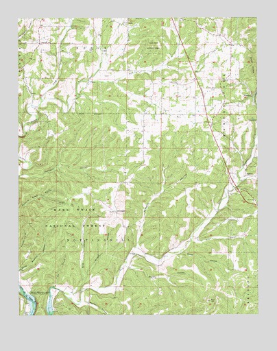
Willhoit, MO USGS Topographic Map
Click on map above to begin viewing in our Map Viewer.

This topographic map contains these locations and features:
Feature Name Type Latitude Longitude GNIS ID View Map
Allen HollowValleyN36.6559°W92.5341°748575View Map
Baker CemeteryCemeteryN36.6251°W92.6207°748644View Map
Bald JessSummitN36.6309°W92.5252°748648View Map
Barren Fork ChurchChurchN36.6734°W92.5013°748688View Map
Barren Fork School (historical)SchoolN36.6715°W92.5171°733808View Map
Barret HollowValleyN36.6251°W92.5777°748691View Map
Bee BranchStreamN36.6367°W92.6077°748759View Map
Bennett HollowValleyN36.6537°W92.5641°748788View Map
Bray HollowValleyN36.6342°W92.5971°749003View Map
Brushy HollowValleyN36.6453°W92.5693°749070View Map
Cedar HollowValleyN36.6509°W92.5404°749303View Map
Council Grove SchoolSchoolN36.7156°W92.5421°734288View Map
Davis CemeteryCemeteryN36.7364°W92.5810°749574View Map
Della Ramsey HollowValleyN36.6437°W92.6249°749620View Map
Franklin Grove CemeteryCemeteryN36.7189°W92.5229°749979View Map
Franklin Grove ChurchChurchN36.7223°W92.5418°749980View Map
Gaulding CemeteryCemeteryN36.6506°W92.5640°750033View Map
Grabeel (historical)Populated PlaceN36.7223°W92.5510°740597View Map
Grabel Post Office (historical)Post OfficeN36.7223°W92.5510°759917View Map
Jackson CemeteryCemeteryN36.7062°W92.5007°750479View Map
Loftis CemeteryCemeteryN36.6872°W92.5001°750814View Map
Ludecker CreekStreamN36.6809°W92.5096°750890View Map
NoblePopulated PlaceN36.7476°W92.5699°751321View Map
Noble School (historical)SchoolN36.7459°W92.5679°733809View Map
NottinghillPopulated PlaceN36.6684°W92.5746°751362View Map
Nottinghill Lookout TowerTowerN36.6717°W92.6002°755346View Map
Oakdale School (historical)SchoolN36.6370°W92.5949°734287View Map
Peters CemeteryCemeteryN36.7356°W92.5871°751570View Map
Pond Hill School (historical)SchoolN36.7089°W92.6096°733807View Map
RomancePopulated PlaceN36.7170°W92.5027°751956View Map
Sister KnobsRangeN36.7328°W92.5038°752183View Map
South Fork Turkey CreekStreamN36.7151°W92.6127°752262View Map
Summit CityPopulated PlaceN36.7392°W92.6138°752430View Map
Township of NottinghillCivilN36.6596°W92.5640°767133View Map
WillhoitPopulated PlaceN36.6834°W92.5068°752907View Map
Wright HollowValleyN36.6417°W92.5902°752985View Map

Note: Coordinates in the location and feature list above are referenced to NAD83 datum.


Copyright (C) 2008-2024 Ryan Niemi / Sunset Dynamics ... All Rights Reserved