TopoQuest Logo
Do you find TopoQuest useful?
Help keep TopoQuest running and adding new maps/features by donating!
Bitcoin:  19c7KJd3qBynnjoSw5npx9KScwjBe4ifkT
Litecoin:  LXs6TkuXGGXo1vDsWCkWVdjQX94eUKd6ui
Home View Maps Find Maps Find Places Resources & Links


Water Hollow Ridge, Utah Topographic Map

USGS Map Title: Water Hollow Ridge, UT
USGS Map MRC: 38111H5
DRG (GeoTIFF) Download: o38111h5.tif


Neighboring USGS Topographic Map Quads:


  Mayfield, UT  
39111A6
 

  Woods Lake, UT  
39111A5
 

  Heliotrope Mountain, UT  
39111A4
 

  Steves Mountain, UT  
38111H6
 

  Water Hollow Ridge, UT  
38111H5
 

  Acord Lakes, UT  
38111H4
 

  Gooseberry Creek, UT  
38111G6
 

  Yogo Creek, UT  
38111G5
 

  Old Woman Plateau, UT  
38111G4


Map MRC Location:

N39°
W112°
N39°
W111°
H8 H7 H6 H5 H4 H3 H2 H1
G8 G7 G6 G5 G4 G3 G2 G1
F8 F7 F6 F5 F4 F3 F2 F1
E8 E7 E6 E5 E4 E3 E2 E1
D8 D7 D6 D5 D4 D3 D2 D1
C8 C7 C6 C5 C4 C3 C2 C1
B8 B7 B6 B5 B4 B3 B2 B1
A8 A7 A6 A5 A4 A3 A2 A1
N38°
W112°
N38°
W111°

Water Hollow Ridge, UT USGS 1:24K Topographic Map Preview:
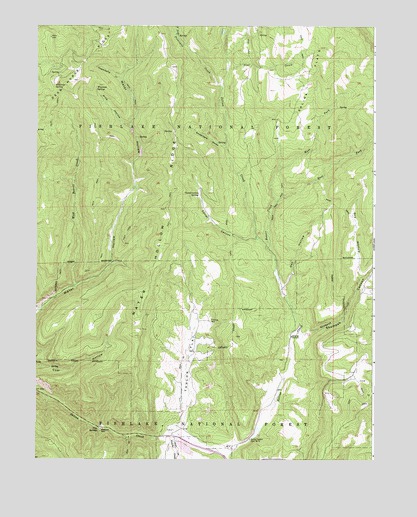
Water Hollow Ridge, UT USGS Topographic Map
Click on map above to begin viewing in our Map Viewer.

This topographic map contains these locations and features:
Feature Name Type Latitude Longitude GNIS ID View Map
Beaver CreekStreamN38.9358°W111.5396°1438514View Map
Chokecherry HollowValleyN38.9652°W111.5555°1439715View Map
Commissary CreekStreamN38.9850°W111.5932°1439907View Map
Conservation SpringSpringN38.9515°W111.5652°1439916View Map
Corral CanyonValleyN38.9386°W111.5435°1439960View Map
Dead Horse RidgeRidgeN38.9966°W111.6010°1440301View Map
Dry HollowValleyN38.9272°W111.5055°1440640View Map
East Fork Beaver CreekStreamN38.9491°W111.5363°1440785View Map
East Fork Picklekeg CreekStreamN38.9969°W111.5727°1440816View Map
Meadow CreekStreamN38.8766°W111.5549°1443273View Map
Niotche CreekStreamN38.8819°W111.5749°1443833View Map
Oak HollowValleyN38.9250°W111.5338°1444026View Map
Picklekeg CreekStreamN38.9822°W111.5566°1444339View Map
Pine CreekStreamN38.9877°W111.5544°1444368View Map
Pine HollowValleyN38.9708°W111.5905°1444387View Map
Pipe SpringsSpringN38.8840°W111.6016°1444456View Map
Salina Canyon Dam Number 4DamN38.8808°W111.5460°1454516View Map
Salina FlatsFlatN38.9939°W111.5202°1445273View Map
Skutumpah CanyonValleyN38.9116°W111.5285°1455085View Map
Skutumpah CreekStreamN38.9116°W111.5285°1455086View Map
Taylor FlatFlatN38.9027°W111.5685°1446348View Map
Water Hollow RidgeRidgeN38.9430°W111.5782°1447065View Map
West Beaver CreekStreamN38.9247°W111.6110°1434047View Map
West Fork Beaver CreekStreamN38.9491°W111.5363°1447129View Map
Wigwam SpringSpringN38.9822°W111.6030°1447336View Map
Wikieup SpringSpringN38.9827°W111.6185°1447337View Map

Note: Coordinates in the location and feature list above are referenced to NAD83 datum.


Copyright (C) 2008-2025 Ryan Niemi / Sunset Dynamics ... All Rights Reserved