TopoQuest Logo
Do you find TopoQuest useful?
Help keep TopoQuest running and adding new maps/features by donating!
Bitcoin:  19c7KJd3qBynnjoSw5npx9KScwjBe4ifkT
Litecoin:  LXs6TkuXGGXo1vDsWCkWVdjQX94eUKd6ui
Home View Maps Find Maps Find Places Resources & Links


Gooseberry Creek, Utah Topographic Map

USGS Map Title: Gooseberry Creek, UT
USGS Map MRC: 38111G6
DRG (GeoTIFF) Download: o38111g6.tif


Neighboring USGS Topographic Map Quads:


  Salina, UT  
38111H7
 

  Steves Mountain, UT  
38111H6
 

  Water Hollow Ridge, UT  
38111H5
 

  Rex Reservoir, UT  
38111G7
 

  Gooseberry Creek, UT  
38111G6
 

  Yogo Creek, UT  
38111G5
 

  Boobe Hole Reservoir, UT  
38111F7
 

  Mount Terrill, UT  
38111F6
 

  Hilgard Mountain, UT  
38111F5


Map MRC Location:

N39°
W112°
N39°
W111°
H8 H7 H6 H5 H4 H3 H2 H1
G8 G7 G6 G5 G4 G3 G2 G1
F8 F7 F6 F5 F4 F3 F2 F1
E8 E7 E6 E5 E4 E3 E2 E1
D8 D7 D6 D5 D4 D3 D2 D1
C8 C7 C6 C5 C4 C3 C2 C1
B8 B7 B6 B5 B4 B3 B2 B1
A8 A7 A6 A5 A4 A3 A2 A1
N38°
W112°
N38°
W111°

Gooseberry Creek, UT USGS 1:24K Topographic Map Preview:
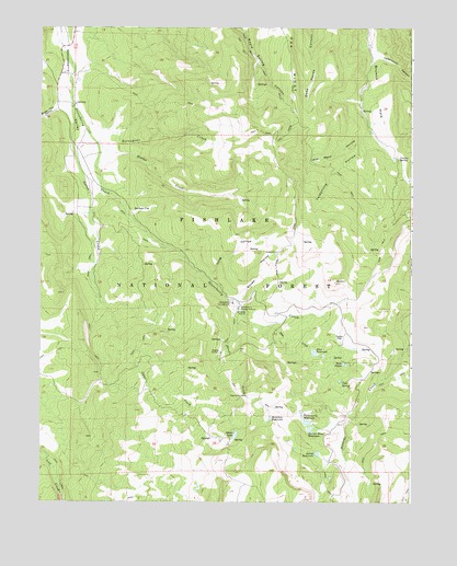
Gooseberry Creek, UT USGS Topographic Map
Click on map above to begin viewing in our Map Viewer.

This topographic map contains these locations and features:
Feature Name Type Latitude Longitude GNIS ID View Map
Abes CreekStreamN38.7966°W111.6741°1438115View Map
Abes ReservoirReservoirN38.7893°W111.6579°1438118View Map
Brush Trail HollowValleyN38.8541°W111.7449°1439199View Map
Catamount CanyonValleyN38.8694°W111.6382°1439533View Map
Cold SpringSpringN38.7817°W111.6485°1439867View Map
Creepy SpringSpringN38.8406°W111.6299°1440144View Map
Farnsworth DamDamN38.7733°W111.6624°1447736View Map
Farnsworth ReservoirReservoirN38.7734°W111.6622°1427890View Map
Gates CreekStreamN38.8552°W111.7396°1441286View Map
Gates LakeReservoirN38.7677°W111.6844°1441287View Map
German FlatFlatN38.8272°W111.7163°1441306View Map
GooseberryLocaleN38.8058°W111.6946°1448430View Map
Gooseberry CampgroundLocaleN38.8030°W111.6871°1441371View Map
Gooseberry Ranger StationLocaleN38.8011°W111.6835°1441378View Map
Hamilton ReservoirReservoirN38.7720°W111.6728°1441560View Map
Harves River ReservoirReservoirN38.7693°W111.6592°1441624View Map
Hoodoo CreekStreamN38.8441°W111.7313°1441833View Map
Jack Went HollowValleyN38.8475°W111.6399°1442081View Map
Long HollowValleyN38.8094°W111.6935°1442911View Map
Oak RidgeRidgeN38.8697°W111.6671°1444029View Map
Porcupine CreekStreamN38.8516°W111.7369°1444579View Map
Salina City DamDamN38.7816°W111.6560°1447737View Map
Salina ReservoirReservoirN38.7627°W111.6569°1445274View Map
Sheep CreekStreamN38.8030°W111.6844°1445488View Map
Squaw HollowValleyN38.8033°W111.6841°1446075View Map
Taylor FlatFlatN38.7936°W111.6494°1446347View Map
Telephone HollowValleyN38.8472°W111.6391°1446377View Map
Twin PondsReservoirN38.7865°W111.6482°1446803View Map

Note: Coordinates in the location and feature list above are referenced to NAD83 datum.


Copyright (C) 2008-2025 Ryan Niemi / Sunset Dynamics ... All Rights Reserved