TopoQuest Logo
Do you find TopoQuest useful?
Help keep TopoQuest running and adding new maps/features by donating!
Bitcoin:  19c7KJd3qBynnjoSw5npx9KScwjBe4ifkT
Litecoin:  LXs6TkuXGGXo1vDsWCkWVdjQX94eUKd6ui
Home View Maps Find Maps Find Places Resources & Links


Watkins, Montana Topographic Map

USGS Map Title: Watkins, MT
USGS Map MRC: 47105B7
DRG (GeoTIFF) Download: o47105b7.tif


Neighboring USGS Topographic Map Quads:


  Beauty Creek, MT  
47105C8
 

  Brockway, MT  
47105C7
 

  Circle SW, MT  
47105C6
 

  Berry School, MT  
47105B8
 

  Watkins, MT  
47105B7
 

  Big Sheep Mountain NW, MT  
47105B6
 

  Heitz School, MT  
47105A8
 

  Watkins SE, MT  
47105A7
 

  Big Sheep Mountain, MT  
47105A6


Map MRC Location:

N48°
W106°
N48°
W105°
H8 H7 H6 H5 H4 H3 H2 H1
G8 G7 G6 G5 G4 G3 G2 G1
F8 F7 F6 F5 F4 F3 F2 F1
E8 E7 E6 E5 E4 E3 E2 E1
D8 D7 D6 D5 D4 D3 D2 D1
C8 C7 C6 C5 C4 C3 C2 C1
B8 B7 B6 B5 B4 B3 B2 B1
A8 A7 A6 A5 A4 A3 A2 A1
N47°
W106°
N47°
W105°

Watkins, MT USGS 1:24K Topographic Map Preview:
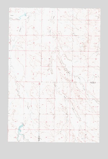
Watkins, MT USGS Topographic Map
Click on map above to begin viewing in our Map Viewer.

This topographic map contains these locations and features:
Feature Name Type Latitude Longitude GNIS ID View Map
16N46E02ACBA01 WellWellN47.1772°W105.8633°821250View Map
16N46E12DCCA01 WellWellN47.1539°W105.8420°821074View Map
16N47E06ADAA01 WellWellN47.1764°W105.8136°821245View Map
16N47E15CBA_01 WellWellN47.1444°W105.7658°821000View Map
16N47E15CBAA02 WellWellN47.1444°W105.7658°821001View Map
16N47E21DAAD01 WellWellN47.1283°W105.7711°820907View Map
17N46E11ADCC01 WellWellN47.2467°W105.8150°821668View Map
17N46E15AAAA01 WellWellN47.2386°W105.8317°821618View Map
17N47E17DBD_01 WellWellN47.2289°W105.7525°821578View Map
17N47E31CCCA01 WellWellN47.1819°W105.7870°821285View Map
Dunlap CreekStreamN47.2139°W105.8047°1716266View Map
East Duck CreekStreamN47.2125°W105.8089°771004View Map
Hughes DamDamN47.2367°W105.8522°795099View Map
Jordan Reservoir Number 1 DamDamN47.2483°W105.8289°796109View Map
Jordan Reservoir Number 2 DamDamN47.2450°W105.8739°796110View Map
Lisk Creek DamDamN47.1417°W105.8556°795097View Map
Lisk Creek DamDamN47.1411°W105.8547°773386View Map
Lisk Creek ReservoirReservoirN47.1354°W105.8579°795098View Map
Thorn DamDamN47.2150°W105.8672°797791View Map
Three Buttes School (historical)SchoolN47.1619°W105.7664°1715744View Map
Trail CreekStreamN47.2419°W105.8478°777735View Map
WatkinsPopulated PlaceN47.2428°W105.8733°778146View Map
Watkins Post Office (historical)Post OfficeN47.2431°W105.8742°1716166View Map
West Duck CreekStreamN47.2125°W105.8089°778212View Map

Note: Coordinates in the location and feature list above are referenced to NAD83 datum.


Copyright (C) 2008-2024 Ryan Niemi / Sunset Dynamics ... All Rights Reserved