TopoQuest Logo
Do you find TopoQuest useful?
Help keep TopoQuest running and adding new maps/features by donating!
Bitcoin:  19c7KJd3qBynnjoSw5npx9KScwjBe4ifkT
Litecoin:  LXs6TkuXGGXo1vDsWCkWVdjQX94eUKd6ui
Home View Maps Find Maps Find Places Resources & Links


Watkins SE, Montana Topographic Map

USGS Map Title: Watkins SE, MT
USGS Map MRC: 47105A7
DRG (GeoTIFF) Download: o47105a7.tif


Neighboring USGS Topographic Map Quads:


  Berry School, MT  
47105B8
 

  Watkins, MT  
47105B7
 

  Big Sheep Mountain NW, MT  
47105B6
 

  Heitz School, MT  
47105A8
 

  Watkins SE, MT  
47105A7
 

  Big Sheep Mountain, MT  
47105A6
 

  Combs Ranch, MT  
46105H8
 

  Little Sheep Mountain, MT  
46105H7
 

  South Fork Reservoir, MT  
46105H6


Map MRC Location:

N48°
W106°
N48°
W105°
H8 H7 H6 H5 H4 H3 H2 H1
G8 G7 G6 G5 G4 G3 G2 G1
F8 F7 F6 F5 F4 F3 F2 F1
E8 E7 E6 E5 E4 E3 E2 E1
D8 D7 D6 D5 D4 D3 D2 D1
C8 C7 C6 C5 C4 C3 C2 C1
B8 B7 B6 B5 B4 B3 B2 B1
A8 A7 A6 A5 A4 A3 A2 A1
N47°
W106°
N47°
W105°

Watkins SE, MT USGS 1:24K Topographic Map Preview:
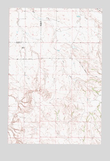
Watkins SE, MT USGS Topographic Map
Click on map above to begin viewing in our Map Viewer.

This topographic map contains these locations and features:
Feature Name Type Latitude Longitude GNIS ID View Map
15N46E11BBCA01 WellWellN47.0750°W105.8736°820578View Map
15N46E23CADB01 WellWellN47.0394°W105.8664°820353View Map
15N46E24AD__01 WellWellN47.0433°W105.8356°820373View Map
15N47E05ADCD01 WellWellN47.0867°W105.7942°820653View Map
15N47E05CB__01 WellWellN47.0806°W105.8042°820619View Map
15N47E06DABC01 WellWellN47.0842°W105.8172°820638View Map
15N47E19DACB01 WellWellN47.0403°W105.8175°820355View Map
15N47E22DDBA01 WellWellN47.0386°W105.7514°820349View Map
15N47E22DDBA02 WellWellN47.0386°W105.7514°820350View Map
16N46E26DBBA01 WellWellN47.1144°W105.8620°820828View Map
16N46E35BDDC01 WellWellN47.1006°W105.8664°820736View Map
16N47E33CAAC01 WellWellN47.0992°W105.7828°820731View Map
Big Sheep Mountain School (historical)SchoolN47.0789°W105.7906°1715673View Map
Duck DamDamN47.1183°W105.7839°797361View Map
Edna Post Office (historical)Post OfficeN47.0422°W105.8111°1715662View Map
For Sale DamDamN47.1033°W105.8639°798181View Map
Morton SpringSpringN47.0881°W105.8545°774405View Map
Mountain View School (historical)SchoolN47.1044°W105.8028°1715717View Map
Sheep Mountain DamDamN47.0883°W105.7889°795733View Map
Sheep Mountain Drop DamDamN47.0867°W105.8106°795734View Map
Wackle DamDamN47.1167°W105.8372°797625View Map

Note: Coordinates in the location and feature list above are referenced to NAD83 datum.


Copyright (C) 2008-2025 Ryan Niemi / Sunset Dynamics ... All Rights Reserved