TopoQuest Logo
Do you find TopoQuest useful?
Help keep TopoQuest running and adding new maps/features by donating!
Bitcoin:  19c7KJd3qBynnjoSw5npx9KScwjBe4ifkT
Litecoin:  LXs6TkuXGGXo1vDsWCkWVdjQX94eUKd6ui
Home View Maps Find Maps Find Places Resources & Links


Bondad Hill, Colorado Topographic Map

USGS Map Title: Bondad Hill, CO
USGS Map MRC: 37107A7
DRG (GeoTIFF) Download: o37107a7.tif


Neighboring USGS Topographic Map Quads:


  Basin Mountain, CO  
37107B8
 

  Loma Linda, CO  
37107B7
 

  Gem Village, CO  
37107B6
 

  Long Mountain, CO  
37107A8
 

  Bondad Hill, CO  
37107A7
 

  Ignacio, CO  
37107A6
 

  Cedar Hill, NM  
36107H8
 

  Mount Nebo, NM  
36107H7
 

  Anastacio Spring, NM  
36107H6


Map MRC Location:

N38°
W108°
N38°
W107°
H8 H7 H6 H5 H4 H3 H2 H1
G8 G7 G6 G5 G4 G3 G2 G1
F8 F7 F6 F5 F4 F3 F2 F1
E8 E7 E6 E5 E4 E3 E2 E1
D8 D7 D6 D5 D4 D3 D2 D1
C8 C7 C6 C5 C4 C3 C2 C1
B8 B7 B6 B5 B4 B3 B2 B1
A8 A7 A6 A5 A4 A3 A2 A1
N37°
W108°
N37°
W107°

Bondad Hill, CO USGS 1:24K Topographic Map Preview:
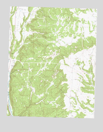
Bondad Hill, CO USGS Topographic Map
Click on map above to begin viewing in our Map Viewer.

This topographic map contains these locations and features:
Feature Name Type Latitude Longitude GNIS ID View Map
Bondad HillSummitN37.0703°W107.8715°184471View Map
Bondad LandfillLocaleN37.0569°W107.8628°2678161View Map
Cow CanyonValleyN37.0906°W107.8535°184470View Map
Durango Fire and Rescue Authority Station 11 - Bondad StationBuildingN37.0552°W107.8732°2667123View Map
Durango Fire and Rescue Authority Station 4BuildingN37.1178°W107.8673°2667122View Map
East Alamo CanyonValleyN37.0498°W107.7577°184475View Map
Finney CutsStreamN37.0781°W107.8312°175351View Map
Florida RiverStreamN37.0489°W107.8728°183961View Map
Gaines CanyonValleyN37.0825°W107.8553°184469View Map
Hat Park CanyonValleyN37.0186°W107.8253°184466View Map
Hereford CanyonValleyN37.1239°W107.8334°184462View Map
Lambert ReservoirReservoirN37.1125°W107.8478°175347View Map
Little Cow CanyonValleyN37.0464°W107.8725°184468View Map
Los Pinos Fire Protection District Station 3BuildingN37.0957°W107.7552°2666998View Map
Mesa MountainsRangeN37.0686°W107.7906°203014View Map
S and M CanalCanalN37.0944°W107.8590°188585View Map
Sanchez DrawValleyN37.1068°W107.8531°184359View Map
Sixshooter CanyonValleyN37.0137°W107.8415°184467View Map
Sunnyside Elementary SchoolSchoolN37.1228°W107.8628°184472View Map
West Alamo CanyonValleyN37.0494°W107.7578°184474View Map
West Leon CreekStreamN37.0861°W107.7915°175352View Map

Note: Coordinates in the location and feature list above are referenced to NAD83 datum.


Copyright (C) 2008-2025 Ryan Niemi / Sunset Dynamics ... All Rights Reserved