TopoQuest Logo
Do you find TopoQuest useful?
Help keep TopoQuest running and adding new maps/features by donating!
Bitcoin:  19c7KJd3qBynnjoSw5npx9KScwjBe4ifkT
Litecoin:  LXs6TkuXGGXo1vDsWCkWVdjQX94eUKd6ui
Home View Maps Find Maps Find Places Resources & Links


Waverly, Alabama Topographic Map

USGS Map Title: Waverly, AL
USGS Map MRC: 32085F5
DRG (GeoTIFF) Download: o32085f5.tif


Neighboring USGS Topographic Map Quads:


  Camp Hill, AL  
32085G6
 

  Camp Hill SE, AL  
32085G5
 

  Moorefield, AL  
32085G4
 

  Thornton, AL  
32085F6
 

  Waverly, AL  
32085F5
 

  Opelika West, AL  
32085F4
 

  Notasulga, AL  
32085E6
 

  Loachapoka, AL  
32085E5
 

  Auburn, AL  
32085E4


Map MRC Location:

N33°
W86°
N33°
W85°
H8 H7 H6 H5 H4 H3 H2 H1
G8 G7 G6 G5 G4 G3 G2 G1
F8 F7 F6 F5 F4 F3 F2 F1
E8 E7 E6 E5 E4 E3 E2 E1
D8 D7 D6 D5 D4 D3 D2 D1
C8 C7 C6 C5 C4 C3 C2 C1
B8 B7 B6 B5 B4 B3 B2 B1
A8 A7 A6 A5 A4 A3 A2 A1
N32°
W86°
N32°
W85°

Waverly, AL USGS 1:24K Topographic Map Preview:
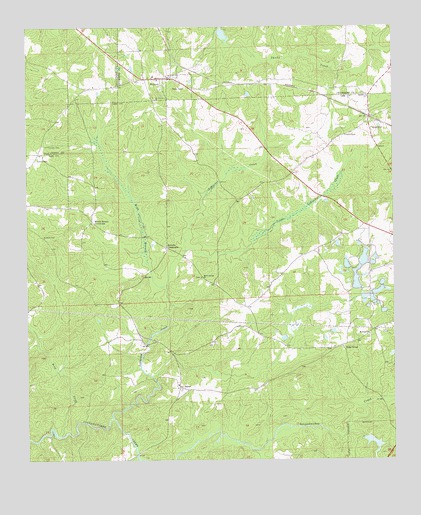
Waverly, AL USGS Topographic Map
Click on map above to begin viewing in our Map Viewer.

This topographic map contains these locations and features:
Feature Name Type Latitude Longitude GNIS ID View Map
Alabama Agricultural Experiment StationLocaleN32.6715°W85.5050°138096View Map
Allens ChapelChurchN32.7185°W85.5161°164019View Map
Auburn Farm Pond Number 1 DamDamN32.6818°W85.5116°130901View Map
Auburn Farm Pond Number S-3 DamDamN32.6801°W85.5150°130899View Map
Auburn Farm Pond Number S-6 DamDamN32.6735°W85.5116°130890View Map
Auburn Farm Pond Number S-8 DamDamN32.6718°W85.5100°130887View Map
Auburn Farm Pond S-14 DamDamN32.6718°W85.5066°130885View Map
Bird CreekStreamN32.6324°W85.6152°114365View Map
Canaan CemeteryCemeteryN32.7158°W85.6181°115516View Map
Canaan Primitive Baptist Church (historical)ChurchN32.7157°W85.6172°137381View Map
Clements PondLakeN32.6601°W85.5375°138130View Map
Daniel-Caldwell CemeteryCemeteryN32.6573°W85.5233°138143View Map
Farmville Volunteer Fire Department Station 2BuildingN32.7224°W85.5093°2691118View Map
Fisheries Research Unit Auburn UniversityLocaleN32.6779°W85.5088°163471View Map
Friendship Church (historical)ChurchN32.6418°W85.5597°138171View Map
Gold HillPopulated PlaceN32.7218°W85.5077°119087View Map
Gold Hill CemeteryCemeteryN32.7246°W85.5055°138179View Map
Gold Hill Methodist ChurchChurchN32.7237°W85.5077°138181View Map
Gold Hill School (historical)SchoolN32.7182°W85.5166°138180View Map
Hayne Church (historical)ChurchN32.7112°W85.5794°138191View Map
JamesPopulated PlaceN32.6449°W85.5730°156522View Map
JamesvillePopulated PlaceN32.7129°W85.6211°156523View Map
Little Loblockee CreekStreamN32.6849°W85.5713°152099View Map
Loachapoka-Roxana DivisionCivilN32.6497°W85.5831°165849View Map
Loblockee CreekStreamN32.6371°W85.5963°152133View Map
Macedonia ChurchChurchN32.7301°W85.5083°164075View Map
Macon Spring ChurchChurchN32.6776°W85.5658°152196View Map
Macon Springs School (historical)SchoolN32.6774°W85.5644°138221View Map
Macons MillLocaleN32.6585°W85.5844°138222View Map
Maddox Family CemeteryCemeteryN32.7329°W85.5205°147445View Map
Middle Brooks CrossroadsPopulated PlaceN32.6940°W85.6025°156703View Map
Mount Sinai CemeteryCemeteryN32.6604°W85.5083°138238View Map
Mount Sinai ChurchChurchN32.6612°W85.5086°154477View Map
Mount Traveler ChurchChurchN32.7293°W85.5808°123405View Map
Ogletree Outing Club DamDamN32.6318°W85.5083°130818View Map
Ogletree Outing Club LakeReservoirN32.6300°W85.5072°130819View Map
Pond Number S-1ReservoirN32.6831°W85.5100°130902View Map
Pond Number S-14ReservoirN32.6734°W85.5055°130886View Map
Pond Number S-3ReservoirN32.6812°W85.5159°130900View Map
Pond Number S-6ReservoirN32.6735°W85.5116°130889View Map
Pond Number S-8ReservoirN32.6721°W85.5096°130888View Map
Ridge GrovePopulated PlaceN32.6579°W85.5180°156967View Map
Ridge Grove CemeteryCemeteryN32.6568°W85.5233°138274View Map
Ridge School (historical)SchoolN32.6610°W85.5091°138273View Map
Rowells CemeteryCemeteryN32.6896°W85.6194°125997View Map
Rowells CrossroadsPopulated PlaceN32.6862°W85.5772°156999View Map
Stephens Mill PondReservoirN32.7479°W85.5579°136115View Map
Swingle CreekStreamN32.6492°W85.5825°2630709View Map
Town of WaverlyCivilN32.7333°W85.5762°2406842View Map
WaverlyPopulated PlaceN32.7354°W85.5791°153904View Map
Waverly CemeteryCemeteryN32.7342°W85.5735°138335View Map
Waverly Post OfficePost OfficeN32.7355°W85.5767°169222View Map
Waverly Public SchoolSchoolN32.7360°W85.5813°148947View Map
Webb BranchStreamN32.6760°W85.5775°128678View Map

Note: Coordinates in the location and feature list above are referenced to NAD83 datum.


Copyright (C) 2008-2025 Ryan Niemi / Sunset Dynamics ... All Rights Reserved