TopoQuest Logo
Do you find TopoQuest useful?
Help keep TopoQuest running and adding new maps/features by donating!
Bitcoin:  19c7KJd3qBynnjoSw5npx9KScwjBe4ifkT
Litecoin:  LXs6TkuXGGXo1vDsWCkWVdjQX94eUKd6ui
Home View Maps Find Maps Find Places Resources & Links


Camp Hill SE, Alabama Topographic Map

USGS Map Title: Camp Hill SE, AL
USGS Map MRC: 32085G5
DRG (GeoTIFF) Download: o32085g5.tif


Neighboring USGS Topographic Map Quads:


  Buttston, AL  
32085H6
 

  Dudleyville, AL  
32085H5
 

  Lafayette, AL  
32085H4
 

  Camp Hill, AL  
32085G6
 

  Camp Hill SE, AL  
32085G5
 

  Moorefield, AL  
32085G4
 

  Thornton, AL  
32085F6
 

  Waverly, AL  
32085F5
 

  Opelika West, AL  
32085F4


Map MRC Location:

N33°
W86°
N33°
W85°
H8 H7 H6 H5 H4 H3 H2 H1
G8 G7 G6 G5 G4 G3 G2 G1
F8 F7 F6 F5 F4 F3 F2 F1
E8 E7 E6 E5 E4 E3 E2 E1
D8 D7 D6 D5 D4 D3 D2 D1
C8 C7 C6 C5 C4 C3 C2 C1
B8 B7 B6 B5 B4 B3 B2 B1
A8 A7 A6 A5 A4 A3 A2 A1
N32°
W86°
N32°
W85°

Camp Hill SE, AL USGS 1:24K Topographic Map Preview:
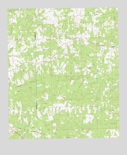
Camp Hill SE, AL USGS Topographic Map
Click on map above to begin viewing in our Map Viewer.

This topographic map contains these locations and features:
Feature Name Type Latitude Longitude GNIS ID View Map
BlackmanPopulated PlaceN32.8682°W85.5266°156070View Map
Center Baptist ChurchChurchN32.8676°W85.5261°154112View Map
Centerview Baptist ChurchChurchN32.8726°W85.6202°115877View Map
Cox DamDamN32.8635°W85.5783°131055View Map
Cox LakeSwampN32.8648°W85.5760°131056View Map
CulebraPopulated PlaceN32.8168°W85.5352°156237View Map
Dean-Shirley CemeteryCemeteryN32.8668°W85.5852°136032View Map
Emfinger BranchStreamN32.8010°W85.5475°117975View Map
Fargason CemeteryCemeteryN32.8429°W85.6238°137417View Map
Gin BranchStreamN32.8021°W85.5583°118977View Map
Hills Chapel ChurchChurchN32.8162°W85.5988°137454View Map
Jones MillPopulated PlaceN32.7507°W85.5594°156538View Map
JudsonPopulated PlaceN32.8360°W85.5861°121065View Map
Kendall CrossroadsPopulated PlaceN32.8368°W85.5072°164070View Map
McCord CemeteryCemeteryN32.8246°W85.5863°147446View Map
Midway CemeteryCemeteryN32.8468°W85.5194°147447View Map
Midway Methodist ChurchChurchN32.8471°W85.5197°152316View Map
Mount Lebanon ChurchChurchN32.8387°W85.5205°123236View Map
Mount Olive CemeteryCemeteryN32.7729°W85.5344°2628218View Map
Mount Olive ChurchChurchN32.7732°W85.5338°123307View Map
Mount Sinai ChurchChurchN32.7832°W85.5844°123394View Map
New Canaan CemeteryCemeteryN32.8274°W85.5767°2628217View Map
New Canaan ChurchChurchN32.8268°W85.5772°123729View Map
New HarmonyPopulated PlaceN32.7801°W85.5300°156780View Map
New Harmony ChurchChurchN32.7812°W85.5302°136075View Map
Peace and Goodwill CemeteryCemeteryN32.7635°W85.5041°124533View Map
Peace and Goodwill ChurchChurchN32.7754°W85.5111°124535View Map
Plainview SchoolSchoolN32.8404°W85.5244°164105View Map
Pleasant View ChurchChurchN32.8454°W85.5519°125059View Map
Pretty CreekStreamN32.8071°W85.5233°125258View Map
Sandy Creek Baptist ChurchChurchN32.8446°W85.6144°153326View Map
Sargent DamDamN32.8635°W85.5966°131057View Map
Seroyer BranchStreamN32.8012°W85.5869°126552View Map
Smith-Willoughby CemeteryCemeteryN32.7732°W85.5338°2628219View Map
SpinksPopulated PlaceN32.7621°W85.6191°137531View Map
Stephens Mill DamDamN32.7505°W85.5588°130984View Map

Note: Coordinates in the location and feature list above are referenced to NAD83 datum.


Copyright (C) 2008-2025 Ryan Niemi / Sunset Dynamics ... All Rights Reserved