TopoQuest Logo
Do you find TopoQuest useful?
Help keep TopoQuest running and adding new maps/features by donating!
Bitcoin:  19c7KJd3qBynnjoSw5npx9KScwjBe4ifkT
Litecoin:  LXs6TkuXGGXo1vDsWCkWVdjQX94eUKd6ui
Home View Maps Find Maps Find Places Resources & Links


Thornton, Alabama Topographic Map

USGS Map Title: Thornton, AL
USGS Map MRC: 32085F6
DRG (GeoTIFF) Download: o32085f6.tif


Neighboring USGS Topographic Map Quads:


  Dadeville, AL  
32085G7
 

  Camp Hill, AL  
32085G6
 

  Camp Hill SE, AL  
32085G5
 

  Ponders, AL  
32085F7
 

  Thornton, AL  
32085F6
 

  Waverly, AL  
32085F5
 

  Carrville, AL  
32085E7
 

  Notasulga, AL  
32085E6
 

  Loachapoka, AL  
32085E5


Map MRC Location:

N33°
W86°
N33°
W85°
H8 H7 H6 H5 H4 H3 H2 H1
G8 G7 G6 G5 G4 G3 G2 G1
F8 F7 F6 F5 F4 F3 F2 F1
E8 E7 E6 E5 E4 E3 E2 E1
D8 D7 D6 D5 D4 D3 D2 D1
C8 C7 C6 C5 C4 C3 C2 C1
B8 B7 B6 B5 B4 B3 B2 B1
A8 A7 A6 A5 A4 A3 A2 A1
N32°
W86°
N32°
W85°

Thornton, AL USGS 1:24K Topographic Map Preview:
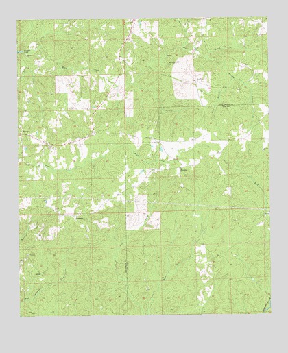
Thornton, AL USGS Topographic Map
Click on map above to begin viewing in our Map Viewer.

This topographic map contains these locations and features:
Feature Name Type Latitude Longitude GNIS ID View Map
Antioch Baptist ChurchChurchN32.6696°W85.7327°113148View Map
Antioch CemeteryCemeteryN32.6687°W85.7319°137364View Map
Church Hill (historical)Populated PlaceN32.6485°W85.7480°137384View Map
Meadows-Robinson CemeteryCemeteryN32.7153°W85.6598°141898View Map
Murphy Gin BranchStreamN32.7340°W85.6552°152571View Map
New Harmony ChurchChurchN32.7126°W85.7141°123754View Map
New Hope CemeteryCemeteryN32.7315°W85.6708°123788View Map
New Hope ChurchChurchN32.7240°W85.6605°123821View Map
North Branch Blue CreekStreamN32.7340°W85.6552°151133View Map
Pentecost CemeteryCemeteryN32.6515°W85.7455°137497View Map
Pentecost Methodist ChurchChurchN32.6510°W85.7458°158898View Map
Pine Grove School (historical)SchoolN32.6260°W85.6611°138263View Map
Rock Mountain Church (historical)ChurchN32.6432°W85.6600°150040View Map
RoxanaPopulated PlaceN32.6871°W85.6691°125999View Map
Roxana CemeteryCemeteryN32.6877°W85.6689°138282View Map
Roxana Methodist ChurchChurchN32.6868°W85.6686°138284View Map
Roxanna CemeteryCemeteryN32.6877°W85.6688°138283View Map
Shiloh CemeteryCemeteryN32.6973°W85.7347°126720View Map
Simmons CrossroadsPopulated PlaceN32.6674°W85.7225°157064View Map
Smith Crossroads (historical)Populated PlaceN32.7260°W85.6611°137530View Map
Still BranchStreamN32.7246°W85.6427°127397View Map
Sweet Pilgrim Church (historical)ChurchN32.6490°W85.6536°138316View Map
ThorntonPopulated PlaceN32.7021°W85.7480°127926View Map

Note: Coordinates in the location and feature list above are referenced to NAD83 datum.


Copyright (C) 2008-2025 Ryan Niemi / Sunset Dynamics ... All Rights Reserved