TopoQuest Logo
Do you find TopoQuest useful?
Help keep TopoQuest running and adding new maps/features by donating!
Bitcoin:  19c7KJd3qBynnjoSw5npx9KScwjBe4ifkT
Litecoin:  LXs6TkuXGGXo1vDsWCkWVdjQX94eUKd6ui
Home View Maps Find Maps Find Places Resources & Links


Weippe North, Idaho Topographic Map

USGS Map Title: Weippe North, ID
USGS Map MRC: 46115D8
DRG (GeoTIFF) Download: o46115d8.tif


Neighboring USGS Topographic Map Quads:


  Grangemont, ID  
46116E1
 

  Whiskey Butte, ID  
46115E8
 

  Jaype, ID  
46115E7
 

  Rudo, ID  
46116D1
 

  Weippe North, ID  
46115D8
 

  Pierce, ID  
46115D7
 

  Woodland, ID  
46116C1
 

  Weippe South, ID  
46115C8
 

  Brown Creek Ridge, ID  
46115C7


Map MRC Location:

N47°
W116°
N47°
W115°
H8 H7 H6 H5 H4 H3 H2 H1
G8 G7 G6 G5 G4 G3 G2 G1
F8 F7 F6 F5 F4 F3 F2 F1
E8 E7 E6 E5 E4 E3 E2 E1
D8 D7 D6 D5 D4 D3 D2 D1
C8 C7 C6 C5 C4 C3 C2 C1
B8 B7 B6 B5 B4 B3 B2 B1
A8 A7 A6 A5 A4 A3 A2 A1
N46°
W116°
N46°
W115°

Weippe North, ID USGS 1:24K Topographic Map Preview:
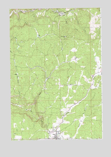
Weippe North, ID USGS Topographic Map
Click on map above to begin viewing in our Map Viewer.

This topographic map contains these locations and features:
Feature Name Type Latitude Longitude GNIS ID View Map
Battles MillLocaleN46.4513°W115.9101°377045View Map
Bennett CreekStreamN46.4963°W115.9901°377363View Map
City of WeippeCivilN46.3787°W115.9393°2412204View Map
Cow CreekPopulated PlaceN46.4957°W115.9329°397584View Map
Cow CreekStreamN46.4974°W115.9354°379963View Map
Grasshopper CreekStreamN46.3821°W115.9479°382574View Map
HaleyPopulated PlaceN46.4952°W115.9254°397770View Map
JohnsonPopulated PlaceN46.4269°W115.9165°399082View Map
Johnsons MillPopulated PlaceN46.4271°W115.9182°397827View Map
Lightning CreekStreamN46.4988°W115.9890°396819View Map
McCann MillLocaleN46.4421°W115.8788°386571View Map
Olson CreekStreamN46.4949°W115.9240°387955View Map
Olson PondReservoirN46.4742°W115.9620°387959View Map
OmillPopulated PlaceN46.4938°W115.9268°400023View Map
Orofino Creek PointCliffN46.4730°W115.9240°387999View Map
Placer CreekStreamN46.4974°W115.9171°388583View Map
Shake MeadowFlatN46.4380°W115.9899°390139View Map
Shake Meadow CreekStreamN46.4085°W115.9926°390140View Map
Space CreekStreamN46.4235°W115.8907°391089View Map
Timberline High SchoolSchoolN46.4352°W115.8876°399294View Map
WeippePopulated PlaceN46.3760°W115.9382°398329View Map
Weippe DivisionCivilN46.3786°W115.9422°1936826View Map
Weippe Elementary SchoolSchoolN46.3762°W115.9351°399700View Map
Weippe High School (historical)SchoolN46.3771°W115.9399°401702View Map
Weippe Middle SchoolSchoolN46.3771°W115.9399°399699View Map
Weippe Post OfficePost OfficeN46.3771°W115.9384°2766851View Map
Weippe Prairie Point of InterestLocaleN46.3760°W115.9546°393994View Map
Weippe Rural Fire DepartmentBuildingN46.3753°W115.9381°2619206View Map
Winter CreekStreamN46.4041°W115.9746°393601View Map

Note: Coordinates in the location and feature list above are referenced to NAD83 datum.


Copyright (C) 2008-2025 Ryan Niemi / Sunset Dynamics ... All Rights Reserved