TopoQuest Logo
Do you find TopoQuest useful?
Help keep TopoQuest running and adding new maps/features by donating!
Bitcoin:  19c7KJd3qBynnjoSw5npx9KScwjBe4ifkT
Litecoin:  LXs6TkuXGGXo1vDsWCkWVdjQX94eUKd6ui
Home View Maps Find Maps Find Places Resources & Links


Whiskey Butte, Idaho Topographic Map

USGS Map Title: Whiskey Butte, ID
USGS Map MRC: 46115E8
DRG (GeoTIFF) Download: o46115e8.tif


Neighboring USGS Topographic Map Quads:


  Little Green Mountain, ID  
46116F1
 

  John Lewis Mountain, ID  
46115F8
 

  Headquarters, ID  
46115F7
 

  Grangemont, ID  
46116E1
 

  Whiskey Butte, ID  
46115E8
 

  Jaype, ID  
46115E7
 

  Rudo, ID  
46116D1
 

  Weippe North, ID  
46115D8
 

  Pierce, ID  
46115D7


Map MRC Location:

N47°
W116°
N47°
W115°
H8 H7 H6 H5 H4 H3 H2 H1
G8 G7 G6 G5 G4 G3 G2 G1
F8 F7 F6 F5 F4 F3 F2 F1
E8 E7 E6 E5 E4 E3 E2 E1
D8 D7 D6 D5 D4 D3 D2 D1
C8 C7 C6 C5 C4 C3 C2 C1
B8 B7 B6 B5 B4 B3 B2 B1
A8 A7 A6 A5 A4 A3 A2 A1
N46°
W116°
N46°
W115°

Whiskey Butte, ID USGS 1:24K Topographic Map Preview:
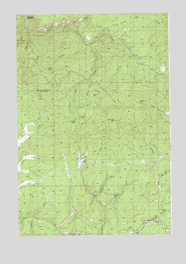
Whiskey Butte, ID USGS Topographic Map
Click on map above to begin viewing in our Map Viewer.

This topographic map contains these locations and features:
Feature Name Type Latitude Longitude GNIS ID View Map
Bald MountainSummitN46.5755°W115.8996°376887View Map
Bargamin CreekStreamN46.5219°W115.9365°376954View Map
Buck ButteSummitN46.5946°W115.9754°378349View Map
Buck CreekStreamN46.6157°W115.9899°397489View Map
Campbells Pond Access AreaLocaleN46.5619°W115.8751°401242View Map
Christmas CreekStreamN46.6066°W115.9421°379330View Map
Cow Creek SaddleGapN46.5655°W115.9532°395264View Map
Crawford MineMineN46.5666°W115.9479°380052View Map
Cully MooresPopulated PlaceN46.5305°W115.9915°399440View Map
Democrat CreekStreamN46.5866°W115.9399°395296View Map
Democrat MineMineN46.5802°W115.9396°380499View Map
Democrat MountainSummitN46.5646°W115.9210°380500View Map
Doe CreekStreamN46.6146°W115.9915°380679View Map
Gold CreekStreamN46.6074°W115.9429°382360View Map
Harvey CreekStreamN46.5327°W115.9474°382947View Map
Hay CreekStreamN46.5316°W115.8871°382982View Map
Konkols PondLakeN46.5416°W115.9479°395559View Map
McCauley CreekStreamN46.5121°W115.8851°386575View Map
PoormanLocaleN46.5085°W115.8879°394935View Map
Poorman CreekStreamN46.5071°W115.8876°400044View Map
Porters CampLocaleN46.5102°W115.8868°394938View Map
Rainy CreekStreamN46.5005°W115.9537°389061View Map
Ruby CreekStreamN46.5885°W115.9413°389696View Map
Skinner CreekStreamN46.5155°W115.9301°396950View Map
Snake CreekStreamN46.6191°W115.9535°390727View Map
Whiskey ButteSummitN46.5821°W115.9790°393301View Map

Note: Coordinates in the location and feature list above are referenced to NAD83 datum.


Copyright (C) 2008-2024 Ryan Niemi / Sunset Dynamics ... All Rights Reserved