TopoQuest Logo
Do you find TopoQuest useful?
Help keep TopoQuest running and adding new maps/features by donating!
Bitcoin:  19c7KJd3qBynnjoSw5npx9KScwjBe4ifkT
Litecoin:  LXs6TkuXGGXo1vDsWCkWVdjQX94eUKd6ui
Home View Maps Find Maps Find Places Resources & Links


Wenaha Forks, Oregon Topographic Map

USGS Map Title: Wenaha Forks, OR
USGS Map MRC: 45117H7
DRG (GeoTIFF) Download: o45117h7.tif


Neighboring USGS Topographic Map Quads:


  Deadman Peak, WA  
46117A8
 

  Godman Spring, WA  
46117A7
 

  Oregon Butte, WA  
46117A6
 

  Bone Spring, OR  
45117H8
 

  Wenaha Forks, OR  
45117H7
 

  Elbow Creek, OR  
45117H6
 

  Jubilee Lake, OR  
45117G8
 

  Fry Meadow, OR  
45117G7
 

  Deep Creek, OR  
45117G6


Map MRC Location:

N46°
W118°
N46°
W117°
H8 H7 H6 H5 H4 H3 H2 H1
G8 G7 G6 G5 G4 G3 G2 G1
F8 F7 F6 F5 F4 F3 F2 F1
E8 E7 E6 E5 E4 E3 E2 E1
D8 D7 D6 D5 D4 D3 D2 D1
C8 C7 C6 C5 C4 C3 C2 C1
B8 B7 B6 B5 B4 B3 B2 B1
A8 A7 A6 A5 A4 A3 A2 A1
N45°
W118°
N45°
W117°

Wenaha Forks, OR USGS 1:24K Topographic Map Preview:
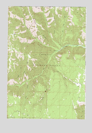
Wenaha Forks, OR USGS Topographic Map
Click on map above to begin viewing in our Map Viewer.

This topographic map contains these locations and features:
Feature Name Type Latitude Longitude GNIS ID View Map
Beaver CreekStreamN45.9544°W117.7863°1137825View Map
Cougar CanyonValleyN45.9179°W117.8413°1140204View Map
Dexter RidgeRidgeN45.9888°W117.8019°1140989View Map
Elk CreekStreamN45.9401°W117.8069°1141750View Map
Elk FlatFlatN45.9143°W117.7613°1141770View Map
Elk Flats Recreation Site (historical)LocaleN45.9182°W117.7666°1162583View Map
Jaussaud CreekStreamN45.9238°W117.8230°1144229View Map
North Fork Wenaha RiverStreamN45.9505°W117.7947°1147019View Map
Peerless SpringSpringN45.8768°W117.8687°1147564View Map
Round ButteSummitN45.9690°W117.8660°1148761View Map
Sawtooth RidgeRidgeN45.9893°W117.8366°1149104View Map
Slick Ear CreekStreamN45.9546°W117.7860°1149682View Map
South Fork Wenaha RiverStreamN45.9507°W117.7941°1150042View Map
Trapper CreekStreamN45.9118°W117.8555°1151394View Map
Trapper RidgeRidgeN45.9257°W117.8469°1151397View Map
Trapper SpringSpringN45.9404°W117.8713°1156397View Map
Umatilla National ForestForestN45.9194°W117.8483°1514039View Map
Wenaha Forks (historical)LocaleN45.9507°W117.7941°1152015View Map

Note: Coordinates in the location and feature list above are referenced to NAD83 datum.


Copyright (C) 2008-2024 Ryan Niemi / Sunset Dynamics ... All Rights Reserved