TopoQuest Logo
Do you find TopoQuest useful?
Help keep TopoQuest running and adding new maps/features by donating!
Bitcoin:  19c7KJd3qBynnjoSw5npx9KScwjBe4ifkT
Litecoin:  LXs6TkuXGGXo1vDsWCkWVdjQX94eUKd6ui
Home View Maps Find Maps Find Places Resources & Links


Godman Spring, Washington Topographic Map

USGS Map Title: Godman Spring, WA
USGS Map MRC: 46117A7
DRG (GeoTIFF) Download: o46117a7.tif


Neighboring USGS Topographic Map Quads:


  Robinette Mountain, WA  
46117B8
 

  Eckler Mountain, WA  
46117B7
 

  Panjab Creek, WA  
46117B6
 

  Deadman Peak, WA  
46117A8
 

  Godman Spring, WA  
46117A7
 

  Oregon Butte, WA  
46117A6
 

  Bone Spring, OR  
45117H8
 

  Wenaha Forks, OR  
45117H7
 

  Elbow Creek, OR  
45117H6


Map MRC Location:

N47°
W118°
N47°
W117°
H8 H7 H6 H5 H4 H3 H2 H1
G8 G7 G6 G5 G4 G3 G2 G1
F8 F7 F6 F5 F4 F3 F2 F1
E8 E7 E6 E5 E4 E3 E2 E1
D8 D7 D6 D5 D4 D3 D2 D1
C8 C7 C6 C5 C4 C3 C2 C1
B8 B7 B6 B5 B4 B3 B2 B1
A8 A7 A6 A5 A4 A3 A2 A1
N46°
W118°
N46°
W117°

Godman Spring, WA USGS 1:24K Topographic Map Preview:
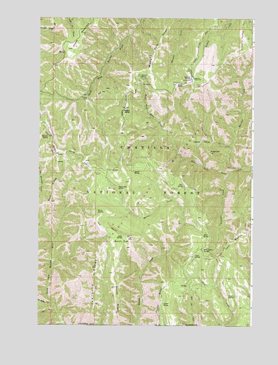
Godman Spring, WA USGS Topographic Map
Click on map above to begin viewing in our Map Viewer.

This topographic map contains these locations and features:
Feature Name Type Latitude Longitude GNIS ID View Map
Beaver RidgeRidgeN46.0054°W117.8294°1137843View Map
Beaver RidgeRidgeN46.0154°W117.8299°1503265View Map
Berry SpringSpringN46.0462°W117.8409°1503324View Map
Bluewood Ski AreaLocaleN46.0863°W117.8549°1514034View Map
Buck RidgeRidgeN46.0501°W117.8677°1503606View Map
Burnt FlatFlatN46.0332°W117.8274°1503664View Map
Burnt Flat CorralLocaleN46.0618°W117.8408°1510310View Map
Cavalier SpringSpringN46.1015°W117.8160°1503865View Map
Chase MountainSummitN46.1124°W117.8580°1512082View Map
Coyote SpringSpringN46.0121°W117.7599°1504231View Map
Deep Saddle CreekStreamN46.0090°W117.8660°1504400View Map
Deer SpringSpringN46.0570°W117.7898°1504422View Map
Dexter RidgeRidgeN46.0121°W117.8033°1504468View Map
Dexter Ridge TrailTrailN46.0124°W117.8035°1510316View Map
Dexter SpringSpringN46.0095°W117.8019°1504469View Map
Elwell SpringSpringN46.0627°W117.8199°1504746View Map
Fuzzy ButteSummitN46.0982°W117.7941°1512230View Map
Godman CampgroundLocaleN46.1001°W117.7869°1514023View Map
Godman Guard StationLocaleN46.1004°W117.7846°1511640View Map
Godman SpringSpringN46.1007°W117.7869°1513119View Map
Grizzly Bear TrailTrailN46.0101°W117.7555°1510035View Map
Happy ValleyValleyN46.0751°W117.7796°1505382View Map
Lady CampLocaleN46.0357°W117.8224°1506042View Map
Lady SpringSpringN46.0360°W117.8259°1506044View Map
Little Turkey Recreation ResidenceBuildingN46.1157°W117.7516°1533289View Map
Little Turkey TailRidgeN46.1165°W117.7563°1513152View Map
Manilla SpringSpringN46.0763°W117.8695°1506446View Map
Mead SpringSpringN46.0375°W117.7770°1506593View Map
Middle Point RidgeRidgeN46.1093°W117.8085°1506667View Map
Preacher CreekStreamN46.0624°W117.7633°1507619View Map
Rainbow CreekStreamN46.0643°W117.7599°1507701View Map
Rainbow Creek Research Natural AreaAreaN46.0701°W117.7705°1533288View Map
Sawtooth RidgeRidgeN46.0165°W117.8419°1508136View Map
Sawtooth TrailTrailN46.0199°W117.8430°1510315View Map
Slick Ear TrailTrailN46.0082°W117.7802°1510317View Map
Stayawhile SpringSpringN46.0561°W117.8293°1508704View Map
SugarloafSummitN46.0707°W117.7749°1512698View Map
Touchet Sno-ParkLocaleN46.0938°W117.8463°1514033View Map
Twin ButtesSummitN46.0393°W117.7544°1509142View Map
Twin Buttes SpringSpringN46.0306°W117.7792°1509144View Map
West Butte Creek TrailTrailN46.0729°W117.7638°1510037View Map
Wildcat SpringSpringN46.0879°W117.8235°1509515View Map
Zuger SpringSpringN46.0285°W117.7835°1509679View Map

Note: Coordinates in the location and feature list above are referenced to NAD83 datum.


Copyright (C) 2008-2025 Ryan Niemi / Sunset Dynamics ... All Rights Reserved