TopoQuest Logo
Do you find TopoQuest useful?
Help keep TopoQuest running and adding new maps/features by donating!
Bitcoin:  19c7KJd3qBynnjoSw5npx9KScwjBe4ifkT
Litecoin:  LXs6TkuXGGXo1vDsWCkWVdjQX94eUKd6ui
Home View Maps Find Maps Find Places Resources & Links


West Grove, Iowa Topographic Map

USGS Map Title: West Grove, IA
USGS Map MRC: 40092F5
DRG (GeoTIFF) Download: o40092f5.tif


Neighboring USGS Topographic Map Quads:


  Unionville, IA  
40092G6
 

  Paris, IA  
40092G5
 

  Bloomfield North, IA  
40092G4
 

  Moulton, IA  
40092F6
 

  West Grove, IA  
40092F5
 

  Bloomfield South, IA  
40092F4
 

  Coatsville, MO  
40092E6
 

  Lancaster, MO  
40092E5
 

  Bunker Hill, MO  
40092E4


Map MRC Location:

N41°
W93°
N41°
W92°
H8 H7 H6 H5 H4 H3 H2 H1
G8 G7 G6 G5 G4 G3 G2 G1
F8 F7 F6 F5 F4 F3 F2 F1
E8 E7 E6 E5 E4 E3 E2 E1
D8 D7 D6 D5 D4 D3 D2 D1
C8 C7 C6 C5 C4 C3 C2 C1
B8 B7 B6 B5 B4 B3 B2 B1
A8 A7 A6 A5 A4 A3 A2 A1
N40°
W93°
N40°
W92°

West Grove, IA USGS 1:24K Topographic Map Preview:
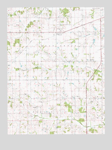
West Grove, IA USGS Topographic Map
Click on map above to begin viewing in our Map Viewer.

This topographic map contains these locations and features:
Feature Name Type Latitude Longitude GNIS ID View Map
Bell CemeteryCemeteryN40.7167°W92.6113°1976128View Map
Bethel CemeteryCemeteryN40.6967°W92.5439°454544View Map
Burgher CemeteryCemeteryN40.6644°W92.6009°454991View Map
Evergreen CemeteryCemeteryN40.6917°W92.6085°1976127View Map
Fenton CemeteryCemeteryN40.6406°W92.5022°456572View Map
Hetzler CemeteryCemeteryN40.6931°W92.6243°457408View Map
Hopkins CemeteryCemeteryN40.6622°W92.5335°457655View Map
Jefferson Post Office (historical)Post OfficeN40.6539°W92.5871°466525View Map
John CemeteryCemeteryN40.7329°W92.6100°457959View Map
Johnson CemeteryCemeteryN40.6296°W92.5772°457964View Map
Kelley CemeteryCemeteryN40.6334°W92.5085°1976124View Map
MarkPopulated PlaceN40.6603°W92.5116°464337View Map
Mark ChurchChurchN40.6609°W92.5044°458808View Map
Mark Post Office (historical)Post OfficeN40.6603°W92.5116°1976015View Map
MontereyPopulated PlaceN40.6522°W92.5880°459190View Map
Monterey Christian ChurchChurchN40.6509°W92.5874°1976077View Map
Monterey Post Office (historical)Post OfficeN40.6522°W92.5880°1976016View Map
Morgan CemeteryCemeteryN40.6569°W92.5151°1823295View Map
Mount Moriah CemeteryCemeteryN40.6980°W92.5190°459313View Map
North Fabius CreekStreamN40.6339°W92.5007°459579View Map
Russellville (historical)Populated PlaceN40.6750°W92.5538°465456View Map
South Fox CreekStreamN40.7434°W92.5821°465367View Map
Township of FabiusCivilN40.6355°W92.5812°467805View Map
Township of West GroveCivilN40.7126°W92.5620°468980View Map
United Methodist ChurchChurchN40.7247°W92.5602°1976084View Map
West GrovePopulated PlaceN40.7247°W92.5602°462862View Map
West Grove CemeteryCemeteryN40.7289°W92.5567°462863View Map
West Grove County ParkParkN40.7264°W92.5557°1981604View Map
West Grove ParkParkN40.7247°W92.5602°1976083View Map
West Grove Post Office (historical)Post OfficeN40.7247°W92.5602°1976085View Map
Westgrove (historical)LocaleN40.7236°W92.5588°1976082View Map

Note: Coordinates in the location and feature list above are referenced to NAD83 datum.


Copyright (C) 2008-2024 Ryan Niemi / Sunset Dynamics ... All Rights Reserved