TopoQuest Logo
Do you find TopoQuest useful?
Help keep TopoQuest running and adding new maps/features by donating!
Bitcoin:  19c7KJd3qBynnjoSw5npx9KScwjBe4ifkT
Litecoin:  LXs6TkuXGGXo1vDsWCkWVdjQX94eUKd6ui
Home View Maps Find Maps Find Places Resources & Links


Lancaster, Missouri Topographic Map

USGS Map Title: Lancaster, MO
USGS Map MRC: 40092E5
DRG (GeoTIFF) Download: o40092e5.tif


Neighboring USGS Topographic Map Quads:


  Moulton, IA  
40092F6
 

  West Grove, IA  
40092F5
 

  Bloomfield South, IA  
40092F4
 

  Coatsville, MO  
40092E6
 

  Lancaster, MO  
40092E5
 

  Bunker Hill, MO  
40092E4
 

  Livonia, MO  
40092D6
 

  Queen City, MO  
40092D5
 

  Downing NW, MO  
40092D4


Map MRC Location:

N41°
W93°
N41°
W92°
H8 H7 H6 H5 H4 H3 H2 H1
G8 G7 G6 G5 G4 G3 G2 G1
F8 F7 F6 F5 F4 F3 F2 F1
E8 E7 E6 E5 E4 E3 E2 E1
D8 D7 D6 D5 D4 D3 D2 D1
C8 C7 C6 C5 C4 C3 C2 C1
B8 B7 B6 B5 B4 B3 B2 B1
A8 A7 A6 A5 A4 A3 A2 A1
N40°
W93°
N40°
W92°

Lancaster, MO USGS 1:24K Topographic Map Preview:
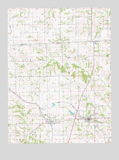
Lancaster, MO USGS Topographic Map
Click on map above to begin viewing in our Map Viewer.

This topographic map contains these locations and features:
Feature Name Type Latitude Longitude GNIS ID View Map
Ailshire School (historical)SchoolN40.5753°W92.6027°733589View Map
Biles CemeteryCemeteryN40.5106°W92.6174°742988View Map
City of LancasterCivilN40.5239°W92.5313°2395624View Map
Coatesville CemeteryCemeteryN40.5872°W92.6157°742992View Map
GlenwoodPopulated PlaceN40.5175°W92.5763°718522View Map
Glenwood CemeteryCemeteryN40.5261°W92.5821°742990View Map
Glenwood JunctionPopulated PlaceN40.5314°W92.5863°740875View Map
Glenwood Post OfficePost OfficeN40.5200°W92.5745°2782589View Map
Helmick Lake DamDamN40.5867°W92.5235°762178View Map
Hickory Mound School (historical)SchoolN40.5178°W92.6191°733590View Map
Independent Order of Odd Fellows CemeteryCemeteryN40.5264°W92.5196°743064View Map
LancasterPopulated PlaceN40.5209°W92.5280°720781View Map
Lancaster City DamDamN40.5267°W92.5469°761482View Map
Lancaster City LakeReservoirN40.5282°W92.5484°761483View Map
Lancaster Fire RescueBuildingN40.5235°W92.5269°2621141View Map
Lancaster Lake DamDamN40.5467°W92.5919°761477View Map
Lancaster Post OfficePost OfficeN40.5227°W92.5268°2783100View Map
Liberty CemeteryCemeteryN40.5792°W92.5530°742991View Map
Liberty School (historical)SchoolN40.5797°W92.5877°733592View Map
Melvin School (historical)SchoolN40.5553°W92.5027°733594View Map
Mount Tabor School (historical)SchoolN40.5595°W92.5488°733593View Map
Mount Vernon School (historical)SchoolN40.5814°W92.5052°733591View Map
Newton CemeteryCemeteryN40.6167°W92.5335°1976116View Map
North Fork of South Fork of North Fabius RiverStreamN40.5742°W92.5457°465883View Map
Number 39 DamDamN40.5817°W92.5169°760827View Map
Schuyler County Sheriff's OfficeBuildingN40.5225°W92.5275°2752520View Map
Siding (historical)LocaleN40.5303°W92.6174°740173View Map
Township of GlenwoodCivilN40.5074°W92.6188°767370View Map
Township of LibertyCivilN40.5349°W92.5158°767372View Map
Ursel Gingerich DamDamN40.5367°W92.5685°760823View Map
Ursel Gingerich LakeReservoirN40.5351°W92.5700°760824View Map
Valley View ChurchChurchN40.5078°W92.5957°742989View Map
Village of GlenwoodCivilN40.5243°W92.5766°2398980View Map
Washington CemeteryCemeteryN40.6165°W92.5431°462687View Map

Note: Coordinates in the location and feature list above are referenced to NAD83 datum.


Copyright (C) 2008-2024 Ryan Niemi / Sunset Dynamics ... All Rights Reserved