TopoQuest Logo
Do you find TopoQuest useful?
Help keep TopoQuest running and adding new maps/features by donating!
Bitcoin:  19c7KJd3qBynnjoSw5npx9KScwjBe4ifkT
Litecoin:  LXs6TkuXGGXo1vDsWCkWVdjQX94eUKd6ui
Home View Maps Find Maps Find Places Resources & Links


West Hamlin, West Virginia Topographic Map

USGS Map Title: West Hamlin, WV
USGS Map MRC: 38082C2
DRG (GeoTIFF) Download: o38082c2.tif


Neighboring USGS Topographic Map Quads:


  Barboursville, WV  
38082D3
 

  Milton, WV  
38082D2
 

  Hurricane, WV  
38082D1
 

  Winslow, WV  
38082C3
 

  West Hamlin, WV  
38082C2
 

  Hamlin, WV  
38082C1
 

  Nestlow, WV  
38082B3
 

  Branchland, WV  
38082B2
 

  Hager, WV  
38082B1


Map MRC Location:

N39°
W83°
N39°
W82°
H8 H7 H6 H5 H4 H3 H2 H1
G8 G7 G6 G5 G4 G3 G2 G1
F8 F7 F6 F5 F4 F3 F2 F1
E8 E7 E6 E5 E4 E3 E2 E1
D8 D7 D6 D5 D4 D3 D2 D1
C8 C7 C6 C5 C4 C3 C2 C1
B8 B7 B6 B5 B4 B3 B2 B1
A8 A7 A6 A5 A4 A3 A2 A1
N38°
W83°
N38°
W82°

West Hamlin, WV USGS 1:24K Topographic Map Preview:
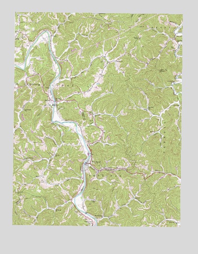
West Hamlin, WV USGS Topographic Map
Click on map above to begin viewing in our Map Viewer.

This topographic map contains these locations and features:
Feature Name Type Latitude Longitude GNIS ID View Map
Balls GapLocaleN38.3606°W82.1313°1535194View Map
Balls Gap School (historical)SchoolN38.3581°W82.1288°1535195View Map
Bear CreekStreamN38.3081°W82.2032°1535355View Map
Bear Creek ChurchChurchN38.3154°W82.1907°1535356View Map
Bias CemeteryCemeteryN38.3070°W82.1926°1535757View Map
Bletcher BrookStreamN38.3668°W82.1285°1536101View Map
Brown CemeteryCemeteryN38.3554°W82.1310°1536403View Map
Browning Gap CemeteryCemeteryN38.2723°W82.2475°2727556View Map
Buffalo ChurchChurchN38.3190°W82.1501°1536618View Map
Buffalo CreekStreamN38.3290°W82.1268°1536622View Map
Burl Farley BridgeBridgeN38.3607°W82.2243°2635370View Map
Cavill CreekStreamN38.3579°W82.2240°1537119View Map
Childers School (historical)SchoolN38.2662°W82.1607°1537314View Map
Coleman CreekStreamN38.2968°W82.1957°1537515View Map
Collins School (historical)SchoolN38.2648°W82.1885°1537535View Map
Crescent Ridge CemeteryCemeteryN38.2723°W82.2475°2726311View Map
Curry ChapelChurchN38.3220°W82.1251°1537929View Map
Dan Bias School (historical)SchoolN38.3195°W82.1504°1537976View Map
Denison ForkStreamN38.3059°W82.1418°1538128View Map
Enom CemeteryCemeteryN38.3470°W82.1835°1538721View Map
Enom ChurchChurchN38.3381°W82.1860°1538722View Map
Falls CreekStreamN38.2656°W82.2040°1538877View Map
Friendly United ChurchChurchN38.3320°W82.2396°1539266View Map
Gilbert Porter SpringSpringN38.3204°W82.2229°1677970View Map
Gill CemeteryCemeteryN38.3198°W82.2168°1539399View Map
Green Valley CemeteryCemeteryN38.2723°W82.2475°2726423View Map
Greenville ChurchChurchN38.2690°W82.2468°1539723View Map
Hatfield CemeteryCemeteryN38.3576°W82.2374°1540058View Map
InezPopulated PlaceN38.3573°W82.2388°1554771View Map
Johnson CemeteryCemeteryN38.3117°W82.1940°1540974View Map
Lees Fishing LakeReservoirN38.2834°W82.1349°1558960View Map
Lees Fishing Lake DamDamN38.2834°W82.1349°1558959View Map
Lick Log HollowValleyN38.2665°W82.1593°1541904View Map
Lisle BranchStreamN38.3190°W82.2204°1542010View Map
Little Buffalo CreekStreamN38.3331°W82.1321°1542043View Map
Long BranchStreamN38.2759°W82.1968°1542349View Map
Lower Big Creek School (historical)SchoolN38.2526°W82.1260°1542522View Map
Madison CreekStreamN38.3104°W82.2207°1542680View Map
Midkiff CemeteryCemeteryN38.2581°W82.2012°1543234View Map
Mount Moriah ChurchChurchN38.2593°W82.2185°1543675View Map
Mount Zion CemeteryCemeteryN38.2923°W82.2215°1543802View Map
Mount Zion ChurchChurchN38.2912°W82.2196°1543819View Map
Onemile CreekStreamN38.2529°W82.1874°1544407View Map
Ousleys Gap School (historical)SchoolN38.3595°W82.2463°1544478View Map
Pisgah ChurchChurchN38.3598°W82.2454°1544956View Map
Porter CemeteryCemeteryN38.3206°W82.2224°1545160View Map
Porter CreekStreamN38.3595°W82.1343°1545161View Map
Porter KnobSummitN38.3606°W82.1582°1545166View Map
PortersvillePopulated PlaceN38.3354°W82.1304°1555394View Map
PrairietownPopulated PlaceN38.3468°W82.1751°1555403View Map
Ray BranchStreamN38.3165°W82.2201°1545433View Map
Ray CemeteryCemeteryN38.3162°W82.1924°1545434View Map
Reuben BranchStreamN38.2965°W82.2149°1545511View Map
RoachLocaleN38.3612°W82.2232°1545786View Map
Ross CemeteryCemeteryN38.2984°W82.2354°1546089View Map
Salt RockPopulated PlaceN38.3231°W82.2210°1555557View Map
Salt Rock Census Designated PlaceCensusN38.3243°W82.2172°2586878View Map
Salt Rock ChurchChurchN38.3237°W82.2149°1546307View Map
Salt Rock Elementary SchoolSchoolN38.3210°W82.2209°1740620View Map
Salt Rock Post OfficePost OfficeN38.3217°W82.2219°1740621View Map
Salt Rock Public LibraryBuildingN38.3204°W82.2213°1740622View Map
Salt Rock Volunteer Fire DepartmentBuildingN38.3228°W82.2206°2577851View Map
Sand ForkStreamN38.2548°W82.2318°1546347View Map
Sheridan District (historical)CivilN38.2626°W82.1942°1928355View Map
Sloan CemeteryCemeteryN38.2506°W82.1915°1546951View Map
Smith CreekStreamN38.3409°W82.2426°1546989View Map
Smith Creek School (historical)SchoolN38.3173°W82.2426°1546991View Map
Straight ForkStreamN38.3231°W82.1268°1547554View Map
Strailey BranchStreamN38.2598°W82.2232°1547579View Map
Susannah ChurchChurchN38.3745°W82.1885°1547777View Map
Swann CemeteryCemeteryN38.3626°W82.2493°1547794View Map
Tom CreekStreamN38.3473°W82.2179°1548118View Map
Town of West HamlinCivilN38.2774°W82.1978°2391476View Map
Trace CreekStreamN38.3381°W82.2165°1548199View Map
Trace CreekStreamN38.3559°W82.1276°1548200View Map
Triplett CemeteryCemeteryN38.2515°W82.1915°1548276View Map
Twomile CreekStreamN38.2909°W82.1929°1548433View Map
Tyler CreekStreamN38.3218°W82.2196°1548445View Map
Upper Madison ChurchChurchN38.2890°W82.2415°1548535View Map
Webb School (historical)SchoolN38.3056°W82.1443°1548870View Map
Welcome Home ChurchChurchN38.2562°W82.1824°1548892View Map
West HamlinPopulated PlaceN38.2856°W82.1957°1548934View Map
West Hamlin BridgeBridgeN38.2870°W82.1969°2647082View Map
West Hamlin Elementary SchoolSchoolN38.2940°W82.1961°1741693View Map
West Hamlin Police DepartmentBuildingN38.2872°W82.1958°2727997View Map
West Hamlin Post OfficePost OfficeN38.2873°W82.1951°1741694View Map
West Hamlin United Methodist ChurchChurchN38.2865°W82.1938°1741695View Map
West Hamlin Volunteer Fire DepartmentBuildingN38.2874°W82.1957°2577664View Map

Note: Coordinates in the location and feature list above are referenced to NAD83 datum.


Copyright (C) 2008-2024 Ryan Niemi / Sunset Dynamics ... All Rights Reserved