TopoQuest Logo
Do you find TopoQuest useful?
Help keep TopoQuest running and adding new maps/features by donating!
Bitcoin:  19c7KJd3qBynnjoSw5npx9KScwjBe4ifkT
Litecoin:  LXs6TkuXGGXo1vDsWCkWVdjQX94eUKd6ui
Home View Maps Find Maps Find Places Resources & Links


Branchland, West Virginia Topographic Map

USGS Map Title: Branchland, WV
USGS Map MRC: 38082B2
DRG (GeoTIFF) Download: o38082b2.tif


Neighboring USGS Topographic Map Quads:


  Winslow, WV  
38082C3
 

  West Hamlin, WV  
38082C2
 

  Hamlin, WV  
38082C1
 

  Nestlow, WV  
38082B3
 

  Branchland, WV  
38082B2
 

  Hager, WV  
38082B1
 

  Kiahsville, WV  
38082A3
 

  Ranger, WV  
38082A2
 

  Big Creek, WV  
38082A1


Map MRC Location:

N39°
W83°
N39°
W82°
H8 H7 H6 H5 H4 H3 H2 H1
G8 G7 G6 G5 G4 G3 G2 G1
F8 F7 F6 F5 F4 F3 F2 F1
E8 E7 E6 E5 E4 E3 E2 E1
D8 D7 D6 D5 D4 D3 D2 D1
C8 C7 C6 C5 C4 C3 C2 C1
B8 B7 B6 B5 B4 B3 B2 B1
A8 A7 A6 A5 A4 A3 A2 A1
N38°
W83°
N38°
W82°

Branchland, WV USGS 1:24K Topographic Map Preview:
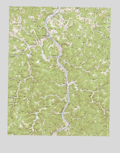
Branchland, WV USGS Topographic Map
Click on map above to begin viewing in our Map Viewer.

This topographic map contains these locations and features:
Feature Name Type Latitude Longitude GNIS ID View Map
Adkins CemeteryCemeteryN38.1437°W82.2368°1534825View Map
Adkins CemeteryCemeteryN38.1645°W82.1924°1534826View Map
Adkins CemeteryCemeteryN38.2112°W82.1896°1534831View Map
Bear KnobSummitN38.1618°W82.2274°1535376View Map
Bear Knob CemeteryCemeteryN38.1593°W82.2310°1535378View Map
Bee BranchStreamN38.2301°W82.1788°1535479View Map
Big Creek School (historical)SchoolN38.2451°W82.1438°1535830View Map
Bluelick BranchStreamN38.1920°W82.1618°1536138View Map
BradyvillePopulated PlaceN38.1465°W82.1838°1549608View Map
BranchlandPopulated PlaceN38.2209°W82.2038°1536304View Map
Branchland Elementary School (historical)SchoolN38.2201°W82.2051°1741598View Map
Branchland Post OfficePost OfficeN38.2285°W82.2036°1741599View Map
Buck BranchStreamN38.1629°W82.2029°1536546View Map
Burger School (historical)SchoolN38.2209°W82.1635°1536735View Map
Burks CemeteryCemeteryN38.2165°W82.1779°1536744View Map
Camp BranchStreamN38.2012°W82.1899°1536898View Map
Camp Branch ChurchChurchN38.2020°W82.1951°1536902View Map
Cartwright CemeteryCemeteryN38.2156°W82.1593°1537077View Map
Chaney CemeteryCemeteryN38.2279°W82.1371°1537191View Map
Chaney ForkStreamN38.2204°W82.1315°1537192View Map
Chapman CemeteryCemeteryN38.2298°W82.2043°1537203View Map
Church of GodChurchN38.1995°W82.1890°1741606View Map
Cooper BranchStreamN38.2359°W82.1287°1537645View Map
Dial CemeteryCemeteryN38.2031°W82.2232°1538166View Map
Dial CemeteryCemeteryN38.2059°W82.2310°1538167View Map
Dial CemeteryCemeteryN38.2098°W82.2260°1538168View Map
Dial School (historical)SchoolN38.1998°W82.2235°1538169View Map
Dick ForkStreamN38.1509°W82.1312°1538176View Map
Edwards CemeteryCemeteryN38.2304°W82.1271°1538563View Map
Falls BranchStreamN38.1609°W82.2415°1538875View Map
Flag KnobSummitN38.2354°W82.2201°1554466View Map
Flowers CemeteryCemeteryN38.2187°W82.1526°1539099View Map
Fourmile ChurchChurchN38.2159°W82.2290°1539177View Map
Fourmile CreekStreamN38.2209°W82.2021°1539178View Map
Franklin CemeteryCemeteryN38.2331°W82.1837°1539228View Map
Franklin HollowValleyN38.1898°W82.1835°1539230View Map
Fulks CemeteryCemeteryN38.1331°W82.1801°1539295View Map
Furnett CreekStreamN38.1443°W82.1826°1539305View Map
Guyan River Volunteer Fire DepartmentBuildingN38.1338°W82.1799°2577589View Map
Guyan Valley High School (historical)SchoolN38.2487°W82.1897°2088218View Map
Guyan Valley Middle SchoolSchoolN38.2489°W82.1900°2489150View Map
Hager CemeteryCemeteryN38.1670°W82.1462°1539834View Map
Hager ForkStreamN38.1676°W82.1451°1539835View Map
Hampton CemeteryCemeteryN38.1684°W82.1754°1539890View Map
Harless ForkStreamN38.2109°W82.2251°1539964View Map
Hollybush BranchStreamN38.2104°W82.2257°1549512View Map
Horse ForkStreamN38.2198°W82.1287°1540486View Map
Horseshoe BranchStreamN38.1884°W82.1524°1540511View Map
HubballPopulated PlaceN38.1990°W82.1879°1540539View Map
Hubball School (historical)SchoolN38.1981°W82.1876°1741636View Map
Hunters PointLocaleN38.1523°W82.2049°1540601View Map
Isaac CemeteryCemeteryN38.2445°W82.1635°1540721View Map
Isaac School (historical)SchoolN38.2481°W82.1660°1540726View Map
Jeffers CemeteryCemeteryN38.2379°W82.2224°1540843View Map
Keck CemeteryCemeteryN38.2273°W82.1979°1541095View Map
Kentuck ForkStreamN38.2037°W82.2251°1541157View Map
Kentuck Fork School (historical)SchoolN38.2020°W82.2457°1541158View Map
Kinder (historical)Populated PlaceN38.1681°W82.1446°1741641View Map
Laurel BranchStreamN38.1359°W82.1754°1541384View Map
Laurel ForkStreamN38.1306°W82.2176°1541455View Map
Laurel Hill District (historical)CivilN38.1375°W82.1885°1928299View Map
Lick BranchStreamN38.1793°W82.2285°1541853View Map
Little Laurel ChurchChurchN38.2206°W82.1262°1542141View Map
Little Laurel CreekStreamN38.2218°W82.1251°1542146View Map
Lower Tenmile ChurchChurchN38.1598°W82.2040°1542577View Map
Lower Twin BranchStreamN38.1473°W82.2135°1542583View Map
Lowgap BranchStreamN38.2126°W82.2088°1542592View Map
Lucas CemeteryCemeteryN38.1893°W82.1821°1542606View Map
Lunsard CemeteryCemeteryN38.1370°W82.1368°1542614View Map
McCallister CemeteryCemeteryN38.1526°W82.1640°1542923View Map
McClarity BranchStreamN38.1554°W82.2435°1542932View Map
McClarity Branch ChurchChurchN38.1568°W82.2426°1542933View Map
McComas BranchStreamN38.1937°W82.1863°1542949View Map
McComas CemeteryCemeteryN38.1706°W82.1668°1542951View Map
McComas CemeteryCemeteryN38.1929°W82.1915°1542952View Map
McComas RidgeRidgeN38.1965°W82.1326°1542953View Map
MidkiffPopulated PlaceN38.1762°W82.1788°1555114View Map
Midkiff Elementary School (historical)SchoolN38.1804°W82.1796°1741652View Map
Midkiff Post OfficePost OfficeN38.1762°W82.1766°1741653View Map
Mildred ChurchChurchN38.2329°W82.1843°1543263View Map
Mill BranchStreamN38.1965°W82.1788°1543295View Map
MinervaPopulated PlaceN38.1626°W82.2374°1549826View Map
Mount Zion ChurchChurchN38.1890°W82.1504°1543816View Map
Ninemile CreekStreamN38.1734°W82.1771°1544177View Map
Parsons CemeteryCemeteryN38.1981°W82.2129°1544602View Map
Payne CemeteryCemeteryN38.1704°W82.1596°1544655View Map
Peyton BranchStreamN38.2440°W82.1938°1544764View Map
Peyton CemeteryCemeteryN38.1348°W82.2193°1544765View Map
Peyton CemeteryCemeteryN38.1393°W82.1421°1544766View Map
Peyton CemeteryCemeteryN38.2481°W82.1679°1544767View Map
Pine Grove ChurchChurchN38.1459°W82.1290°1544877View Map
Pine Grove School (historical)SchoolN38.1354°W82.1279°1544889View Map
Pleasant ViewPopulated PlaceN38.2495°W82.1904°1555373View Map
Pleasant View Elementary School (historical)SchoolN38.2490°W82.1899°1741664View Map
Porter CemeteryCemeteryN38.2309°W82.1254°1545159View Map
Pound ForkStreamN38.1826°W82.2229°1545197View Map
PricePopulated PlaceN38.1440°W82.1268°1555407View Map
Ranger BranchStreamN38.1318°W82.1818°1545411View Map
Red River ForkStreamN38.1768°W82.2349°1545462View Map
RedwingPopulated PlaceN38.1776°W82.2346°1549893View Map
Reuben BranchStreamN38.2312°W82.2035°1545510View Map
Rockhouse BranchStreamN38.1737°W82.2371°1545976View Map
RockvillePopulated PlaceN38.1662°W82.1771°1555512View Map
Roy CemeteryCemeteryN38.2067°W82.1987°1546126View Map
Saunders CemeteryCemeteryN38.1995°W82.2007°1546453View Map
Seites CemeteryCemeteryN38.2348°W82.1801°1546556View Map
SheridanPopulated PlaceN38.2404°W82.1985°1546676View Map
Sixmile CreekStreamN38.1926°W82.1840°1546849View Map
Sloan CemeteryCemeteryN38.2498°W82.1651°1546950View Map
Smith CemeteryCemeteryN38.2390°W82.1993°1546969View Map
Spears ForkStreamN38.1440°W82.1265°1547118View Map
Stone Coal HollowValleyN38.2129°W82.1860°1547454View Map
Stout CreekStreamN38.1745°W82.1782°1547515View Map
Tenmile ChurchChurchN38.1576°W82.1768°1547959View Map
Tenmile CreekStreamN38.1579°W82.1760°1547967View Map
Thomas BranchStreamN38.1320°W82.2193°1548019View Map
Trace ForkStreamN38.2134°W82.2126°1548232View Map
Trace Fork School (historical)SchoolN38.2287°W82.2326°1548240View Map
Twomile CreekStreamN38.2454°W82.1896°1548432View Map
Upper Twin BranchStreamN38.1456°W82.2143°1548564View Map
Workman CemeteryCemeteryN38.1951°W82.1271°1549414View Map
Works CemeteryCemeteryN38.1279°W82.2351°1549421View Map
Yeager CemeteryCemeteryN38.1923°W82.1254°1549449View Map

Note: Coordinates in the location and feature list above are referenced to NAD83 datum.


Copyright (C) 2008-2024 Ryan Niemi / Sunset Dynamics ... All Rights Reserved