TopoQuest Logo
Do you find TopoQuest useful?
Help keep TopoQuest running and adding new maps/features by donating!
Bitcoin:  19c7KJd3qBynnjoSw5npx9KScwjBe4ifkT
Litecoin:  LXs6TkuXGGXo1vDsWCkWVdjQX94eUKd6ui
Home View Maps Find Maps Find Places Resources & Links


West Jefferson, Ohio Topographic Map

USGS Map Title: West Jefferson, OH
USGS Map MRC: 39083H3
DRG (GeoTIFF) Download: o39083h3.tif


Neighboring USGS Topographic Map Quads:


  Plumwood, OH  
40083A4
 

  Plain City, OH  
40083A3
 

  Hilliard, OH  
40083A2
 

  London, OH  
39083H4
 

  West Jefferson, OH  
39083H3
 

  Galloway, OH  
39083H2
 

  Walnut Run, OH  
39083G4
 

  Big Plain, OH  
39083G3
 

  Harrisburg, OH  
39083G2


Map MRC Location:

N40°
W84°
N40°
W83°
H8 H7 H6 H5 H4 H3 H2 H1
G8 G7 G6 G5 G4 G3 G2 G1
F8 F7 F6 F5 F4 F3 F2 F1
E8 E7 E6 E5 E4 E3 E2 E1
D8 D7 D6 D5 D4 D3 D2 D1
C8 C7 C6 C5 C4 C3 C2 C1
B8 B7 B6 B5 B4 B3 B2 B1
A8 A7 A6 A5 A4 A3 A2 A1
N39°
W84°
N39°
W83°

West Jefferson, OH USGS 1:24K Topographic Map Preview:
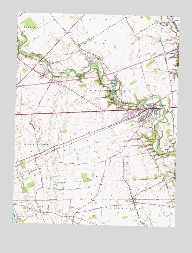
West Jefferson, OH USGS Topographic Map
Click on map above to begin viewing in our Map Viewer.

This topographic map contains these locations and features:
Feature Name Type Latitude Longitude GNIS ID View Map
Alder ChapelChurchN39.9942°W83.2630°1070659View Map
Blair CemeteryCemeteryN39.9737°W83.3110°1038096View Map
Bridenstine DitchCanalN39.9890°W83.2791°1038300View Map
Carters (historical)Populated PlaceN39.9395°W83.3630°1067460View Map
City of JeffersonCivilN39.9451°W83.2682°1085661View Map
Deer Run Jersey FarmLocaleN39.9700°W83.3742°2628463View Map
Denes Tree FarmLocaleN39.9558°W83.2906°2647900View Map
Foster Chapel CemeteryCemeteryN39.9956°W83.2630°1040598View Map
Foster Chapel Methodist Church (historical)ChurchN39.9951°W83.2635°1068816View Map
Frey Elementary SchoolSchoolN39.9412°W83.2699°1054048View Map
GillivanPopulated PlaceN39.9887°W83.3369°1048783View Map
Gillivan Methodist ChurchChurchN39.9887°W83.3374°1068817View Map
Gillivan School (historical)SchoolN39.9901°W83.3352°1068987View Map
Glade School (historical)SchoolN39.9164°W83.3546°1054052View Map
Hampton CemeteryCemeteryN39.9396°W83.2688°1041279View Map
Hidden Creek At The DarbyPopulated PlaceN39.9328°W83.2596°2771811View Map
Interchange 80CrossingN39.9590°W83.3446°1054051View Map
Interchange 85CrossingN39.9776°W83.2610°1054050View Map
Jefferson Lodge Mobile Home ParkPopulated PlaceN39.9450°W83.2964°2630803View Map
Jefferson Memorial Middle SchoolSchoolN39.9417°W83.2705°1054049View Map
Jefferson Township Fire and Emergency Medical Services DepartmentBuildingN39.9433°W83.2880°2550539View Map
Kent DitchCanalN39.9259°W83.2871°1042232View Map
Lake ForestLakeN39.9508°W83.2990°1040576View Map
Lilly ChapelPopulated PlaceN39.8890°W83.2816°1064995View Map
Lilly Chapel Post Office (historical)Post OfficeN39.8890°W83.2819°2030244View Map
Lilly Chapel School (historical)SchoolN39.8881°W83.2832°1068988View Map
Lilly Chapel United Methodist ChurchChurchN39.8890°W83.2821°1075219View Map
Lower Glade CemeteryCemeteryN39.8816°W83.3512°1042807View Map
Lower Glade Methodist Episcopal Church (historical)ChurchN39.8820°W83.3530°1068821View Map
Miller FarmsLocaleN39.9766°W83.3526°2729993View Map
Monroe Bidwell DitchCanalN39.9826°W83.3246°1043439View Map
Morning Star Morgan FarmLocaleN39.8823°W83.3588°2729994View Map
Mount Calvary CemeteryCemeteryN39.9365°W83.2769°1043539View Map
Norwood Elementary SchoolSchoolN39.9403°W83.2930°1068824View Map
Oakwood AcresPopulated PlaceN39.9428°W83.2869°2630805View Map
Ohio State Highway Patrol - West Jefferson Patrol PostBuildingN39.9422°W83.3058°2733120View Map
Pleasant Hill CemeteryCemeteryN39.9445°W83.2844°1044544View Map
Roberts (historical)Populated PlaceN39.9426°W83.3063°1067463View Map
RupertPopulated PlaceN39.8826°W83.3533°1062997View Map
Rupert Post Office (historical)Post OfficeN39.8820°W83.3527°2030253View Map
Salyers FarmLocaleN39.9406°W83.3712°2729999View Map
Silver Creek ReservoirReservoirN39.9657°W83.2517°1077722View Map
Sylvina Wilson DitchCanalN39.8953°W83.3660°1046929View Map
Thomas DitchCanalN39.9037°W83.2707°1047027View Map
Township of JeffersonCivilN39.9560°W83.3006°1086544View Map
Village of West JeffersonCivilN39.9487°W83.2993°2400132View Map
West JeffersonPopulated PlaceN39.9448°W83.2688°1085494View Map
West Jefferson High SchoolSchoolN39.9340°W83.2769°1054047View Map
West Jefferson Police DepartmentBuildingN39.9451°W83.2682°2732672View Map
West Jefferson Post OfficePost OfficeN39.9441°W83.2755°1083259View Map
West Jefferson Public LibraryBuildingN39.9384°W83.2744°1084116View Map
West Jefferson United Methodist ChurchChurchN39.9445°W83.2682°1067643View Map
Westwood ParkParkN39.9406°W83.2896°1068840View Map
Willows (historical)Populated PlaceN39.9328°W83.3333°1067464View Map
Wissalohican CampLocaleN39.9773°W83.2507°1048021View Map
Wright CemeteryCemeteryN39.9342°W83.3616°1048154View Map
Zion Lutheran ChurchChurchN39.9440°W83.2677°1067644View Map

Note: Coordinates in the location and feature list above are referenced to NAD83 datum.


Copyright (C) 2008-2025 Ryan Niemi / Sunset Dynamics ... All Rights Reserved