TopoQuest Logo
Do you find TopoQuest useful?
Help keep TopoQuest running and adding new maps/features by donating!
Bitcoin:  19c7KJd3qBynnjoSw5npx9KScwjBe4ifkT
Litecoin:  LXs6TkuXGGXo1vDsWCkWVdjQX94eUKd6ui
Home View Maps Find Maps Find Places Resources & Links


Walnut Run, Ohio Topographic Map

USGS Map Title: Walnut Run, OH
USGS Map MRC: 39083G4
DRG (GeoTIFF) Download: o39083g4.tif


Neighboring USGS Topographic Map Quads:


  South Vienna, OH  
39083H5
 

  London, OH  
39083H4
 

  West Jefferson, OH  
39083H3
 

  Florence, OH  
39083G5
 

  Walnut Run, OH  
39083G4
 

  Big Plain, OH  
39083G3
 

  Jeffersonville, OH  
39083F5
 

  Midway, OH  
39083F4
 

  Mount Sterling, OH  
39083F3


Map MRC Location:

N40°
W84°
N40°
W83°
H8 H7 H6 H5 H4 H3 H2 H1
G8 G7 G6 G5 G4 G3 G2 G1
F8 F7 F6 F5 F4 F3 F2 F1
E8 E7 E6 E5 E4 E3 E2 E1
D8 D7 D6 D5 D4 D3 D2 D1
C8 C7 C6 C5 C4 C3 C2 C1
B8 B7 B6 B5 B4 B3 B2 B1
A8 A7 A6 A5 A4 A3 A2 A1
N39°
W84°
N39°
W83°

Walnut Run, OH USGS 1:24K Topographic Map Preview:
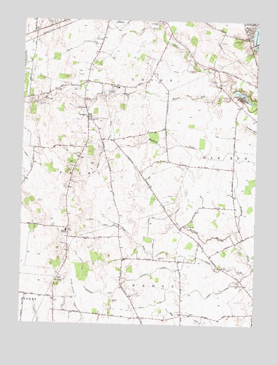
Walnut Run, OH USGS Topographic Map
Click on map above to begin viewing in our Map Viewer.

This topographic map contains these locations and features:
Feature Name Type Latitude Longitude GNIS ID View Map
Ambassador Bible InstituteSchoolN39.8698°W83.4949°1068807View Map
Black DitchCanalN39.8545°W83.4155°1075390View Map
Bradford BranchStreamN39.7889°W83.3855°1038246View Map
Burr FarmsLocaleN39.8660°W83.4924°2729985View Map
Carson CemeteryCemeteryN39.7600°W83.4499°1038842View Map
Central Township Fire Department Station 2BuildingN39.8358°W83.4657°2550315View Map
Century Two FarmsLocaleN39.7554°W83.4125°2729987View Map
Chenoweth DitchCanalN39.7714°W83.4291°1039011View Map
Chrisman DitchCanalN39.8617°W83.3902°1039083View Map
Clearview FarmLocaleN39.7633°W83.4369°2729988View Map
Concord Methodist Episcopal Church (historical)ChurchN39.7664°W83.4466°1068983View Map
Concord School (historical)SchoolN39.7623°W83.4433°1054072View Map
Crawford DitchCanalN39.7631°W83.4560°1039459View Map
Dunkin DitchCanalN39.7578°W83.4308°1039879View Map
Emma Welch DitchCanalN39.8170°W83.4588°1040193View Map
Evans CemeteryCemeteryN39.8458°W83.4720°1040254View Map
Filmore Jackson DitchCanalN39.8706°W83.4424°1040435View Map
First Church of GodChurchN39.8701°W83.4221°1068986View Map
Hickory Grove Golf CourseLocaleN39.8484°W83.3788°1054073View Map
Johnston-McClimans CemeteryCemeteryN39.7673°W83.3830°1042132View Map
Jones DitchCanalN39.8301°W83.4544°1042139View Map
Kilgore CemeteryCemeteryN39.8161°W83.4630°1042256View Map
Kirkwood CemeteryCemeteryN39.8742°W83.4827°1042303View Map
Madison DitchCanalN39.8023°W83.4149°1042882View Map
Madison LakePopulated PlaceN39.8709°W83.3796°1048944View Map
Madison Lake DamDamN39.8659°W83.3758°1078380View Map
Madison Lake State ReserveParkN39.8742°W83.3752°1042877View Map
Madison Rural Elementary SchoolSchoolN39.8476°W83.4488°1081601View Map
Madison-Plains High SchoolSchoolN39.7884°W83.4758°1071025View Map
Merri-Mac ParkParkN39.8742°W83.4435°1054074View Map
NewportPopulated PlaceN39.8351°W83.4652°1065147View Map
Old Johnston CemeteryCemeteryN39.7908°W83.4127°1044111View Map
Paint Township CemeteryCemeteryN39.8401°W83.4927°1068825View Map
Pentecostal Church of ChristChurchN39.8698°W83.4949°1068826View Map
Phifer DitchCanalN39.8176°W83.4963°1057920View Map
Roberts Airport (historical)AirportN39.8528°W83.4705°1082798View Map
Roberts DitchCanalN39.7812°W83.4724°1045090View Map
Saint Patricks CemeteryCemeteryN39.8745°W83.4288°1045728View Map
Seaburn FarmsLocaleN39.7731°W83.4786°2730000View Map
Shepherd CemeteryCemeteryN39.7777°W83.4264°1046184View Map
Sifrit CemeteryCemeteryN39.8164°W83.4721°1046263View Map
Sugar Maple Hiking TrailTrailN39.8726°W83.3763°1961345View Map
Walnut RunStreamN39.8451°W83.3874°1047524View Map

Note: Coordinates in the location and feature list above are referenced to NAD83 datum.


Copyright (C) 2008-2025 Ryan Niemi / Sunset Dynamics ... All Rights Reserved