TopoQuest Logo
Do you find TopoQuest useful?
Help keep TopoQuest running and adding new maps/features by donating!
Bitcoin:  19c7KJd3qBynnjoSw5npx9KScwjBe4ifkT
Litecoin:  LXs6TkuXGGXo1vDsWCkWVdjQX94eUKd6ui
Home View Maps Find Maps Find Places Resources & Links


West Mineral, Kansas Topographic Map

USGS Map Title: West Mineral, KS
USGS Map MRC: 37094C8
DRG (GeoTIFF) Download: o37094c8.tif


Neighboring USGS Topographic Map Quads:


  McCune NE, KS  
37095D1
 

  Grindstone Creek, KS  
37094D8
 

  Radley, KS  
37094D7
 

  McCune, KS  
37095C1
 

  West Mineral, KS  
37094C8
 

  Cherokee, KS  
37094C7
 

  Oswego, KS  
37095B1
 

  Hallowell, KS  
37094B8
 

  Columbus, KS  
37094B7


Map MRC Location:

N38°
W95°
N38°
W94°
H8 H7 H6 H5 H4 H3 H2 H1
G8 G7 G6 G5 G4 G3 G2 G1
F8 F7 F6 F5 F4 F3 F2 F1
E8 E7 E6 E5 E4 E3 E2 E1
D8 D7 D6 D5 D4 D3 D2 D1
C8 C7 C6 C5 C4 C3 C2 C1
B8 B7 B6 B5 B4 B3 B2 B1
A8 A7 A6 A5 A4 A3 A2 A1
N37°
W95°
N37°
W94°

West Mineral, KS USGS 1:24K Topographic Map Preview:
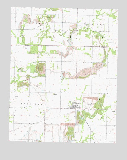
West Mineral, KS USGS Topographic Map
Click on map above to begin viewing in our Map Viewer.

This topographic map contains these locations and features:
Feature Name Type Latitude Longitude GNIS ID View Map
Bell MoundSummitN37.2951°W94.9491°469624View Map
Borland CemeteryCemeteryN37.2600°W94.9773°469625View Map
Bruce (historical)LocaleN37.3442°W94.8864°483500View Map
Camp Number Six (historical)LocaleN37.3098°W94.9425°485373View Map
Centerville School (historical)SchoolN37.3542°W94.8766°483502View Map
Cherry (historical)LocaleN37.2812°W94.9400°482075View Map
City of West MineralCivilN37.2839°W94.9269°2397270View Map
East Mineral (historical)Populated PlaceN37.2814°W94.9050°483278View Map
Hamilton Camp (historical)Populated PlaceN37.2645°W94.9044°483280View Map
Immaculate Conception Church (historical)ChurchN37.2773°W94.9044°483336View Map
Liberty School (historical)SchoolN37.2964°W94.9861°483340View Map
Limestone CreekStreamN37.3498°W94.9586°469630View Map
Mayer (historical)Populated PlaceN37.2701°W94.9058°483282View Map
Mined Land Wildlife AreaParkN37.3376°W94.9308°479817View Map
Mineral LakeLakeN37.2876°W94.9127°480393View Map
Miriam School (historical)SchoolN37.2520°W94.9047°483345View Map
MonmouthPopulated PlaceN37.3631°W94.9369°469622View Map
Monmouth CemeteryCemeteryN37.3538°W94.9495°469621View Map
Monte Carlo (historical)Populated PlaceN37.2814°W94.8775°483283View Map
Mount Olive School (historical)SchoolN37.3217°W94.9583°483350View Map
Mulberry CreekStreamN37.3339°W94.9658°469631View Map
Mulberry School (historical)SchoolN37.3620°W94.9683°483544View Map
Pleasant Hill School (historical)SchoolN37.3251°W94.9250°483357View Map
Plum CreekStreamN37.3073°W94.9958°469629View Map
Rigney CemeteryCemeteryN37.3394°W94.9943°469620View Map
Star CemeteryCemeteryN37.2776°W94.9601°469626View Map
Star School (historical)SchoolN37.2739°W94.9591°483367View Map
Starvale (historical)LocaleN37.2520°W94.9686°482074View Map
Stone City (historical)Populated PlaceN37.3073°W94.9044°483285View Map
Township of RossCivilN37.2739°W94.8863°469492View Map
West MineralPopulated PlaceN37.2842°W94.9230°469627View Map
West Mineral Elementary School (historical)SchoolN37.2849°W94.9208°481101View Map
West Mineral Fire DepartmentBuildingN37.2820°W94.9253°2111975View Map
West Mineral Police DepartmentBuildingN37.2830°W94.9264°2504215View Map
West Mineral Post OfficePost OfficeN37.2820°W94.9204°2694019View Map
West Mineral Wastewater Treatment PlantLocaleN37.2837°W94.9163°2691904View Map
Wolf CreekStreamN37.3559°W94.9111°469623View Map

Note: Coordinates in the location and feature list above are referenced to NAD83 datum.


Copyright (C) 2008-2025 Ryan Niemi / Sunset Dynamics ... All Rights Reserved