TopoQuest Logo
Do you find TopoQuest useful?
Help keep TopoQuest running and adding new maps/features by donating!
Bitcoin:  19c7KJd3qBynnjoSw5npx9KScwjBe4ifkT
Litecoin:  LXs6TkuXGGXo1vDsWCkWVdjQX94eUKd6ui
Home View Maps Find Maps Find Places Resources & Links


Biggs, California Topographic Map

USGS Map Title: Biggs, CA
USGS Map MRC: 39121D6
DRG (GeoTIFF) Download: o39121d6.tif


Neighboring USGS Topographic Map Quads:


  Nelson, CA  
39121E7
 

  Shippee, CA  
39121E6
 

  Oroville, CA  
39121E5
 

  West of Biggs, CA  
39121D7
 

  Biggs, CA  
39121D6
 

  Palermo, CA  
39121D5
 

  Pennington, CA  
39121C7
 

  Gridley, CA  
39121C6
 

  Honcut, CA  
39121C5


Map MRC Location:

N40°
W122°
N40°
W121°
H8 H7 H6 H5 H4 H3 H2 H1
G8 G7 G6 G5 G4 G3 G2 G1
F8 F7 F6 F5 F4 F3 F2 F1
E8 E7 E6 E5 E4 E3 E2 E1
D8 D7 D6 D5 D4 D3 D2 D1
C8 C7 C6 C5 C4 C3 C2 C1
B8 B7 B6 B5 B4 B3 B2 B1
A8 A7 A6 A5 A4 A3 A2 A1
N39°
W122°
N39°
W121°

Biggs, CA USGS 1:24K Topographic Map Preview:
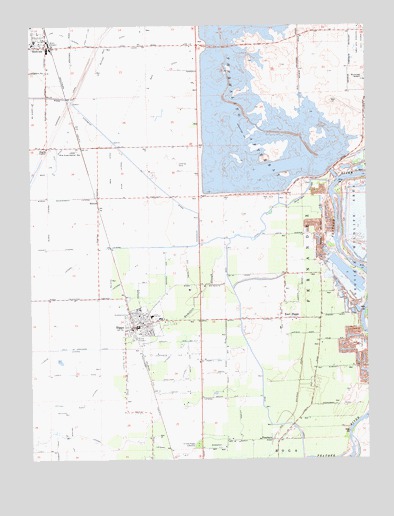
Biggs, CA USGS Topographic Map
Click on map above to begin viewing in our Map Viewer.

This topographic map contains these locations and features:
Feature Name Type Latitude Longitude GNIS ID View Map
BiggsPopulated PlaceN39.4124°W121.7128°277474View Map
Biggs Assembly of God ChurchChurchN39.4163°W121.7111°1723916View Map
Biggs Branch Butte County LibraryBuildingN39.4141°W121.7091°1723917View Map
Biggs City HallBuildingN39.4141°W121.7091°1723918View Map
Biggs Elementary SchoolSchoolN39.4154°W121.7030°1723919View Map
Biggs ExtensionCanalN39.4463°W121.6897°219283View Map
Biggs Middle SchoolSchoolN39.4161°W121.7059°236822View Map
Biggs Police DepartmentBuildingN39.4139°W121.7107°2751013View Map
Biggs Post OfficePost OfficeN39.4131°W121.7102°1723920View Map
Biggs Station (historical)LocaleN39.4154°W121.6491°1666767View Map
Biggs United Methodist ChurchChurchN39.4143°W121.7094°1723921View Map
Burns Government LateralCanalN39.4504°W121.7428°220215View Map
Burns LateralCanalN39.4432°W121.7447°220216View Map
Butler CanalCanalN39.4938°W121.7178°220276View Map
Butte County Fire Department Station 71BuildingN39.4952°W121.7471°2622318View Map
Butte County Fire Department Station 73BuildingN39.4138°W121.7092°2621803View Map
Cherokee CanalCanalN39.4757°W121.7375°220939View Map
City of BiggsCivilN39.4133°W121.7101°2409848View Map
East BiggsPopulated PlaceN39.4152°W121.6539°1658456View Map
Evangelical Free ChurchChurchN39.4946°W121.7500°1723944View Map
FernandezCivilN39.4338°W121.6464°223472View Map
First Baptist ChurchChurchN39.4113°W121.7105°1723946View Map
Fleming LateralCanalN39.4066°W121.7422°223599View Map
Gridley - Biggs CemeteryCemeteryN39.3793°W121.6888°224613View Map
Hamilton SloughGutN39.4235°W121.6866°233978View Map
Haselbusch (historical)Populated PlaceN39.4474°W121.6497°1666783View Map
High Lift LateralCanalN39.4985°W121.7291°225267View Map
Hume (historical)Populated PlaceN39.4282°W121.6494°1666785View Map
Jones/Ag-Viation AirportAirportN39.4535°W121.6999°1653265View Map
Lateral ACanalN39.4321°W121.7333°254878View Map
Lateral A-6CanalN39.4293°W121.7147°254879View Map
Lateral EastCanalN39.3788°W121.7239°254881View Map
Lateral East-7CanalN39.3766°W121.7011°254882View Map
Lateral HCanalN39.4024°W121.6908°254885View Map
Lateral H-3CanalN39.4063°W121.6978°254886View Map
Lee LateralCanalN39.4613°W121.7416°226994View Map
Lorraine (historical)Populated PlaceN39.4691°W121.6503°1670423View Map
Low Lift LateralCanalN39.4979°W121.7400°227751View Map
Main CanalCanalN39.3854°W121.6625°234228View Map
Main Ditch ACanalN39.4599°W121.7214°234231View Map
Main Ditch BCanalN39.4660°W121.7375°234232View Map
McQueen LateralCanalN39.4729°W121.7494°228450View Map
Old Hamilton CemeteryCemeteryN39.4540°W121.6474°2773294View Map
Onstott RanchLocaleN39.3816°W121.6622°1670424View Map
PeachtonPopulated PlaceN39.3804°W121.6614°1659356View Map
RicetonPopulated PlaceN39.4493°W121.7255°1659505View Map
Richland (historical)Populated PlaceN39.3974°W121.6461°1666797View Map
RichvalePopulated PlaceN39.4938°W121.7447°231556View Map
Richvale Elementary SchoolSchoolN39.4954°W121.7489°1723995View Map
Richvale Post OfficePost OfficeN39.4956°W121.7486°2769472View Map
River District School (historical)SchoolN39.4352°W121.6566°1666799View Map
Stine LateralCanalN39.4571°W121.7164°235488View Map
Table Mountain Municipal Golf CourseLocaleN39.4949°W121.6277°1654477View Map
Thermalito AfterbayReservoirN39.4757°W121.6677°236232View Map
Thermalito Afterbay 1-055 DamDamN39.4499°W121.6344°1663258View Map
USDA Rice Experimental StationLocaleN39.4641°W121.7333°236753View Map

Note: Coordinates in the location and feature list above are referenced to NAD83 datum.


Copyright (C) 2008-2025 Ryan Niemi / Sunset Dynamics ... All Rights Reserved