TopoQuest Logo
Do you find TopoQuest useful?
Help keep TopoQuest running and adding new maps/features by donating!
Bitcoin:  19c7KJd3qBynnjoSw5npx9KScwjBe4ifkT
Litecoin:  LXs6TkuXGGXo1vDsWCkWVdjQX94eUKd6ui
Home View Maps Find Maps Find Places Resources & Links


Argyle, Iowa Topographic Map

USGS Map Title: Argyle, IA
USGS Map MRC: 40091E5
DRG (GeoTIFF) Download: o40091e5.tif


Neighboring USGS Topographic Map Quads:


  Farmington, IA  
40091F6
 

  Donnellson, IA  
40091F5
 

  West Point, IA  
40091F4
 

  Croton, IA  
40091E6
 

  Argyle, IA  
40091E5
 

  Nauvoo, IL  
40091E4
 

  Kahoka, MO  
40091D6
 

  Wayland, MO  
40091D5
 

  Keokuk, IA  
40091D4


Map MRC Location:

N41°
W92°
N41°
W91°
H8 H7 H6 H5 H4 H3 H2 H1
G8 G7 G6 G5 G4 G3 G2 G1
F8 F7 F6 F5 F4 F3 F2 F1
E8 E7 E6 E5 E4 E3 E2 E1
D8 D7 D6 D5 D4 D3 D2 D1
C8 C7 C6 C5 C4 C3 C2 C1
B8 B7 B6 B5 B4 B3 B2 B1
A8 A7 A6 A5 A4 A3 A2 A1
N40°
W92°
N40°
W91°

Argyle, IA USGS 1:24K Topographic Map Preview:
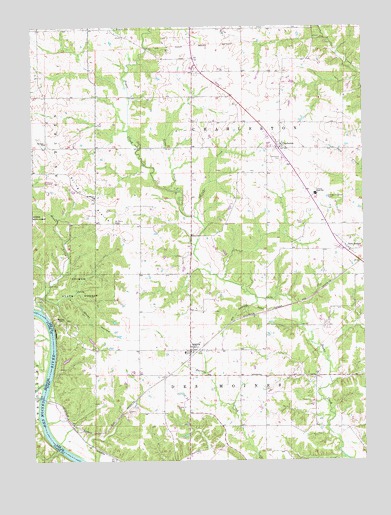
Argyle, IA USGS Topographic Map
Click on map above to begin viewing in our Map Viewer.

This topographic map contains these locations and features:
Feature Name Type Latitude Longitude GNIS ID View Map
Ambrosia CemeteryCemeteryN40.5242°W91.5015°1981376View Map
ArgylePopulated PlaceN40.5317°W91.5663°454227View Map
ArgyleLocaleN40.5320°W91.5627°1981305View Map
Argyle City HallBuildingN40.5317°W91.5663°1981309View Map
Argyle Memorial CemeteryCemeteryN40.5320°W91.5418°1981377View Map
Argyle Post OfficePost OfficeN40.5317°W91.5663°1981306View Map
Argyle Presbyterian ChurchChurchN40.5317°W91.5663°1981308View Map
Belfast (historical)LocaleN40.5425°W91.6185°1981111View Map
Belfast Post Office (historical)Post OfficeN40.5425°W91.6185°1981110View Map
Bethel Bible ChurchChurchN40.5317°W91.5663°1981307View Map
Birch CreekStreamN40.5698°W91.5627°454642View Map
Bowman CemeteryCemeteryN40.6248°W91.5927°454774View Map
Bryan HillSummitN40.5412°W91.6168°454901View Map
Central Lee Elementary SchoolSchoolN40.5763°W91.5152°2719738View Map
Central Lee High SchoolSchoolN40.5770°W91.5181°455315View Map
Central Lee Middle SchoolSchoolN40.5759°W91.5151°2719873View Map
CharlestonPopulated PlaceN40.5909°W91.5313°455355View Map
Charleston (historical)LocaleN40.5909°W91.5313°1981106View Map
Charleston CemeteryCemeteryN40.5866°W91.5299°455356View Map
Charleston Post Office (historical)Post OfficeN40.5909°W91.5313°1981105View Map
Charleston Roadside ParkParkN40.5928°W91.5335°1981056View Map
Des Moines Township Fire and RescueBuildingN40.5314°W91.5678°2577384View Map
Donnellson Airport (historical)AirportN40.6209°W91.5418°466780View Map
Dumas CreekStreamN40.5223°W91.6213°735585View Map
Embury CemeteryCemeteryN40.5911°W91.6196°1981380View Map
Embury ChurchChurchN40.5914°W91.6199°456358View Map
Ghost HollowValleyN40.5475°W91.6109°456892View Map
Goose CreekStreamN40.5781°W91.5732°456966View Map
Hinsdale (historical)LocaleN40.5084°W91.6085°1981112View Map
Hinsdale Post Office (historical)Post OfficeN40.5084°W91.6085°1981113View Map
Monks CreekStreamN40.5437°W91.6221°459171View Map
New BostonPopulated PlaceN40.5606°W91.5054°459469View Map
New Boston (historical)LocaleN40.5606°W91.5054°1981108View Map
New Boston CemeteryCemeteryN40.5636°W91.5088°1981378View Map
New Boston Mennonite ChurchChurchN40.5609°W91.5054°1981287View Map
New Boston Post Office (historical)Post OfficeN40.5606°W91.5054°1981107View Map
Saint Marys CemeteryCemeteryN40.5689°W91.5940°1981379View Map
Saint Marys ChurchChurchN40.5759°W91.6013°461196View Map
South CemeteryCemeteryN40.5687°W91.5227°461771View Map
String PrairieAreaN40.5748°W91.6038°462035View Map
String Prairie Post Office (historical)Post OfficeN40.5181°W91.5363°1981109View Map
Township of CharlestonCivilN40.5965°W91.5449°467593View Map
Township of Des MoinesCivilN40.5094°W91.5480°467709View Map
Turkey Run AccessLocaleN40.5375°W91.6140°1981054View Map

Note: Coordinates in the location and feature list above are referenced to NAD83 datum.


Copyright (C) 2008-2024 Ryan Niemi / Sunset Dynamics ... All Rights Reserved