TopoQuest Logo
Do you find TopoQuest useful?
Help keep TopoQuest running and adding new maps/features by donating!
Bitcoin:  19c7KJd3qBynnjoSw5npx9KScwjBe4ifkT
Litecoin:  LXs6TkuXGGXo1vDsWCkWVdjQX94eUKd6ui
Home View Maps Find Maps Find Places Resources & Links


Camden West, New York Topographic Map

USGS Map Title: Camden West, NY
USGS Map MRC: 43075C7
DRG (GeoTIFF) Download: o43075c7.tif


Neighboring USGS Topographic Map Quads:


  Williamstown, NY  
43075D8
 

  Westdale, NY  
43075D7
 

  Florence, NY  
43075D6
 

  Panther Lake, NY  
43075C8
 

  Camden West, NY  
43075C7
 

  Camden East, NY  
43075C6
 

  Cleveland, NY  
43075B8
 

  Jewell, NY  
43075B7
 

  Sylvan Beach, NY  
43075B6


Map MRC Location:

N44°
W76°
N44°
W75°
H8 H7 H6 H5 H4 H3 H2 H1
G8 G7 G6 G5 G4 G3 G2 G1
F8 F7 F6 F5 F4 F3 F2 F1
E8 E7 E6 E5 E4 E3 E2 E1
D8 D7 D6 D5 D4 D3 D2 D1
C8 C7 C6 C5 C4 C3 C2 C1
B8 B7 B6 B5 B4 B3 B2 B1
A8 A7 A6 A5 A4 A3 A2 A1
N43°
W76°
N43°
W75°

Camden West, NY USGS 1:24K Topographic Map Preview:
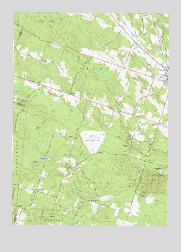
Camden West, NY USGS Topographic Map
Click on map above to begin viewing in our Map Viewer.

This topographic map contains these locations and features:
Feature Name Type Latitude Longitude GNIS ID View Map
Brockway BrookStreamN43.2773°W75.8282°944805View Map
Brockway CornersLocaleN43.2645°W75.8124°944806View Map
Bullhead BrookStreamN43.3206°W75.8366°945145View Map
Bullhead PondLakeN43.3071°W75.8576°945150View Map
Camden High SchoolSchoolN43.3464°W75.7561°2437723View Map
Camden PitMineN43.2761°W75.7664°2712458View Map
Cleveland ReservoirReservoirN43.2615°W75.8713°946859View Map
ElpisPopulated PlaceN43.2837°W75.8221°949608View Map
Fields BrookStreamN43.2940°W75.7627°950025View Map
Gorton BrookStreamN43.2831°W75.8255°951392View Map
Gorton PondLakeN43.2892°W75.8468°951397View Map
HillsboroPopulated PlaceN43.3273°W75.8294°972617View Map
Howard PondLakeN43.2968°W75.7816°953313View Map
Lynch CemeteryCemeteryN43.2653°W75.8576°956171View Map
Maple FlatsPopulated PlaceN43.2703°W75.8549°972755View Map
Pierce BrookStreamN43.2953°W75.7655°960352View Map
Preston HillSummitN43.3103°W75.7574°961125View Map
School Number 12 (historical)SchoolN43.2701°W75.8557°975044View Map
School Number 2 (historical)SchoolN43.2919°W75.8278°2106135View Map
School Number 2 (historical)SchoolN43.3603°W75.7803°2106136View Map
School Number 3 (historical)SchoolN43.3428°W75.7867°2106137View Map
School Number 4 (historical)SchoolN43.3106°W75.7569°975371View Map
School Number 6 (historical)SchoolN43.3456°W75.8447°2106138View Map
Servants Baptist ChurchChurchN43.3670°W75.7864°2617078View Map
South Branch Little RiverStreamN43.3045°W75.7946°965700View Map
Starkweather PondLakeN43.2823°W75.7551°966259View Map
Temple CemeteryCemeteryN43.3333°W75.8549°967139View Map
Temple School (historical)SchoolN43.3331°W75.8544°2106139View Map
The Abundant Life Community ChurchChurchN43.3359°W75.7584°2616316View Map
Thompsons BranchStreamN43.3692°W75.7852°967421View Map
Thompsons CornerPopulated PlaceN43.2884°W75.7680°973152View Map
Town of CamdenCivilN43.3436°W75.7796°978777View Map
Trout BrookStreamN43.3048°W75.7841°967861View Map
West Branch Little RiverStreamN43.3281°W75.8507°969126View Map
Wetmor BrookStreamN43.3148°W75.8185°970955View Map

Note: Coordinates in the location and feature list above are referenced to NAD83 datum.


Copyright (C) 2008-2024 Ryan Niemi / Sunset Dynamics ... All Rights Reserved