TopoQuest Logo
Do you find TopoQuest useful?
Help keep TopoQuest running and adding new maps/features by donating!
Bitcoin:  19c7KJd3qBynnjoSw5npx9KScwjBe4ifkT
Litecoin:  LXs6TkuXGGXo1vDsWCkWVdjQX94eUKd6ui
Home View Maps Find Maps Find Places Resources & Links


Noxapater, Mississippi Topographic Map

USGS Map Title: Noxapater, MS
USGS Map MRC: 32089H1
DRG (GeoTIFF) Download: o32089h1.tif


Neighboring USGS Topographic Map Quads:


  Louisville SW, MS  
33089A2
 

  Louisville South, MS  
33089A1
 

  Boon, MS  
33088A8
 

  Plattsburg, MS  
32089H2
 

  Noxapater, MS  
32089H1
 

  Vernon, MS  
32088H8
 

  Pearl River, MS  
32089G2
 

  Philadelphia, MS  
32089G1
 

  Owl Creek, MS  
32088G8


Map MRC Location:

N33°
W90°
N33°
W89°
H8 H7 H6 H5 H4 H3 H2 H1
G8 G7 G6 G5 G4 G3 G2 G1
F8 F7 F6 F5 F4 F3 F2 F1
E8 E7 E6 E5 E4 E3 E2 E1
D8 D7 D6 D5 D4 D3 D2 D1
C8 C7 C6 C5 C4 C3 C2 C1
B8 B7 B6 B5 B4 B3 B2 B1
A8 A7 A6 A5 A4 A3 A2 A1
N32°
W90°
N32°
W89°

Noxapater, MS USGS 1:24K Topographic Map Preview:
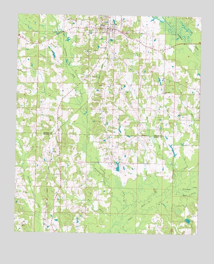
Noxapater, MS USGS Topographic Map
Click on map above to begin viewing in our Map Viewer.

This topographic map contains these locations and features:
Feature Name Type Latitude Longitude GNIS ID View Map
Argo (historical)LocaleN32.9432°W89.0862°707442View Map
Bell BranchStreamN32.8779°W89.0584°666771View Map
Bogue ChittoStreamN32.8990°W89.0148°691542View Map
First Pentecostal ChurchChurchN32.9821°W89.0667°669970View Map
HightPopulated PlaceN32.9543°W89.0653°711165View Map
Hight CemeteryCemeteryN32.9601°W89.0606°710039View Map
Hight ChurchChurchN32.9599°W89.0626°671198View Map
Jesus Name ChurchChurchN32.9790°W89.0751°671873View Map
Joe C Reese Lake DamDamN32.8951°W89.0901°681731View Map
Joel CreekStreamN32.8990°W89.0231°671892View Map
Kingdom Hall of Jehovahs WitnessesChurchN32.9207°W89.0945°685035View Map
Methodist CemeteryCemeteryN32.9871°W89.0603°710050View Map
Mount Ary CemeteryCemeteryN32.9121°W89.0939°707211View Map
Mount Ary ChurchChurchN32.9126°W89.0945°673921View Map
Mount Pisgah CemeteryCemeteryN32.9310°W89.0395°707214View Map
Mount Pisgah CemeteryCemeteryN32.9312°W89.0395°710054View Map
Mount Pisgah ChurchChurchN32.9315°W89.0401°674200View Map
Mount Vernon ChurchChurchN32.9962°W89.0867°674300View Map
Nanih Waiya CreekStreamN32.8990°W89.0148°694146View Map
Narrow Way ChurchChurchN32.9082°W89.0948°674509View Map
NoxapaterPopulated PlaceN32.9924°W89.0662°674982View Map
Noxapater CemeteryCemeteryN32.9932°W89.0667°710059View Map
Noxapater CreekStreamN32.8840°W89.0526°674983View Map
Noxapater Methodist ChurchChurchN32.9943°W89.0667°710060View Map
Noxapater Police DepartmentBuildingN32.9920°W89.0665°2754269View Map
Noxapater Post OfficePost OfficeN32.9940°W89.0644°2768588View Map
Noxapater SchoolSchoolN32.9946°W89.0681°710061View Map
Noxapater Volunteer Fire DepartmentBuildingN32.9920°W89.0671°2665683View Map
O'Neal Jackson Lake DamDamN32.8751°W89.0067°681716View Map
Odell Barrier DamDamN32.9785°W89.0534°681772View Map
R Baskin Lake DamDamN32.9235°W89.0101°681739View Map
Salem CemeteryCemeteryN32.8793°W89.1201°707227View Map
Salem ChurchChurchN32.8785°W89.1201°677279View Map
StalloPopulated PlaceN32.9201°W89.1006°692242View Map
Stallo Volunteer Fire Department Station 1 HeadquartersBuildingN32.8901°W89.0889°2665837View Map
Stallo Volunteer Fire Department Station 2BuildingN32.9119°W89.1163°2665802View Map
T J Barrier Lake DamDamN32.9085°W89.0384°681734View Map
Town of NoxapaterCivilN32.9936°W89.0635°2407013View Map
Union Ridge Baptist ChurchChurchN32.9560°W89.0248°679108View Map
Union Ridge CemeteryCemeteryN32.9573°W89.0251°710076View Map
Watkins Lake DamDamN32.9751°W89.1001°681770View Map

Note: Coordinates in the location and feature list above are referenced to NAD83 datum.


Copyright (C) 2008-2024 Ryan Niemi / Sunset Dynamics ... All Rights Reserved