TopoQuest Logo
Do you find TopoQuest useful?
Help keep TopoQuest running and adding new maps/features by donating!
Bitcoin:  19c7KJd3qBynnjoSw5npx9KScwjBe4ifkT
Litecoin:  LXs6TkuXGGXo1vDsWCkWVdjQX94eUKd6ui
Home View Maps Find Maps Find Places Resources & Links


Vernon, Mississippi Topographic Map

USGS Map Title: Vernon, MS
USGS Map MRC: 32088H8
DRG (GeoTIFF) Download: o32088h8.tif


Neighboring USGS Topographic Map Quads:


  Louisville South, MS  
33089A1
 

  Boon, MS  
33088A8
 

  Fearns Springs, MS  
33088A7
 

  Noxapater, MS  
32089H1
 

  Vernon, MS  
32088H8
 

  Preston, MS  
32088H7
 

  Philadelphia, MS  
32089G1
 

  Owl Creek, MS  
32088G8
 

  Lynville, MS  
32088G7


Map MRC Location:

N33°
W89°
N33°
W88°
H8 H7 H6 H5 H4 H3 H2 H1
G8 G7 G6 G5 G4 G3 G2 G1
F8 F7 F6 F5 F4 F3 F2 F1
E8 E7 E6 E5 E4 E3 E2 E1
D8 D7 D6 D5 D4 D3 D2 D1
C8 C7 C6 C5 C4 C3 C2 C1
B8 B7 B6 B5 B4 B3 B2 B1
A8 A7 A6 A5 A4 A3 A2 A1
N32°
W89°
N32°
W88°

Vernon, MS USGS 1:24K Topographic Map Preview:
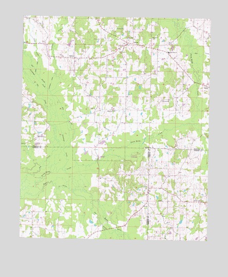
Vernon, MS USGS Topographic Map
Click on map above to begin viewing in our Map Viewer.

This topographic map contains these locations and features:
Feature Name Type Latitude Longitude GNIS ID View Map
Big SloughStreamN32.9257°W88.9714°667144View Map
Canie CanalCanalN32.9712°W88.9906°668046View Map
Canie CreekStreamN32.9657°W88.9917°668047View Map
ClaytownPopulated PlaceN32.9765°W88.9664°668542View Map
Coonwood (historical)Populated PlaceN32.9779°W88.9834°687696View Map
Coopwood CanalCanalN32.9629°W88.9809°668816View Map
Coopwood CreekStreamN32.9576°W88.9817°668817View Map
CoyPopulated PlaceN32.9035°W88.9148°668920View Map
Coy CemeteryCemeteryN32.9040°W88.9153°707194View Map
Coy ChurchChurchN32.8846°W88.9017°668921View Map
Dry CreekStreamN32.9807°W88.8867°669439View Map
Enon CemeteryCemeteryN32.9857°W88.9859°669785View Map
Enon ChurchChurchN32.9946°W88.9881°669787View Map
Fox BranchStreamN32.9112°W88.9951°670144View Map
Fulton CemeteryCemeteryN32.9876°W88.9501°670271View Map
Grim Branch SchoolSchoolN32.9540°W88.9026°670748View Map
Harmony CemeteryCemeteryN32.9885°W88.9134°710038View Map
Harmony ChurchChurchN32.9887°W88.9153°670937View Map
Humphreys LakeLakeN32.9299°W88.9184°687701View Map
Middleton CemeteryCemeteryN32.9479°W88.9392°710051View Map
Middleton ChurchChurchN32.9476°W88.9403°673536View Map
Mississippi No Name 58 DamDamN32.9785°W88.9501°681771View Map
Mississippi No Name 59 DamDamN32.9818°W88.8984°681773View Map
Nanih WaiyaPopulated PlaceN32.9215°W88.9487°692095View Map
Nanih Waiya SchoolSchoolN32.9807°W88.9034°674505View Map
Nanih Waiya Volunteer Fire DepartmentBuildingN32.9805°W88.9041°2665865View Map
Nanih Waya State ParkParkN32.9210°W88.9487°690821View Map
North Bend Volunteer Fire Department Station 3BuildingN32.8825°W88.9313°2665836View Map
Oak Grove Baptist ChurchChurchN32.9318°W88.9887°675045View Map
Oak Grove CemeteryCemeteryN32.9315°W88.9889°710062View Map
Oak Grove SchoolSchoolN32.8976°W88.8798°675069View Map
Old CreekStreamN32.9026°W88.9987°675175View Map
Owl CreekStreamN32.8965°W88.9517°675354View Map
Prince ChapelPopulated PlaceN32.9043°W88.9064°691640View Map
Tallahaga CreekStreamN32.9137°W88.9726°694930View Map
VernonPopulated PlaceN32.9857°W88.9314°679207View Map
Vernon Assembly of God ChurchChurchN32.9840°W88.9337°710077View Map
Vernon CemeteryCemeteryN32.9837°W88.9342°710078View Map
Vernon CemeteryCemeteryN32.9854°W88.9312°710079View Map
Vernon Methodist ChurchChurchN32.9857°W88.9309°710080View Map
Whitehead CemeteryCemeteryN32.9940°W88.9345°679622View Map
Winston ChurchChurchN32.9482°W88.9523°679790View Map

Note: Coordinates in the location and feature list above are referenced to NAD83 datum.


Copyright (C) 2008-2024 Ryan Niemi / Sunset Dynamics ... All Rights Reserved