TopoQuest Logo
Do you find TopoQuest useful?
Help keep TopoQuest running and adding new maps/features by donating!
Bitcoin:  19c7KJd3qBynnjoSw5npx9KScwjBe4ifkT
Litecoin:  LXs6TkuXGGXo1vDsWCkWVdjQX94eUKd6ui
Home View Maps Find Maps Find Places Resources & Links


Boones Mill, Virginia Topographic Map

USGS Map Title: Boones Mill, VA
USGS Map MRC: 37079A8
DRG (GeoTIFF) Download: o37079a8.tif


Neighboring USGS Topographic Map Quads:


  Bent Mountain, VA  
37080B1
 

  Garden City, VA  
37079B8
 

  Hardy, VA  
37079B7
 

  Callaway, VA  
37080A1
 

  Boones Mill, VA  
37079A8
 

  Redwood, VA  
37079A7
 

  Ferrum, VA  
36080H1
 

  Rocky Mount, VA  
36079H8
 

  Gladehill, VA  
36079H7


Map MRC Location:

N38°
W80°
N38°
W79°
H8 H7 H6 H5 H4 H3 H2 H1
G8 G7 G6 G5 G4 G3 G2 G1
F8 F7 F6 F5 F4 F3 F2 F1
E8 E7 E6 E5 E4 E3 E2 E1
D8 D7 D6 D5 D4 D3 D2 D1
C8 C7 C6 C5 C4 C3 C2 C1
B8 B7 B6 B5 B4 B3 B2 B1
A8 A7 A6 A5 A4 A3 A2 A1
N37°
W80°
N37°
W79°

Boones Mill, VA USGS 1:24K Topographic Map Preview:
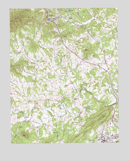
Boones Mill, VA USGS Topographic Map
Click on map above to begin viewing in our Map Viewer.

This topographic map contains these locations and features:
Feature Name Type Latitude Longitude GNIS ID View Map
Abshire CemeteryCemeteryN37.1157°W79.9270°1462344View Map
Antioch CemeteryCemeteryN37.0379°W79.9761°1791029View Map
Antioch ChurchChurchN37.0379°W79.9773°1462501View Map
Barney Bay DairyLocaleN37.0319°W79.9628°2675268View Map
Benjamin Franklin Middle School West HallSchoolN37.0177°W79.8848°1494384View Map
Bethlehem CemeteryCemeteryN37.0826°W79.9936°1791036View Map
Bethlehem ChurchChurchN37.0846°W79.9892°1463229View Map
BonbrookLocaleN37.1007°W79.8753°1463652View Map
Bonbrook CemeteryCemeteryN37.1024°W79.8756°1791037View Map
Bonbrook ChurchChurchN37.1018°W79.8759°1494393View Map
Boone CemeteryCemeteryN37.0346°W79.9981°1791038View Map
Boones MillPopulated PlaceN37.1168°W79.9553°1492609View Map
Boones Mill Baptist ChurchChurchN37.1224°W79.9553°1494394View Map
Boones Mill CemeteryCemeteryN37.1221°W79.9553°1494395View Map
Boones Mill Christian ChurchChurchN37.0936°W79.9486°2437929View Map
Boones Mill Elementary SchoolSchoolN37.0907°W79.9294°1494396View Map
Boones Mill Police DepartmentBuildingN37.1158°W79.9494°2767076View Map
Boones Mill Post OfficePost OfficeN37.1150°W79.9539°2766160View Map
Boones Mill Volunteer Fire Department Company 7BuildingN37.1197°W79.9564°2086295View Map
Brick ChurchChurchN37.0732°W79.9184°1463799View Map
Brown CemeteryCemeteryN37.0199°W79.9931°1463901View Map
Buck RunStreamN37.0538°W79.9367°1463996View Map
Bunker HillSummitN37.0704°W79.9759°1494791View Map
Byrdview CemeteryCemeteryN37.0071°W79.8884°1464212View Map
Carolina Spring ChurchChurchN37.0096°W79.9459°1464451View Map
Carolina Springs CemeteryCemeteryN37.0104°W79.9453°1791045View Map
Carper CemeteryCemeteryN37.0440°W79.9453°1791046View Map
Claiborn (historical)Populated PlaceN37.0026°W79.9431°1494792View Map
Clemons CemeteryCemeteryN37.1237°W79.9350°1464976View Map
Clower KnobSummitN37.0810°W79.9014°1465005View Map
Coles CreekStreamN37.0179°W79.9664°1465099View Map
Coles KnobSummitN37.0074°W79.9828°1465101View Map
County High SchoolSchoolN37.0051°W79.8775°1465299View Map
County Junior High SchoolSchoolN37.0038°W79.8795°1465302View Map
Donahoo CemeteryCemeteryN37.1204°W79.9289°1465884View Map
DugwellPopulated PlaceN37.0401°W79.9589°1477282View Map
Fisher CemeteryCemeteryN37.0924°W79.8964°1466602View Map
Flora CemeteryCemeteryN37.0568°W79.9995°1791070View Map
Flora-Teel CemeteryCemeteryN37.0865°W79.9461°1791071View Map
Franklin County Education CenterSchoolN37.0039°W79.8816°2498504View Map
Franklin County High SchoolSchoolN37.0051°W79.8785°1494436View Map
Franklin Memorial ParkCemeteryN37.0782°W79.9148°1466854View Map
Germantown Brick CemeteryCemeteryN37.0749°W79.9170°1791073View Map
GogginsvillePopulated PlaceN37.0404°W79.9259°1477357View Map
Gogginsville CemeteryCemeteryN37.0426°W79.9267°1494441View Map
Gogginsville Methodist ChurchChurchN37.0424°W79.9267°1494442View Map
Grassy HillSummitN37.0168°W79.9048°1493016View Map
Hay RunStreamN37.0235°W79.9431°1467856View Map
HelmPopulated PlaceN37.0796°W79.9475°1467909View Map
Helms CemeteryCemeteryN37.0918°W79.9603°1791076View Map
HickmanPopulated PlaceN37.0240°W79.9834°1493077View Map
Hodges CemeteryCemeteryN37.0162°W79.8923°1791077View Map
Hodges CemeteryCemeteryN37.0401°W79.9300°1468090View Map
Hodges-Stump CemeteryCemeteryN37.0021°W79.9078°1791079View Map
Leonard A Gereau Center for Applied TechnologySchoolN37.0147°W79.8959°2498402View Map
Little CreekStreamN37.0482°W79.9086°1469521View Map
Little Creek CemeteryCemeteryN37.0412°W79.9275°1494453View Map
Little Creek Church (historical)ChurchN37.0540°W79.8956°1494454View Map
Little Creek Primitive Baptist ChurchChurchN37.0413°W79.9278°1494455View Map
Little MountainSummitN37.0857°W79.9117°1469602View Map
Madcap CreekStreamN37.0210°W79.9820°1469998View Map
Maple BranchStreamN37.0204°W79.9781°1470064View Map
Melody DamDamN37.1229°W79.9311°1489810View Map
Melody LakeReservoirN37.1234°W79.9325°1502069View Map
Minnix CemeteryCemeteryN37.1185°W79.8809°1470616View Map
Mount Olive CemeteryCemeteryN37.1079°W79.9445°1494463View Map
Mount Olive ChurchChurchN37.1082°W79.9445°1494464View Map
Mount Olive SchoolSchoolN37.1082°W79.9439°1470992View Map
Mountain View Burial ParkCemeteryN37.0651°W79.9361°1471186View Map
Oak Grove CemeteryCemeteryN37.0190°W79.9203°1791105View Map
Oak Grove ChurchChurchN37.0185°W79.9203°1471713View Map
Overfelt CemeteryCemeteryN37.0340°W79.9170°1471983View Map
Pate CemeteryCemeteryN37.1229°W79.9550°1472099View Map
Peters CemeteryCemeteryN37.0837°W79.9806°1791111View Map
Rocky Mount DistrictCivilN37.0116°W79.8810°1927475View Map
Rocky Mount Police DepartmentBuildingN37.0128°W79.8924°2767003View Map
Rocky Mount Shoppers World Shopping CenterLocaleN37.0038°W79.8820°1494500View Map
Rocky Mount Volunteer Fire Department Company 1BuildingN37.0130°W79.8924°2086286View Map
Saint Pauls ChurchChurchN37.1096°W79.9450°1473875View Map
Starkey CemeteryCemeteryN37.1243°W79.8798°1475077View Map
TaylorPopulated PlaceN37.0988°W79.9048°1493691View Map
Teels CreekStreamN37.0585°W79.9175°1475529View Map
Town of Boones MillCivilN37.1156°W79.9515°2390739View Map
Town of Rocky MountCivilN37.0045°W79.8855°2391395View Map
Turnbull CemeteryCemeteryN37.0790°W79.8831°1475977View Map
W N Angle Memorial BridgeBridgeN37.0018°W79.8911°1494531View Map
Webster CemeteryCemeteryN37.0912°W79.9517°1791137View Map
Whispering Oaks FarmLocaleN37.0703°W79.9094°2676018View Map
White Oak CreekStreamN37.1165°W79.9003°1476607View Map
White Oak Grove School (historical)SchoolN37.1207°W79.9081°1494529View Map
Willis CemeteryCemeteryN37.0337°W79.9309°1791140View Map
WirtzPopulated PlaceN37.0765°W79.8895°1477892View Map
Wright CemeteryCemeteryN37.1085°W79.9200°1474298View Map
WYTI-AM (Rocky Mount)TowerN37.0199°W79.8856°1498954View Map

Note: Coordinates in the location and feature list above are referenced to NAD83 datum.


Copyright (C) 2008-2025 Ryan Niemi / Sunset Dynamics ... All Rights Reserved