TopoQuest Logo
Do you find TopoQuest useful?
Help keep TopoQuest running and adding new maps/features by donating!
Bitcoin:  19c7KJd3qBynnjoSw5npx9KScwjBe4ifkT
Litecoin:  LXs6TkuXGGXo1vDsWCkWVdjQX94eUKd6ui
Home View Maps Find Maps Find Places Resources & Links


Whistler, Mississippi Topographic Map

USGS Map Title: Whistler, MS
USGS Map MRC: 31088F7
DRG (GeoTIFF) Download: o31088f7.tif


Neighboring USGS Topographic Map Quads:


  Heidelberg SW, MS  
31088G8
 

  Eucutta, MS  
31088G7
 

  Shubuta, MS  
31088G6
 

  Myrick, MS  
31088F8
 

  Whistler, MS  
31088F7
 

  Waynesboro, MS  
31088F6
 

  Strengthford, MS  
31088E8
 

  Water Oak, MS  
31088E7
 

  Clara, MS  
31088E6


Map MRC Location:

N32°
W89°
N32°
W88°
H8 H7 H6 H5 H4 H3 H2 H1
G8 G7 G6 G5 G4 G3 G2 G1
F8 F7 F6 F5 F4 F3 F2 F1
E8 E7 E6 E5 E4 E3 E2 E1
D8 D7 D6 D5 D4 D3 D2 D1
C8 C7 C6 C5 C4 C3 C2 C1
B8 B7 B6 B5 B4 B3 B2 B1
A8 A7 A6 A5 A4 A3 A2 A1
N31°
W89°
N31°
W88°

Whistler, MS USGS 1:24K Topographic Map Preview:
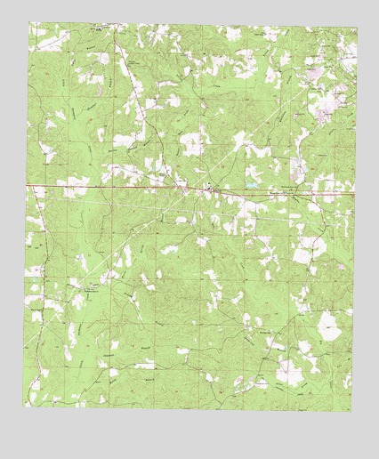
Whistler, MS USGS Topographic Map
Click on map above to begin viewing in our Map Viewer.

This topographic map contains these locations and features:
Feature Name Type Latitude Longitude GNIS ID View Map
Allen ProngStreamN31.6341°W88.7587°666215View Map
Altaire ChurchChurchN31.7488°W88.8470°666238View Map
Arrington CemeteryCemeteryN31.6996°W88.8187°666383View Map
Beat Four Elementary SchoolSchoolN31.6985°W88.8056°706409View Map
Beat Four High SchoolSchoolN31.6968°W88.8056°706410View Map
Boyles ChapelChurchN31.7010°W88.8220°667502View Map
Boyles Chapel CemeteryCemeteryN31.7015°W88.8223°706414View Map
Brushy BranchStreamN31.6635°W88.8417°667680View Map
Burro Spring BranchStreamN31.6596°W88.8506°667839View Map
Dogwood BranchStreamN31.6438°W88.8500°669321View Map
Gully BranchStreamN31.7282°W88.8612°670778View Map
Lowery CemeteryCemeteryN31.7293°W88.7636°706434View Map
Lowery ChurchChurchN31.7299°W88.7637°672928View Map
Martha Holland BranchStreamN31.7060°W88.8500°673168View Map
Maxey BranchStreamN31.6332°W88.8548°673250View Map
Maynor Creek ChurchChurchN31.6957°W88.7773°673270View Map
McGill SchoolSchoolN31.7482°W88.8481°673357View Map
McLain ChapelChurchN31.6566°W88.8681°673389View Map
Mozingo CemeteryCemeteryN31.6502°W88.7809°674421View Map
Mozingo Store (historical)LocaleN31.6496°W88.7675°684089View Map
Old Harmony Church (historical)ChurchN31.6377°W88.8681°684094View Map
Paster Reed BrakeStreamN31.7274°W88.8112°675484View Map
Plummer BranchStreamN31.7185°W88.8575°676153View Map
Pole BranchStreamN31.6385°W88.7573°676175View Map
Sanderson BranchStreamN31.6343°W88.7662°677362View Map
Sanderson CemeteryCemeteryN31.6340°W88.7867°677363View Map
Supervisor District 4CivilN31.7287°W88.8409°712132View Map
Thompson Creek ChurchChurchN31.6635°W88.8520°678711View Map
Wards Camp (historical)LocaleN31.6649°W88.8459°684112View Map
Wayne County Volunteer Fire Department Beat Four StationBuildingN31.6964°W88.8034°2667999View Map
West Pond DamDamN31.6985°W88.7867°680837View Map
West School (historical)SchoolN31.7393°W88.7617°684127View Map
West Shady Grove CemeteryCemeteryN31.6968°W88.7717°1805862View Map
West Shady Grove ChurchChurchN31.6979°W88.7720°679528View Map
West Yellow Creek Oil FieldOilfieldN31.7460°W88.7695°706461View Map
Whetstone BranchStreamN31.7474°W88.7762°679556View Map
WhistlerPopulated PlaceN31.6971°W88.8045°679565View Map
Whistler Lookout TowerTowerN31.7371°W88.8370°711333View Map
Williams Lake DamDamN31.7285°W88.8484°680855View Map
Williams Store (historical)LocaleN31.6646°W88.8334°684128View Map
Yellow Creek CemeteryCemeteryN31.7479°W88.7850°706467View Map
Yellow Creek ChurchChurchN31.7474°W88.7845°679941View Map

Note: Coordinates in the location and feature list above are referenced to NAD83 datum.


Copyright (C) 2008-2025 Ryan Niemi / Sunset Dynamics ... All Rights Reserved