TopoQuest Logo
Do you find TopoQuest useful?
Help keep TopoQuest running and adding new maps/features by donating!
Bitcoin:  19c7KJd3qBynnjoSw5npx9KScwjBe4ifkT
Litecoin:  LXs6TkuXGGXo1vDsWCkWVdjQX94eUKd6ui
Home View Maps Find Maps Find Places Resources & Links


White Mud Lake, Washington Topographic Map

USGS Map Title: White Mud Lake, WA
USGS Map MRC: 48117E7
DRG (GeoTIFF) Download: o48117e7.tif


Neighboring USGS Topographic Map Quads:


  Echo Valley, WA  
48117F8
 

  Gillette Mountain, WA  
48117F7
 

  Aladdin, WA  
48117F6
 

  Colville, WA  
48117E8
 

  White Mud Lake, WA  
48117E7
 

  Park Rapids, WA  
48117E6
 

  Arden, WA  
48117D8
 

  Addy Mountain, WA  
48117D7
 

  Cliff Ridge, WA  
48117D6


Map MRC Location:

N49°
W118°
N49°
W117°
H8 H7 H6 H5 H4 H3 H2 H1
G8 G7 G6 G5 G4 G3 G2 G1
F8 F7 F6 F5 F4 F3 F2 F1
E8 E7 E6 E5 E4 E3 E2 E1
D8 D7 D6 D5 D4 D3 D2 D1
C8 C7 C6 C5 C4 C3 C2 C1
B8 B7 B6 B5 B4 B3 B2 B1
A8 A7 A6 A5 A4 A3 A2 A1
N48°
W118°
N48°
W117°

White Mud Lake, WA USGS 1:24K Topographic Map Preview:
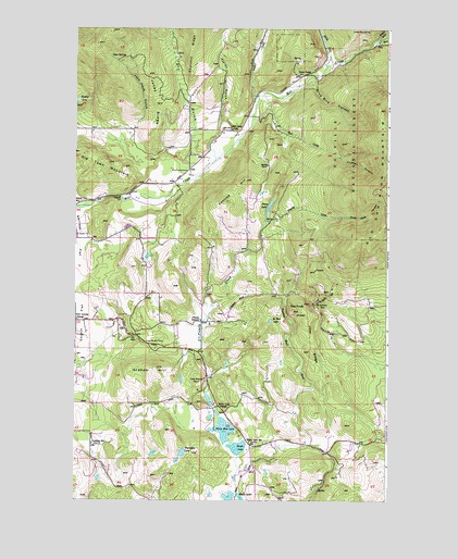
White Mud Lake, WA USGS Topographic Map
Click on map above to begin viewing in our Map Viewer.

This topographic map contains these locations and features:
Feature Name Type Latitude Longitude GNIS ID View Map
Aladdin PitMineN48.5921°W117.8258°2605631View Map
Blue Bird CanyonValleyN48.6102°W117.7805°1516663View Map
Colville DivisionCivilN48.5629°W117.7710°1939480View Map
Colville Gun ClubLocaleN48.5418°W117.8461°1533102View Map
Coonrad HillSummitN48.5843°W117.8066°1518052View Map
Crusher CanyonValleyN48.5907°W117.7697°1518364View Map
De Hart LakeLakeN48.5476°W117.7971°1518524View Map
Douglass LakeLakeN48.6058°W117.8743°1518902View Map
Dry GulchValleyN48.5907°W117.8300°1518965View Map
Finley GulchValleyN48.5999°W117.8158°1519530View Map
Fort Colville GrangeLocaleN48.5477°W117.8741°1519703View Map
Graham HillSummitN48.5346°W117.8416°1520187View Map
Graham SchoolLocaleN48.5149°W117.8680°1520188View Map
Grevit CreekStreamN48.6055°W117.8019°1520350View Map
Hawkins QuarryMineN48.5521°W117.8555°2605632View Map
Hull CreekStreamN48.6074°W117.7991°1521051View Map
Jack Hook GulchValleyN48.5966°W117.8522°1521288View Map
Joes RidgeRidgeN48.5396°W117.7814°1521397View Map
Jones RidgeRidgeN48.6049°W117.8428°1521463View Map
Keogh LakeLakeN48.5140°W117.8092°1521626View Map
Middle Fork Mill CreekStreamN48.6221°W117.7550°1523075View Map
Mill Creek SchoolSchoolN48.5982°W117.8116°1523167View Map
North Fork Mill CreekStreamN48.6152°W117.7750°1523805View Map
Old Dominion MineMineN48.5518°W117.7794°1523998View Map
Old Town MountainSummitN48.5891°W117.8619°1524018View Map
Peery LakeReservoirN48.5782°W117.7973°1524302View Map
Prouty CornersLocaleN48.5474°W117.8241°1524668View Map
Prouty CreekStreamN48.5280°W117.8222°1524669View Map
Rosanna Lake DamDamN48.5749°W117.7994°1532546View Map
Saint John's Episcopal ChurchChurchN48.5359°W117.8749°2609117View Map
Smith AirportAirportN48.5231°W117.8549°2443381View Map
South Fork Mill CreekStreamN48.6219°W117.7550°1526218View Map
Tepee SpringsSpringN48.6175°W117.8614°1527009View Map
The KnobSummitN48.5505°W117.7880°1527045View Map
Thompson LakeLakeN48.5125°W117.8321°1527109View Map
Three ForksLocaleN48.6124°W117.7850°1527148View Map
Truman Wood CreekStreamN48.5160°W117.7811°1527421View Map
Tulare Dolomite QuarryMineN48.5321°W117.8228°1527435View Map
White LakeLakeN48.5266°W117.8216°1530036View Map
White Lake GrangeLocaleN48.5243°W117.8161°1528064View Map
White Lake SchoolLocaleN48.5155°W117.8053°1528065View Map
White Mud LakeLakeN48.5187°W117.8151°1528073View Map
White Rock CanyonValleyN48.5752°W117.7716°1528085View Map

Note: Coordinates in the location and feature list above are referenced to NAD83 datum.


Copyright (C) 2008-2025 Ryan Niemi / Sunset Dynamics ... All Rights Reserved