TopoQuest Logo
Do you find TopoQuest useful?
Help keep TopoQuest running and adding new maps/features by donating!
Bitcoin:  19c7KJd3qBynnjoSw5npx9KScwjBe4ifkT
Litecoin:  LXs6TkuXGGXo1vDsWCkWVdjQX94eUKd6ui
Home View Maps Find Maps Find Places Resources & Links


Echo Valley, Washington Topographic Map

USGS Map Title: Echo Valley, WA
USGS Map MRC: 48117F8
DRG (GeoTIFF) Download: o48117f8.tif


Neighboring USGS Topographic Map Quads:


  Bossburg, WA  
48118G1
 

  China Bend, WA  
48117G8
 

  Onion Creek, WA  
48117G7
 

  Marcus, WA  
48118F1
 

  Echo Valley, WA  
48117F8
 

  Gillette Mountain, WA  
48117F7
 

  Kettle Falls, WA  
48118E1
 

  Colville, WA  
48117E8
 

  White Mud Lake, WA  
48117E7


Map MRC Location:

N49°
W118°
N49°
W117°
H8 H7 H6 H5 H4 H3 H2 H1
G8 G7 G6 G5 G4 G3 G2 G1
F8 F7 F6 F5 F4 F3 F2 F1
E8 E7 E6 E5 E4 E3 E2 E1
D8 D7 D6 D5 D4 D3 D2 D1
C8 C7 C6 C5 C4 C3 C2 C1
B8 B7 B6 B5 B4 B3 B2 B1
A8 A7 A6 A5 A4 A3 A2 A1
N48°
W118°
N48°
W117°

Echo Valley, WA USGS 1:24K Topographic Map Preview:
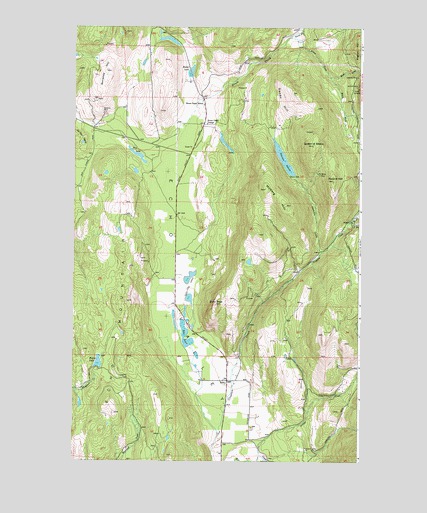
Echo Valley, WA USGS Topographic Map
Click on map above to begin viewing in our Map Viewer.

This topographic map contains these locations and features:
Feature Name Type Latitude Longitude GNIS ID View Map
Aspend HillSummitN48.7057°W117.8872°1515975View Map
Bonanza HillSummitN48.7374°W117.9867°1516776View Map
Bonanza MineMineN48.7257°W117.9872°1516778View Map
Bruce CreekStreamN48.7191°W117.9567°1516996View Map
Bruce Creek GrangeLocaleN48.7221°W117.9425°1516997View Map
Bruce Creek SchoolSchoolN48.7277°W117.9439°1516998View Map
Dry LakeLakeN48.7130°W117.9725°1518971View Map
East Fork Bruce CreekStreamN48.7360°W117.8889°1519087View Map
EchoPopulated PlaceN48.6480°W117.9328°1519164View Map
Echo MountainSummitN48.6388°W117.9822°1519173View Map
Echo PeakSummitN48.6702°W117.9380°1519174View Map
Echo ValleyValleyN48.6307°W117.9339°1519176View Map
Eureka SurpriseMineN48.7324°W117.8764°1519394View Map
Gillette CreekStreamN48.6260°W117.9183°1519961View Map
Harbison GulchValleyN48.6866°W117.8933°1520530View Map
Hill Cliff MineMineN48.7332°W117.8775°1520805View Map
Lake CityLocaleN48.6766°W117.9564°1530163View Map
Lake City LakesLakeN48.6788°W117.9482°1521830View Map
Leadville MineMineN48.7360°W117.8769°1521976View Map
Lucky Stone MineMineN48.7077°W117.8933°1522568View Map
Moberg HillSummitN48.6982°W117.9075°1523298View Map
North Fork Bruce CreekStreamN48.7471°W117.9064°1523742View Map
North Fork Clugston CreekStreamN48.6941°W117.8800°1523760View Map
Old Placer DiggingsMineN48.7180°W117.9964°1524009View Map
Peterson SwampSwampN48.7119°W117.9089°1524365View Map
Queen of ShebaSummitN48.7155°W117.8961°1524754View Map
Reeder LakeLakeN48.7377°W117.9486°1524977View Map
Rigley LakeLakeN48.6538°W117.9889°1525050View Map
South Fork Bruce CreekStreamN48.7360°W117.8889°1526164View Map
South Fork Clugston CreekStreamN48.6938°W117.8800°1526180View Map
Swede HillSummitN48.7310°W117.9033°1526851View Map
Zema Private AirportAirportN48.6443°W117.9359°2443379View Map

Note: Coordinates in the location and feature list above are referenced to NAD83 datum.


Copyright (C) 2008-2025 Ryan Niemi / Sunset Dynamics ... All Rights Reserved