TopoQuest Logo
Do you find TopoQuest useful?
Help keep TopoQuest running and adding new maps/features by donating!
Bitcoin:  19c7KJd3qBynnjoSw5npx9KScwjBe4ifkT
Litecoin:  LXs6TkuXGGXo1vDsWCkWVdjQX94eUKd6ui
Home View Maps Find Maps Find Places Resources & Links


White West, Georgia Topographic Map

USGS Map Title: White West, GA
USGS Map MRC: 34084C7
DRG (GeoTIFF) Download: o34084c7.tif


Neighboring USGS Topographic Map Quads:


  Calhoun South, GA  
34084D8
 

  Sonoraville, GA  
34084D7
 

  Fairmount, GA  
34084D6
 

  Adairsville, GA  
34084C8
 

  White West, GA  
34084C7
 

  White East, GA  
34084C6
 

  Kingston, GA  
34084B8
 

  Cartersville, GA  
34084B7
 

  Allatoona Dam, GA  
34084B6


Map MRC Location:

N35°
W85°
N35°
W84°
H8 H7 H6 H5 H4 H3 H2 H1
G8 G7 G6 G5 G4 G3 G2 G1
F8 F7 F6 F5 F4 F3 F2 F1
E8 E7 E6 E5 E4 E3 E2 E1
D8 D7 D6 D5 D4 D3 D2 D1
C8 C7 C6 C5 C4 C3 C2 C1
B8 B7 B6 B5 B4 B3 B2 B1
A8 A7 A6 A5 A4 A3 A2 A1
N34°
W85°
N34°
W84°

White West, GA USGS 1:24K Topographic Map Preview:
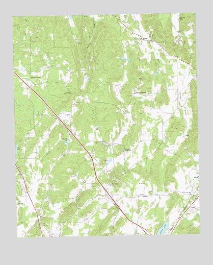
White West, GA USGS Topographic Map
Click on map above to begin viewing in our Map Viewer.

This topographic map contains these locations and features:
Feature Name Type Latitude Longitude GNIS ID View Map
AubreyPopulated PlaceN34.2645°W84.7527°331066View Map
Aubrey LakeReservoirN34.2527°W84.7755°310668View Map
Bartow Cumberland Presbyterian Church CemeteryCemeteryN34.3597°W84.7739°2357977View Map
Best ChapelChurchN34.3031°W84.8180°354564View Map
Big Spring BranchStreamN34.2615°W84.7652°334240View Map
Cassville CemeteryCemeteryN34.2508°W84.8464°2358229View Map
Chunn EstatesPopulated PlaceN34.2534°W84.8605°334258View Map
Clear CreekStreamN34.2595°W84.8691°312720View Map
Clear Creek ChurchChurchN34.2976°W84.8594°312721View Map
Clear Creek Elementary SchoolSchoolN34.2880°W84.8664°2545621View Map
Clear LakeReservoirN34.2994°W84.8745°312725View Map
Community House of PrayerChurchN34.3312°W84.8358°312875View Map
Corra Harris HomeBuildingN34.3718°W84.7608°313004View Map
Crow SpringSpringN34.3009°W84.8088°313186View Map
Crow Springs ChurchChurchN34.3031°W84.8147°355391View Map
Cumberland ChurchChurchN34.3584°W84.7760°313212View Map
Denman Family CemeteryCemeteryN34.3583°W84.7819°2358469View Map
Dewey Baptist Church CemeteryCemeteryN34.3375°W84.7889°2358529View Map
Dewey ChurchChurchN34.3376°W84.7894°313459View Map
Dewey CrossroadsPopulated PlaceN34.3298°W84.7919°355484View Map
Five ForksPopulated PlaceN34.2795°W84.8102°326281View Map
Five Forks ChurchChurchN34.2818°W84.8047°334277View Map
Five Forks School (historical)SchoolN34.2793°W84.8099°334278View Map
Grace ChurchChurchN34.3137°W84.8374°334281View Map
GrassdalePopulated PlaceN34.2729°W84.7869°331850View Map
Gum SpringsPopulated PlaceN34.3604°W84.7866°356126View Map
Lewis-Linn CemeteryCemeteryN34.3722°W84.8017°2359089View Map
Lipscomb BranchStreamN34.3412°W84.7552°316920View Map
Little LakeReservoirN34.3492°W84.7967°339738View Map
Little Lake DamDamN34.3501°W84.7949°339737View Map
Manning LakeReservoirN34.3037°W84.8393°317664View Map
Manning Lake DamDamN34.3043°W84.8413°339389View Map
McCalliePopulated PlaceN34.2587°W84.7649°334309View Map
Mount Zion Baptist Church CemeteryCemeteryN34.2862°W84.7863°334316View Map
Mount Zion ChurchChurchN34.2793°W84.7874°319041View Map
Mud CreekStreamN34.2670°W84.8691°319104View Map
Oakdale School (historical)SchoolN34.2973°W84.8402°334323View Map
Pettit School (historical)SchoolN34.2798°W84.8688°334326View Map
Pine Log Tributary Structure Number 21 DamDamN34.3434°W84.7766°339387View Map
Pleasant ValleyPopulated PlaceN34.3395°W84.8630°332716View Map
Pleasant Valley ChurchChurchN34.3473°W84.8636°334331View Map
Richards LakeReservoirN34.3418°W84.7772°339388View Map
Rock Creek School (historical)SchoolN34.3601°W84.7791°334335View Map
Saddle Ridge EstatesPopulated PlaceN34.2576°W84.8438°334342View Map
Simpson CrossroadsPopulated PlaceN34.2976°W84.8002°326516View Map
Sophia (historical)Populated PlaceN34.3195°W84.7999°334349View Map
South Fork Two Run CreekStreamN34.2595°W84.8691°334350View Map
Stephenson Family CemeteryCemeteryN34.2692°W84.7531°2368949View Map
Stovall Family CemeteryCemeteryN34.3528°W84.7689°2363449View Map
Tanner Mill (historical)LocaleN34.3520°W84.7549°334357View Map
Towe ChapelChurchN34.3590°W84.8311°324236View Map
Towe Chapel CemeteryCemeteryN34.3608°W84.8308°2363470View Map
White CemeteryCemeteryN34.2847°W84.7511°2363609View Map
White Elementary SchoolSchoolN34.2786°W84.7629°334368View Map
Woffords Crossroads Baptist Church CemeteryCemeteryN34.2728°W84.7556°2363610View Map
Woffords Crossroads ChurchChurchN34.2729°W84.7560°356647View Map
Wolfpen BranchStreamN34.2812°W84.7530°325515View Map

Note: Coordinates in the location and feature list above are referenced to NAD83 datum.


Copyright (C) 2008-2024 Ryan Niemi / Sunset Dynamics ... All Rights Reserved