TopoQuest Logo
Do you find TopoQuest useful?
Help keep TopoQuest running and adding new maps/features by donating!
Bitcoin:  19c7KJd3qBynnjoSw5npx9KScwjBe4ifkT
Litecoin:  LXs6TkuXGGXo1vDsWCkWVdjQX94eUKd6ui
Home View Maps Find Maps Find Places Resources & Links


Fairmount, Georgia Topographic Map

USGS Map Title: Fairmount, GA
USGS Map MRC: 34084D6
DRG (GeoTIFF) Download: o34084d6.tif


Neighboring USGS Topographic Map Quads:


  Redbud, GA  
34084E7
 

  Oakman, GA  
34084E6
 

  Talking Rock, GA  
34084E5
 

  Sonoraville, GA  
34084D7
 

  Fairmount, GA  
34084D6
 

  Ludville, GA  
34084D5
 

  White West, GA  
34084C7
 

  White East, GA  
34084C6
 

  Waleska, GA  
34084C5


Map MRC Location:

N35°
W85°
N35°
W84°
H8 H7 H6 H5 H4 H3 H2 H1
G8 G7 G6 G5 G4 G3 G2 G1
F8 F7 F6 F5 F4 F3 F2 F1
E8 E7 E6 E5 E4 E3 E2 E1
D8 D7 D6 D5 D4 D3 D2 D1
C8 C7 C6 C5 C4 C3 C2 C1
B8 B7 B6 B5 B4 B3 B2 B1
A8 A7 A6 A5 A4 A3 A2 A1
N34°
W85°
N34°
W84°

Fairmount, GA USGS 1:24K Topographic Map Preview:
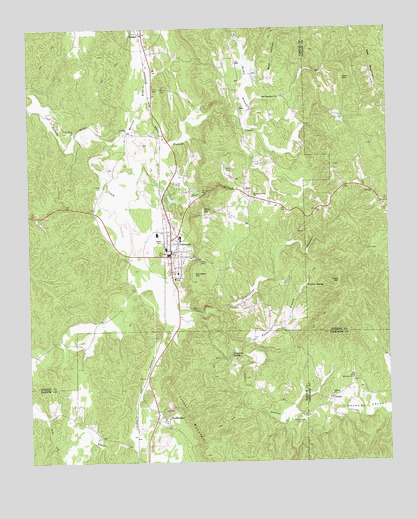
Fairmount, GA USGS Topographic Map
Click on map above to begin viewing in our Map Viewer.

This topographic map contains these locations and features:
Feature Name Type Latitude Longitude GNIS ID View Map
Anderson LakeReservoirN34.4739°W84.6411°336987View Map
Becky BranchStreamN34.4718°W84.6747°354523View Map
BoboPopulated PlaceN34.4768°W84.6752°331199View Map
Bobo School (historical)SchoolN34.4762°W84.6760°335310View Map
Brannon LakeReservoirN34.4167°W84.6593°337156View Map
Calico ValleyValleyN34.3767°W84.7388°312160View Map
Camp SunriseLocaleN34.4140°W84.7374°334426View Map
Carter MountainSummitN34.4479°W84.6885°331331View Map
City of FairmountCivilN34.4380°W84.6998°2403592View Map
Dripping SpringSpringN34.4056°W84.6797°313627View Map
East Damascus ChurchChurchN34.4804°W84.6619°355595View Map
Edward Lacy Mill (historical)LocaleN34.4348°W84.7013°334443View Map
Erwin Family CemeteryCemeteryN34.4122°W84.7008°2358629View Map
Erwin Mill (historical)LocaleN34.4179°W84.6888°334444View Map
FairmountPopulated PlaceN34.4362°W84.6999°355758View Map
Fairmount Elementary SchoolSchoolN34.4396°W84.6972°334445View Map
Fairmount Police DepartmentBuildingN34.4386°W84.7009°2734151View Map
Fairmount Post OfficePost OfficeN34.4437°W84.7013°352032View Map
Fairview CemeteryCemeteryN34.3990°W84.6366°1730650View Map
Fairview Methodist ChurchChurchN34.3990°W84.6377°355764View Map
First Baptist Church of FairmountChurchN34.4340°W84.6999°334452View Map
Forest Hill School (historical)SchoolN34.4198°W84.6730°334456View Map
Fuller BranchStreamN34.4181°W84.6833°314451View Map
Fuller MountainSummitN34.4265°W84.6419°331780View Map
FunkhouserPopulated PlaceN34.3870°W84.7019°355969View Map
Gee MountainSummitN34.4898°W84.6302°331798View Map
Gordon County Fire and Rescue Department Station 8 FairmountBuildingN34.4465°W84.7027°2604984View Map
Gordon County Fire Rescue Department Station 8 FairmountBuildingN34.4464°W84.7031°2604983View Map
GreelyPopulated PlaceN34.3931°W84.6449°331858View Map
Igo (historical)Populated PlaceN34.4829°W84.7066°334468View Map
Johnson MountainSummitN34.3884°W84.6930°332109View Map
Jones LakeReservoirN34.4851°W84.6799°339283View Map
Lewis Family CemeteryCemeteryN34.3955°W84.7122°2364089View Map
Mahan CemeteryCemeteryN34.3981°W84.6285°1730651View Map
Marlowe BranchStreamN34.4679°W84.7188°317707View Map
Ninetynine BranchStreamN34.4340°W84.7144°356432View Map
Orr Mill (historical)LocaleN34.4759°W84.6824°335311View Map
Pack MountainSummitN34.4854°W84.6399°332591View Map
Patterson LakeReservoirN34.4867°W84.6706°337153View Map
Pinhook CreekStreamN34.4556°W84.7216°320744View Map
Pleasant Grove ChurchChurchN34.4509°W84.6705°320847View Map
Ramsaeur MountainSummitN34.4295°W84.6927°332788View Map
Ranger Post OfficePost OfficeN34.4990°W84.7099°352042View Map
Richardson Family CemeteryCemeteryN34.3873°W84.6569°321568View Map
RyoPopulated PlaceN34.4540°W84.6738°332949View Map
Salacoa ChurchChurchN34.3943°W84.6449°322324View Map
Salacoa Creek Watershed Dam Number 100DamN34.4851°W84.6799°339282View Map
Salacoa Creek Watershed Dam Number 67DamN34.4851°W84.6716°337152View Map
Salacoa School (historical)SchoolN34.3929°W84.6677°334343View Map
Salacoa ValleyValleyN34.3886°W84.6443°322326View Map
Salacoa Volunteer Fire DepartmentBuildingN34.3944°W84.6273°2603972View Map
Sallacoa Creek Watershed Dam Number 89DamN34.4168°W84.6599°337155View Map
Sallacoa Creek Watershed Number 99 DamDamN34.4968°W84.6766°337154View Map
Sallacoa Watershed Dam Number 48DamN34.4734°W84.6416°336986View Map
Scott BranchStreamN34.4559°W84.7030°322646View Map
Shiloh CemeteryCemeteryN34.4826°W84.7027°322855View Map
Sulphur SpringSpringN34.4256°W84.6535°323732View Map
Takila LakeReservoirN34.4509°W84.7003°337178View Map
Takila Lake DamDamN34.4518°W84.7016°337177View Map
Wolf HollowValleyN34.4842°W84.6689°325503View Map

Note: Coordinates in the location and feature list above are referenced to NAD83 datum.


Copyright (C) 2008-2025 Ryan Niemi / Sunset Dynamics ... All Rights Reserved