TopoQuest Logo
Do you find TopoQuest useful?
Help keep TopoQuest running and adding new maps/features by donating!
Bitcoin:  19c7KJd3qBynnjoSw5npx9KScwjBe4ifkT
Litecoin:  LXs6TkuXGGXo1vDsWCkWVdjQX94eUKd6ui
Home View Maps Find Maps Find Places Resources & Links


Whitefield, Illinois Topographic Map

USGS Map Title: Whitefield, IL
USGS Map MRC: 41089B5
DRG (GeoTIFF) Download: o41089b5.tif


Neighboring USGS Topographic Map Quads:


  Buda, IL  
41089C6
 

  Wyanet, IL  
41089C5
 

  Princeton South, IL  
41089C4
 

  Bradford, IL  
41089B6
 

  Whitefield, IL  
41089B5
 

  Putnam, IL  
41089B4
 

  Castleton, IL  
41089A6
 

  La Prairie Center, IL  
41089A5
 

  Lacon, IL  
41089A4


Map MRC Location:

N42°
W90°
N42°
W89°
H8 H7 H6 H5 H4 H3 H2 H1
G8 G7 G6 G5 G4 G3 G2 G1
F8 F7 F6 F5 F4 F3 F2 F1
E8 E7 E6 E5 E4 E3 E2 E1
D8 D7 D6 D5 D4 D3 D2 D1
C8 C7 C6 C5 C4 C3 C2 C1
B8 B7 B6 B5 B4 B3 B2 B1
A8 A7 A6 A5 A4 A3 A2 A1
N41°
W90°
N41°
W89°

Whitefield, IL USGS 1:24K Topographic Map Preview:
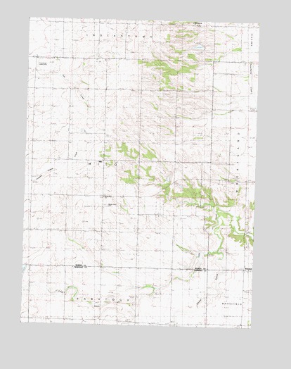
Whitefield, IL USGS Topographic Map
Click on map above to begin viewing in our Map Viewer.

This topographic map contains these locations and features:
Feature Name Type Latitude Longitude GNIS ID View Map
Boyds Grove CemeteryCemeteryN41.1628°W89.5801°1719850View Map
Boyds Grove ChurchChurchN41.1773°W89.5820°404759View Map
Clover Leaf Ranch LakeReservoirN41.2396°W89.5326°1692491View Map
Clover Leaf Ranch Lake DamDamN41.2400°W89.5284°1692490View Map
Cloverleaf Ranch AirportAirportN41.2379°W89.5315°2679093View Map
Conover School (historical)SchoolN41.1417°W89.5829°406485View Map
Cottage School (historical)SchoolN41.2214°W89.5240°406620View Map
Dorr Hill School (historical)SchoolN41.2489°W89.5676°407322View Map
Evergreen School (historical)SchoolN41.2217°W89.6212°408127View Map
Hoffman School (historical)SchoolN41.1261°W89.5434°410345View Map
Hunter CemeteryCemeteryN41.1959°W89.5195°1822659View Map
Hunter School (historical)SchoolN41.1925°W89.5301°410697View Map
Jamison School (historical)SchoolN41.2486°W89.6073°411036View Map
Mason School (historical)SchoolN41.2217°W89.5815°413104View Map
MiloPopulated PlaceN41.1925°W89.5823°413630View Map
Milo CemeteryCemeteryN41.1931°W89.5829°1822688View Map
Newton LakeReservoirN41.1834°W89.5451°1692512View Map
Newton Lake DamDamN41.1834°W89.5451°1692511View Map
Newton-Hager LakeReservoirN41.1850°W89.5384°1692505View Map
Newton-Hager Lake DamDamN41.1850°W89.5384°1692504View Map
Reid School (historical)SchoolN41.1628°W89.5443°416514View Map
Rinkenberger RLA AirportAirportN41.2337°W89.6204°427081View Map
Scholes BranchStreamN41.1564°W89.5195°418100View Map
Sharkey School (historical)SchoolN41.1925°W89.6207°418286View Map
Shurts School (historical)SchoolN41.1625°W89.5818°418484View Map
Township of MiloCivilN41.1913°W89.5816°429371View Map
WhitefieldPopulated PlaceN41.1486°W89.5048°421088View Map
Willow Springs CemeteryCemeteryN41.2498°W89.5365°1820602View Map
Willow Springs Mennonite ChurchChurchN41.2489°W89.5362°421270View Map
Wilson School (historical)SchoolN41.1273°W89.6198°421303View Map

Note: Coordinates in the location and feature list above are referenced to NAD83 datum.


Copyright (C) 2008-2025 Ryan Niemi / Sunset Dynamics ... All Rights Reserved