TopoQuest Logo
Do you find TopoQuest useful?
Help keep TopoQuest running and adding new maps/features by donating!
Bitcoin:  19c7KJd3qBynnjoSw5npx9KScwjBe4ifkT
Litecoin:  LXs6TkuXGGXo1vDsWCkWVdjQX94eUKd6ui
Home View Maps Find Maps Find Places Resources & Links


La Prairie Center, Illinois Topographic Map

USGS Map Title: La Prairie Center, IL
USGS Map MRC: 41089A5
DRG (GeoTIFF) Download: o41089a5.tif


Neighboring USGS Topographic Map Quads:


  Bradford, IL  
41089B6
 

  Whitefield, IL  
41089B5
 

  Putnam, IL  
41089B4
 

  Castleton, IL  
41089A6
 

  La Prairie Center, IL  
41089A5
 

  Lacon, IL  
41089A4
 

  Edelstein, IL  
40089H6
 

  Rome, IL  
40089H5
 

  Chillicothe, IL  
40089H4


Map MRC Location:

N42°
W90°
N42°
W89°
H8 H7 H6 H5 H4 H3 H2 H1
G8 G7 G6 G5 G4 G3 G2 G1
F8 F7 F6 F5 F4 F3 F2 F1
E8 E7 E6 E5 E4 E3 E2 E1
D8 D7 D6 D5 D4 D3 D2 D1
C8 C7 C6 C5 C4 C3 C2 C1
B8 B7 B6 B5 B4 B3 B2 B1
A8 A7 A6 A5 A4 A3 A2 A1
N41°
W90°
N41°
W89°

La Prairie Center, IL USGS 1:24K Topographic Map Preview:
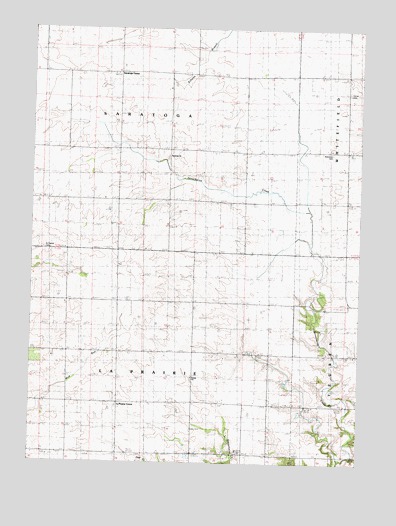
La Prairie Center, IL USGS Topographic Map
Click on map above to begin viewing in our Map Viewer.

This topographic map contains these locations and features:
Feature Name Type Latitude Longitude GNIS ID View Map
Collins School (historical)SchoolN41.0467°W89.5907°406384View Map
Coulter School (historical)SchoolN41.0895°W89.5440°406646View Map
Doyle School (historical)SchoolN41.0900°W89.5812°407372View Map
Drake School (historical)SchoolN41.0456°W89.5045°407379View Map
Henry Fire Protection District Station 2BuildingN41.1113°W89.5310°2640725View Map
Hull School (historical)SchoolN41.0167°W89.5506°410672View Map
Kaifer School (historical)SchoolN41.0717°W89.5045°411290View Map
La Prairie CenterLocaleN41.0170°W89.5907°411651View Map
La Prairie United Presbyterian ChurchChurchN41.0242°W89.5629°420059View Map
Mansfield CemeteryCemeteryN41.0895°W89.5109°1719846View Map
McVicker School (historical)SchoolN41.1103°W89.5443°413176View Map
Red Town School (historical)SchoolN41.1109°W89.5056°416468View Map
Rickey School (historical)SchoolN41.0670°W89.5431°416626View Map
Saint Patrick CemeteryCemeteryN41.0617°W89.6206°1719848View Map
Saratoga CenterPopulated PlaceN41.1117°W89.5920°423157View Map
Saratoga ChurchChurchN41.0884°W89.5734°1719847View Map
Senachwine School (historical)SchoolN41.0167°W89.5059°418207View Map
Smith School (historical)SchoolN41.0464°W89.5531°418647View Map
Township of La PrairieCivilN41.0171°W89.5817°429233View Map
Township of SaratogaCivilN41.1048°W89.5815°429715View Map

Note: Coordinates in the location and feature list above are referenced to NAD83 datum.


Copyright (C) 2008-2025 Ryan Niemi / Sunset Dynamics ... All Rights Reserved