TopoQuest Logo
Do you find TopoQuest useful?
Help keep TopoQuest running and adding new maps/features by donating!
Bitcoin:  19c7KJd3qBynnjoSw5npx9KScwjBe4ifkT
Litecoin:  LXs6TkuXGGXo1vDsWCkWVdjQX94eUKd6ui
Home View Maps Find Maps Find Places Resources & Links


Castleton, Illinois Topographic Map

USGS Map Title: Castleton, IL
USGS Map MRC: 41089A6
DRG (GeoTIFF) Download: o41089a6.tif


Neighboring USGS Topographic Map Quads:


  Elmira, IL  
41089B7
 

  Bradford, IL  
41089B6
 

  Whitefield, IL  
41089B5
 

  Wyoming, IL  
41089A7
 

  Castleton, IL  
41089A6
 

  La Prairie Center, IL  
41089A5
 

  Princeville, IL  
40089H7
 

  Edelstein, IL  
40089H6
 

  Rome, IL  
40089H5


Map MRC Location:

N42°
W90°
N42°
W89°
H8 H7 H6 H5 H4 H3 H2 H1
G8 G7 G6 G5 G4 G3 G2 G1
F8 F7 F6 F5 F4 F3 F2 F1
E8 E7 E6 E5 E4 E3 E2 E1
D8 D7 D6 D5 D4 D3 D2 D1
C8 C7 C6 C5 C4 C3 C2 C1
B8 B7 B6 B5 B4 B3 B2 B1
A8 A7 A6 A5 A4 A3 A2 A1
N41°
W90°
N41°
W89°

Castleton, IL USGS 1:24K Topographic Map Preview:
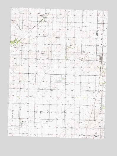
Castleton, IL USGS Topographic Map
Click on map above to begin viewing in our Map Viewer.

This topographic map contains these locations and features:
Feature Name Type Latitude Longitude GNIS ID View Map
Baughn School (historical)SchoolN41.0467°W89.7257°403973View Map
Breezy Point Landing Strip (historical)AirportN41.0811°W89.7104°1725350View Map
Camp CreekStreamN41.0111°W89.7318°405453View Map
Camp GrovePopulated PlaceN41.0789°W89.6332°405471View Map
Camp Grove Community Fire DistrictBuildingN41.0788°W89.6318°2640194View Map
CastletonPopulated PlaceN41.1178°W89.7062°405694View Map
Castleton Post OfficePost OfficeN41.1177°W89.7067°1821213View Map
Colgan School (historical)SchoolN41.0170°W89.6582°406363View Map
Dewey School (historical)SchoolN41.0461°W89.6582°407170View Map
Eagleston CemeteryCemeteryN41.0978°W89.6868°407582View Map
Grant CemeteryCemeteryN41.0775°W89.6576°1866781View Map
Grant School (historical)SchoolN41.0767°W89.6568°409303View Map
Jefferson School (historical)SchoolN41.0761°W89.7343°411070View Map
Kellogg School (historical)SchoolN41.0406°W89.6304°411365View Map
Lincoln School (historical)SchoolN41.0759°W89.6968°412172View Map
Logan School (historical)SchoolN41.1045°W89.6584°412519View Map
Pleasant Valley CemeteryCemeteryN41.0750°W89.7165°415899View Map
Saint Timothy Lutheran ChurchChurchN41.0767°W89.6593°1725351View Map
Sheridan School (historical)SchoolN41.0467°W89.6959°418356View Map
Tanner's OrchardLocaleN41.0300°W89.6256°2556432View Map
Township of PennCivilN41.1047°W89.6961°429546View Map
Township of ValleyCivilN41.0176°W89.6964°429860View Map
Valley Center School (historical)SchoolN41.0175°W89.6968°420199View Map
Valley Grove School (historical)SchoolN41.0170°W89.7343°420201View Map
Valley SchoolSchoolN41.0170°W89.6979°1725352View Map

Note: Coordinates in the location and feature list above are referenced to NAD83 datum.


Copyright (C) 2008-2025 Ryan Niemi / Sunset Dynamics ... All Rights Reserved