TopoQuest Logo
Do you find TopoQuest useful?
Help keep TopoQuest running and adding new maps/features by donating!
Bitcoin:  19c7KJd3qBynnjoSw5npx9KScwjBe4ifkT
Litecoin:  LXs6TkuXGGXo1vDsWCkWVdjQX94eUKd6ui
Home View Maps Find Maps Find Places Resources & Links


Whitehouse, Ohio Topographic Map

USGS Map Title: Whitehouse, OH
USGS Map MRC: 41083E7
DRG (GeoTIFF) Download: o41083e7.tif


Neighboring USGS Topographic Map Quads:


  Assumption, OH  
41083F8
 

  Berkey, OH  
41083F7
 

  Sylvania, OH  
41083F6
 

  Swanton, OH  
41083E8
 

  Whitehouse, OH  
41083E7
 

  Maumee, OH  
41083E6
 

  Colton, OH  
41083D8
 

  Grand Rapids, OH  
41083D7
 

  Bowling Green North, OH  
41083D6


Map MRC Location:

N42°
W84°
N42°
W83°
H8 H7 H6 H5 H4 H3 H2 H1
G8 G7 G6 G5 G4 G3 G2 G1
F8 F7 F6 F5 F4 F3 F2 F1
E8 E7 E6 E5 E4 E3 E2 E1
D8 D7 D6 D5 D4 D3 D2 D1
C8 C7 C6 C5 C4 C3 C2 C1
B8 B7 B6 B5 B4 B3 B2 B1
A8 A7 A6 A5 A4 A3 A2 A1
N41°
W84°
N41°
W83°

Whitehouse, OH USGS 1:24K Topographic Map Preview:
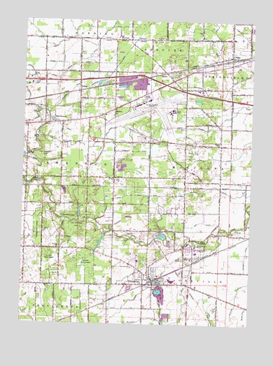
Whitehouse, OH USGS Topographic Map
Click on map above to begin viewing in our Map Viewer.

This topographic map contains these locations and features:
Feature Name Type Latitude Longitude GNIS ID View Map
Ai CreekStreamN41.5656°W83.8677°1037331View Map
Anthony Wayne High SchoolSchoolN41.5326°W83.7799°1037438View Map
Antioch Baptist ChurchChurchN41.5598°W83.8261°1072186View Map
Arrowhead LakePopulated PlaceN41.5989°W83.8361°2678140View Map
Bench DitchCanalN41.6164°W83.8544°1037846View Map
Benien DitchCanalN41.5503°W83.8305°1037851View Map
Bird Family CemeteryCemeteryN41.5498°W83.8535°1962968View Map
Blue CreekStreamN41.5003°W83.7938°1060885View Map
Bovee DitchCanalN41.5531°W83.8161°1038216View Map
Buchman DitchCanalN41.5287°W83.7524°1038445View Map
Bushnell DitchCanalN41.5748°W83.8563°1038558View Map
Butler DitchCanalN41.6192°W83.7713°1038565View Map
Cairl DitchCanalN41.5909°W83.7566°1038606View Map
Chateau EstatesPopulated PlaceN41.6028°W83.7936°2678141View Map
Cook School (historical)SchoolN41.5598°W83.8255°1051560View Map
CrisseyPopulated PlaceN41.6103°W83.7619°1070725View Map
Crissey Elementary SchoolSchoolN41.6104°W83.7622°1051567View Map
Cunningham DitchCanalN41.5948°W83.7749°1039538View Map
Cutshall DitchCanalN41.5606°W83.8086°1039553View Map
Dedman School (historical)SchoolN41.5164°W83.7852°1051564View Map
Dennis DitchCanalN41.6073°W83.8591°1039674View Map
East SwantonPopulated PlaceN41.5828°W83.8544°1040015View Map
East Swanton CemeteryCemeteryN41.5851°W83.8622°1962969View Map
Eber DitchCanalN41.5420°W83.7752°1040060View Map
Emmanuel Mennonite ChurchChurchN41.5198°W83.8047°1807557View Map
Evans DitchCanalN41.5353°W83.8577°1040258View Map
Evergreen LakeReservoirN41.5337°W83.8318°1079509View Map
Evergreen Lake DamDamN41.5334°W83.8316°1079508View Map
Fallen Timbers Middle SchoolSchoolN41.5309°W83.7799°1056285View Map
Felt School (historical)SchoolN41.5592°W83.7722°1051565View Map
Franklin CemeteryCemeteryN41.5295°W83.8549°1962971View Map
Franklin School (historical)SchoolN41.5312°W83.8547°1051555View Map
Frogpond School (historical)SchoolN41.6173°W83.8174°1051563View Map
Gale RunStreamN41.5426°W83.8441°1066722View Map
GardenPopulated PlaceN41.6042°W83.7963°1063112View Map
Gruboak School (historical)SchoolN41.5892°W83.8255°1051562View Map
Harkum School (historical)SchoolN41.5751°W83.7772°1051566View Map
Hatch School (historical)SchoolN41.5603°W83.8688°1051556View Map
Heath DitchCanalN41.5134°W83.7735°1041443View Map
Hill DitchCanalN41.5803°W83.8280°1041583View Map
Hope United Methodist ChurchChurchN41.5339°W83.7961°1807558View Map
Iron Ore DitchCanalN41.5159°W83.8666°1066768View Map
Irwin ChurchChurchN41.6201°W83.7799°1042000View Map
Kujowski Central DitchCanalN41.6051°W83.7841°1042349View Map
Larc CampLocaleN41.5270°W83.8455°1042422View Map
Love ChurchChurchN41.6170°W83.8069°1042799View Map
Lucas County Emergency Medical Services Life Squad 9BuildingN41.5171°W83.7952°2550713View Map
Lucas County Emergency Medical Services Lifesquad 10BuildingN41.6122°W83.7620°2550808View Map
Lytle DitchCanalN41.5067°W83.7733°1042855View Map
Mennonite CemeteryCemeteryN41.5239°W83.7816°1962976View Map
Metropolitan ParkParkN41.5587°W83.8655°1043240View Map
MidwayPopulated PlaceN41.5884°W83.8255°1065782View Map
Midway (historical)Populated PlaceN41.5564°W83.8249°1051559View Map
Muntwiller DitchCanalN41.5945°W83.7949°1066358View Map
Murbach DitchCanalN41.6006°W83.8669°1043737View Map
Oak DitchCanalN41.5234°W83.8080°1044022View Map
Oak Grove School (historical)SchoolN41.5459°W83.7855°1069576View Map
Oak Openings Preserve MetroparkParkN41.5709°W83.8636°1044045View Map
Ohio State Highway Patrol - Toledo Patrol PostBuildingN41.6010°W83.7908°2733119View Map
Rakestraw DitchCanalN41.5095°W83.8416°1044846View Map
Rhuland DitchCanalN41.5942°W83.8524°1045283View Map
Roberts ChapelChurchN41.5742°W83.7683°1045089View Map
Rocky Ridge Airpark (historical)AirportN41.5078°W83.7713°1083093View Map
Roth CemeteryCemeteryN41.5562°W83.7541°1045217View Map
Rupp CemeteryCemeteryN41.5323°W83.7857°1962979View Map
Ryan DitchCanalN41.5431°W83.8008°1045303View Map
Scott DitchCanalN41.5814°W83.8555°1046061View Map
South SwantonPopulated PlaceN41.5823°W83.8633°1051557View Map
Springfield Township Fire Department Station 2BuildingN41.6122°W83.7620°2549063View Map
Stone DitchCanalN41.5717°W83.7552°1046710View Map
Strong DitchCanalN41.6217°W83.8566°1046772View Map
Stull DitchCanalN41.6223°W83.8224°1048377View Map
Swanton Township SchoolSchoolN41.5862°W83.8305°1051561View Map
Swanton Upground Reservoir DamDamN41.5684°W83.8733°1078970View Map
Toledo Air Guard Fire DepartmentBuildingN41.5887°W83.7928°2550352View Map
Toledo Express AirportAirportN41.5925°W83.8061°1083057View Map
Toledo Lucas County Port Authority Fire DepartmentBuildingN41.5912°W83.8090°2549143View Map
Township of HardingCivilN41.6238°W83.8422°1086525View Map
Township of MonclovaCivilN41.5625°W83.7506°1086528View Map
Township of SwantonCivilN41.5625°W83.8468°1086535View Map
Township of WatervilleCivilN41.5063°W83.7802°1086539View Map
Valley Wood Golf ClubLocaleN41.5864°W83.8708°1047410View Map
Van Fleet DitchCanalN41.5567°W83.7685°1047411View Map
Village of WhitehouseCivilN41.5213°W83.7965°2400165View Map
Webster DitchCanalN41.5712°W83.8130°1047651View Map
Weot DitchCanalN41.5759°W83.7830°1047682View Map
WhitehousePopulated PlaceN41.5189°W83.8038°1056573View Map
Whitehouse CemeteryCemeteryN41.5205°W83.7838°1962986View Map
Whitehouse Elementary SchoolSchoolN41.5212°W83.8058°1051558View Map
Whitehouse Fire DepartmentBuildingN41.5171°W83.7950°2549768View Map
Whitehouse Police DepartmentBuildingN41.5141°W83.8024°2732723View Map
WilkinsPopulated PlaceN41.5973°W83.8455°1063095View Map
Wilkins United Methodist ChurchChurchN41.5978°W83.8449°1071967View Map
Winslow CemeteryCemeteryN41.5345°W83.8008°1962987View Map
Wood DitchCanalN41.6087°W83.7649°1048064View Map
Zaleski DitchCanalN41.5812°W83.7841°1048221View Map
Zeigler Landing StripAirportN41.6041°W83.8700°1083037View Map
Zion United Methodist ChurchChurchN41.5189°W83.8041°1807559View Map

Note: Coordinates in the location and feature list above are referenced to NAD83 datum.


Copyright (C) 2008-2025 Ryan Niemi / Sunset Dynamics ... All Rights Reserved