TopoQuest Logo
Do you find TopoQuest useful?
Help keep TopoQuest running and adding new maps/features by donating!
Bitcoin:  19c7KJd3qBynnjoSw5npx9KScwjBe4ifkT
Litecoin:  LXs6TkuXGGXo1vDsWCkWVdjQX94eUKd6ui
Home View Maps Find Maps Find Places Resources & Links


Assumption, Ohio Topographic Map

USGS Map Title: Assumption, OH
USGS Map MRC: 41083F8
DRG (GeoTIFF) Download: o41083f8.tif


Neighboring USGS Topographic Map Quads:


  Jasper, MI  
41084G1
 

  Palmyra, MI  
41083G8
 

  Blissfield, MI  
41083G7
 

  Lyons, OH  
41084F1
 

  Assumption, OH  
41083F8
 

  Berkey, OH  
41083F7
 

  Delta, OH  
41084E1
 

  Swanton, OH  
41083E8
 

  Whitehouse, OH  
41083E7


Map MRC Location:

N42°
W84°
N42°
W83°
H8 H7 H6 H5 H4 H3 H2 H1
G8 G7 G6 G5 G4 G3 G2 G1
F8 F7 F6 F5 F4 F3 F2 F1
E8 E7 E6 E5 E4 E3 E2 E1
D8 D7 D6 D5 D4 D3 D2 D1
C8 C7 C6 C5 C4 C3 C2 C1
B8 B7 B6 B5 B4 B3 B2 B1
A8 A7 A6 A5 A4 A3 A2 A1
N41°
W84°
N41°
W83°

Assumption, OH USGS 1:24K Topographic Map Preview:
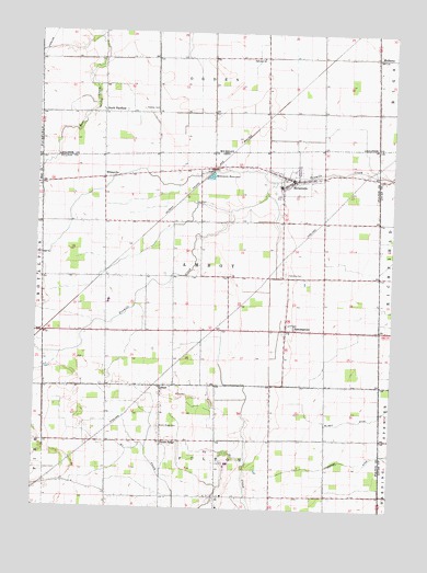
Assumption, OH USGS Topographic Map
Click on map above to begin viewing in our Map Viewer.

This topographic map contains these locations and features:
Feature Name Type Latitude Longitude GNIS ID View Map
AiPopulated PlaceN41.6281°W83.9352°1048449View Map
Ai CemeteryCemeteryN41.6287°W83.9380°1960493View Map
Ai Post Office (historical)Post OfficeN41.6278°W83.9347°1083287View Map
Ai Union ChurchChurchN41.6284°W83.9391°1071862View Map
Amboy Township CemeteryCemeteryN41.6867°W83.9112°1960494View Map
AssumptionPopulated PlaceN41.6720°W83.9116°1048469View Map
Beroske Farms and GreenhouseLocaleN41.6517°W83.9586°2652241View Map
Blain School (historical)SchoolN41.6889°W83.9983°1080959View Map
ChampionPopulated PlaceN41.7148°W83.9333°1062443View Map
Dennis School (historical)SchoolN41.6437°W83.8786°1080953View Map
Dowling Dairy FarmsLocaleN41.6464°W83.9175°2585379View Map
Dutch RidgePopulated PlaceN41.6426°W83.9549°1062741View Map
Dutch Ridge CemeteryCemeteryN41.6462°W83.9558°1039903View Map
Evergreen High SchoolSchoolN41.6792°W83.9741°1055284View Map
Evergreen Middle SchoolSchoolN41.7098°W83.9144°1055286View Map
Fairview ChurchChurchN41.7434°W83.9224°625774View Map
Faith Lutheran ChurchChurchN41.7123°W83.9113°1071875View Map
Favorite School (historical)SchoolN41.6434°W83.9169°1080954View Map
Finnigan School (historical)SchoolN41.6856°W83.8947°1080951View Map
Fulton Elementary schoolSchoolN41.6253°W83.9347°1055289View Map
Lebanon Evangelical Church (historical)ChurchN41.6423°W83.9555°1079679View Map
Leslie (historical)Populated PlaceN41.6856°W83.9519°1067162View Map
Leslie Post Office (historical)Post OfficeN41.6862°W83.9513°1987676View Map
Little Bear CreekStreamN41.7139°W83.9988°1042644View Map
LyttonPopulated PlaceN41.6573°W83.9552°1042857View Map
Lytton Post Office (historical)Post OfficeN41.6570°W83.9555°1987677View Map
Lytton Zion United Church of ChristChurchN41.6556°W83.9552°1079560View Map
MetamoraPopulated PlaceN41.7117°W83.9097°1048968View Map
Metamora Amboy Volunteer Fire DepartmentBuildingN41.7100°W83.9109°2549389View Map
Metamora Post OfficePost OfficeN41.7117°W83.9108°1987650View Map
Metamora ReservoirReservoirN41.7123°W83.9390°1043237View Map
Metamora United Methodist ChurchChurchN41.7112°W83.9097°1071886View Map
Mobes School (historical)SchoolN41.7012°W83.9766°1080958View Map
Mountain Assembly of God ChurchChurchN41.6423°W83.9555°1079683View Map
MulberryPopulated PlaceN41.7437°W83.8816°633095View Map
Mulberry Post Office (historical)Post OfficeN41.7436°W83.8817°2435673View Map
Nevitt School (historical)SchoolN41.6667°W83.8977°1080952View Map
Peebles CemeteryCemeteryN41.7298°W83.9636°634559View Map
Saint Marys Catholic CemeteryCemeteryN41.6714°W83.9130°1960511View Map
Saint Marys Catholic ChurchChurchN41.6717°W83.9033°1071892View Map
School Number 15 (historical)SchoolN41.6284°W83.9394°1080957View Map
Shook School (historical)SchoolN41.6628°W83.9411°1080956View Map
Siney (historical)Populated PlaceN41.6564°W83.9966°1067163View Map
Siney Post Office (historical)Post OfficeN41.6570°W83.9972°1987684View Map
South FairfieldPopulated PlaceN41.7287°W83.9772°1617858View Map
South Fairfield Post Office (historical)Post OfficeN41.7286°W83.9772°2435597View Map
Special School (historical)SchoolN41.6564°W83.9788°1080961View Map
Townline (historical)Populated PlaceN41.7098°W83.9986°1067164View Map
Township of AmboyCivilN41.6880°W83.9382°1086120View Map
Treadway (historical)Populated PlaceN41.7123°W83.8805°1080950View Map
Tripp School (historical)SchoolN41.6912°W83.9424°1080955View Map
Village of MetamoraCivilN41.7113°W83.9054°2399324View Map
WhitevillePopulated PlaceN41.7117°W83.9763°1063093View Map
Whiteville Post Office (historical)Post OfficeN41.7112°W83.9763°1083294View Map
Wright School (historical)SchoolN41.6717°W83.9605°1080960View Map

Note: Coordinates in the location and feature list above are referenced to NAD83 datum.


Copyright (C) 2008-2024 Ryan Niemi / Sunset Dynamics ... All Rights Reserved