TopoQuest Logo
Do you find TopoQuest useful?
Help keep TopoQuest running and adding new maps/features by donating!
Bitcoin:  19c7KJd3qBynnjoSw5npx9KScwjBe4ifkT
Litecoin:  LXs6TkuXGGXo1vDsWCkWVdjQX94eUKd6ui
Home View Maps Find Maps Find Places Resources & Links


Whitesville, Kentucky Topographic Map

USGS Map Title: Whitesville, KY
USGS Map MRC: 37086F7
DRG (GeoTIFF) Download: o37086f7.tif


Neighboring USGS Topographic Map Quads:


  Maceo, KY  
37086G8
 

  Pellville, KY  
37086G7
 

  Cloverport, KY  
37086G6
 

  Philpot, KY  
37086F8
 

  Whitesville, KY  
37086F7
 

  Fordsville, KY  
37086F6
 

  Pleasant Ridge, KY  
37086E8
 

  Dundee, KY  
37086E7
 

  Olaton, KY  
37086E6


Map MRC Location:

N38°
W87°
N38°
W86°
H8 H7 H6 H5 H4 H3 H2 H1
G8 G7 G6 G5 G4 G3 G2 G1
F8 F7 F6 F5 F4 F3 F2 F1
E8 E7 E6 E5 E4 E3 E2 E1
D8 D7 D6 D5 D4 D3 D2 D1
C8 C7 C6 C5 C4 C3 C2 C1
B8 B7 B6 B5 B4 B3 B2 B1
A8 A7 A6 A5 A4 A3 A2 A1
N37°
W87°
N37°
W86°

Whitesville, KY USGS 1:24K Topographic Map Preview:
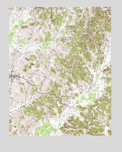
Whitesville, KY USGS Topographic Map
Click on map above to begin viewing in our Map Viewer.

This topographic map contains these locations and features:
Feature Name Type Latitude Longitude GNIS ID View Map
AetnavillePopulated PlaceN37.6728°W86.7905°485788View Map
Barnetts KnobSummitN37.6752°W86.8573°2742910View Map
Barnetts Knob CemeteryCemeteryN37.6753°W86.8578°486413View Map
Bellamy CemeteryCemeteryN37.6398°W86.8017°486801View Map
Carter DitchCanalN37.6323°W86.8314°489006View Map
Cates CemeteryCemeteryN37.6820°W86.8575°489089View Map
City of WhitesvilleCivilN37.6831°W86.8696°2405737View Map
Daviess County Fire Department WhitesvilleBuildingN37.6829°W86.8647°2637048View Map
DeanefieldPopulated PlaceN37.6595°W86.8069°507827View Map
Ellis CemeteryCemeteryN37.6767°W86.8192°491715View Map
Fordsville DivisionCivilN37.6280°W86.7520°1937005View Map
Friendship ChurchChurchN37.6412°W86.7744°492553View Map
Haynes CemeteryCemeteryN37.6873°W86.7703°493921View Map
HaynesvillePopulated PlaceN37.6851°W86.7567°508209View Map
HerbertPopulated PlaceN37.7187°W86.7994°508225View Map
North Branch South Fork Panther CreekStreamN37.6914°W86.7600°499538View Map
Old Panther ChurchChurchN37.7187°W86.8097°499865View Map
Reynolds StationLocaleN37.6548°W86.8042°501749View Map
RosevillePopulated PlaceN37.7173°W86.7550°508976View Map
Roseville CemeteryCemeteryN37.7223°W86.7572°502354View Map
Saint Mary of the Woods CemeteryCemeteryN37.6606°W86.8711°502687View Map
Saint Thomas ChurchChurchN37.7220°W86.7780°502751View Map
South Branch South Fork Panther CreekStreamN37.6914°W86.7600°503893View Map
West Point Baptist ChurchChurchN37.7282°W86.7791°506468View Map
WhitesvillePopulated PlaceN37.6831°W86.8714°506683View Map
Zion ChurchChurchN37.6676°W86.7603°507285View Map

Note: Coordinates in the location and feature list above are referenced to NAD83 datum.


Copyright (C) 2008-2025 Ryan Niemi / Sunset Dynamics ... All Rights Reserved