TopoQuest Logo
Do you find TopoQuest useful?
Help keep TopoQuest running and adding new maps/features by donating!
Bitcoin:  19c7KJd3qBynnjoSw5npx9KScwjBe4ifkT
Litecoin:  LXs6TkuXGGXo1vDsWCkWVdjQX94eUKd6ui
Home View Maps Find Maps Find Places Resources & Links


Pellville, Kentucky Topographic Map

USGS Map Title: Pellville, KY
USGS Map MRC: 37086G7
DRG (GeoTIFF) Download: o37086g7.tif


Neighboring USGS Topographic Map Quads:


  Lewisport, KY  
37086H8
 

  Tell City, IN  
37086H7
 

  Cannelton, IN  
37086H6
 

  Maceo, KY  
37086G8
 

  Pellville, KY  
37086G7
 

  Cloverport, KY  
37086G6
 

  Philpot, KY  
37086F8
 

  Whitesville, KY  
37086F7
 

  Fordsville, KY  
37086F6


Map MRC Location:

N38°
W87°
N38°
W86°
H8 H7 H6 H5 H4 H3 H2 H1
G8 G7 G6 G5 G4 G3 G2 G1
F8 F7 F6 F5 F4 F3 F2 F1
E8 E7 E6 E5 E4 E3 E2 E1
D8 D7 D6 D5 D4 D3 D2 D1
C8 C7 C6 C5 C4 C3 C2 C1
B8 B7 B6 B5 B4 B3 B2 B1
A8 A7 A6 A5 A4 A3 A2 A1
N37°
W87°
N37°
W86°

Pellville, KY USGS 1:24K Topographic Map Preview:
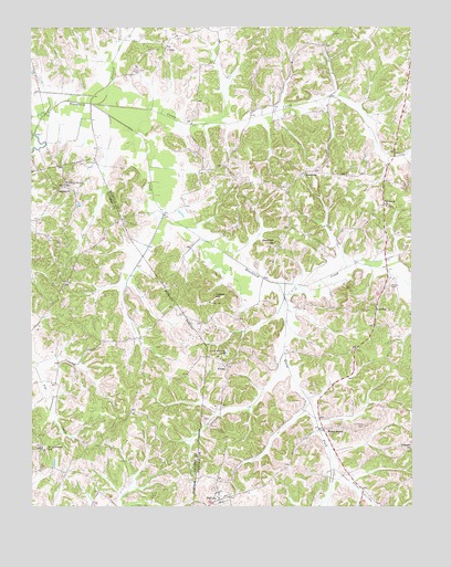
Pellville, KY USGS Topographic Map
Click on map above to begin viewing in our Map Viewer.

This topographic map contains these locations and features:
Feature Name Type Latitude Longitude GNIS ID View Map
Bates HollowValleyN37.7595°W86.7750°486467View Map
Blackford Baptist ChurchChurchN37.8181°W86.7955°487411View Map
Caney CreekStreamN37.8548°W86.8550°488842View Map
ChambersPopulated PlaceN37.8373°W86.7853°507682View Map
Chambers CemeteryCemeteryN37.8637°W86.8411°489321View Map
Concord ChurchChurchN37.7648°W86.7505°489934View Map
Driskell BranchStreamN37.8551°W86.8533°491126View Map
Flat Branch Horse ForkStreamN37.7903°W86.7919°2743744View Map
FloralPopulated PlaceN37.7867°W86.8108°508017View Map
Friendly Grove ChurchChurchN37.8339°W86.8644°492535View Map
GatewoodPopulated PlaceN37.8331°W86.8661°508075View Map
GoeringPopulated PlaceN37.8009°W86.7617°508103View Map
Hancock CountyCivilN37.8415°W86.7779°516892View Map
Horse ForkStreamN37.8078°W86.7944°494577View Map
Indian HillSummitN37.8045°W86.8125°494960View Map
Lamar CemeteryCemeteryN37.8745°W86.8500°495932View Map
Mount Eden Baptist ChurchChurchN37.8282°W86.7583°498719View Map
Oak Grove CemeteryCemeteryN37.7703°W86.7672°499665View Map
PellvillePopulated PlaceN37.7523°W86.8136°500366View Map
Powers CemeteryCemeteryN37.8073°W86.7569°501257View Map
Saint Lawrence (historical)Populated PlaceN37.7593°W86.8647°2742946View Map
Saint Lawrence SchoolSchoolN37.7651°W86.8700°502671View Map
Schafer Memorial CampSchoolN37.7909°W86.8108°503040View Map
South Hancock Fire DepartmentBuildingN37.7523°W86.8131°2637050View Map
UtilityLocaleN37.8698°W86.8305°505929View Map
WeberstownPopulated PlaceN37.7703°W86.7789°509330View Map

Note: Coordinates in the location and feature list above are referenced to NAD83 datum.


Copyright (C) 2008-2025 Ryan Niemi / Sunset Dynamics ... All Rights Reserved