TopoQuest Logo
Do you find TopoQuest useful?
Help keep TopoQuest running and adding new maps/features by donating!
Bitcoin:  19c7KJd3qBynnjoSw5npx9KScwjBe4ifkT
Litecoin:  LXs6TkuXGGXo1vDsWCkWVdjQX94eUKd6ui
Home View Maps Find Maps Find Places Resources & Links


Whitmell, Virginia Topographic Map

USGS Map Title: Whitmell, VA
USGS Map MRC: 36079F5
DRG (GeoTIFF) Download: o36079f5.tif


Neighboring USGS Topographic Map Quads:


  Mountain Valley, VA  
36079G6
 

  Callands, VA  
36079G5
 

  Chatham, VA  
36079G4
 

  Axton, VA  
36079F6
 

  Whitmell, VA  
36079F5
 

  Mount Hermon, VA  
36079F4
 

  Northeast Eden, NC  
36079E6
 

  Brosville, VA  
36079E5
 

  Danville, VA  
36079E4


Map MRC Location:

N37°
W80°
N37°
W79°
H8 H7 H6 H5 H4 H3 H2 H1
G8 G7 G6 G5 G4 G3 G2 G1
F8 F7 F6 F5 F4 F3 F2 F1
E8 E7 E6 E5 E4 E3 E2 E1
D8 D7 D6 D5 D4 D3 D2 D1
C8 C7 C6 C5 C4 C3 C2 C1
B8 B7 B6 B5 B4 B3 B2 B1
A8 A7 A6 A5 A4 A3 A2 A1
N36°
W80°
N36°
W79°

Whitmell, VA USGS 1:24K Topographic Map Preview:
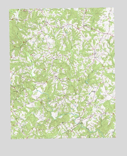
Whitmell, VA USGS Topographic Map
Click on map above to begin viewing in our Map Viewer.

This topographic map contains these locations and features:
Feature Name Type Latitude Longitude GNIS ID View Map
Adams School (historical)SchoolN36.7257°W79.5898°1738302View Map
Bacon PondReservoirN36.6428°W79.5805°1490579View Map
Bawley BranchStreamN36.7149°W79.6114°1462836View Map
Bethel ChurchChurchN36.6796°W79.5636°1463160View Map
Bethlehem ChurchChurchN36.6710°W79.6167°1463225View Map
Canaan ChurchChurchN36.6943°W79.5748°1464387View Map
Carter School (historical)SchoolN36.7235°W79.5836°1738309View Map
Coon BranchStreamN36.6762°W79.6089°1465211View Map
Dunbar CreekStreamN36.6321°W79.5192°1466039View Map
Hardys CreekStreamN36.6362°W79.5409°1467745View Map
HinesvillePopulated PlaceN36.7018°W79.5731°1477415View Map
Layton Bacon DamDamN36.6418°W79.5798°1490578View Map
Little Stewart CreekStreamN36.6660°W79.5423°1469659View Map
Oakes DamDamN36.7368°W79.5081°1490608View Map
Pittsylvania County Riding Club DamDamN36.6801°W79.5348°1490607View Map
Rocky BranchStreamN36.6251°W79.5314°1473444View Map
Saint Johns ChurchChurchN36.6432°W79.5423°1473755View Map
Saint Matthews ChurchChurchN36.6826°W79.5673°1473845View Map
SharonPopulated PlaceN36.6585°W79.5303°1477742View Map
Sharon ChurchChurchN36.6571°W79.5320°1738353View Map
Sharon School (historical)SchoolN36.6485°W79.5122°1738354View Map
Silver CreekStreamN36.6371°W79.5406°1474592View Map
Silver Creek ChurchChurchN36.6449°W79.5406°1474594View Map
South Prong Sandy RiverStreamN36.6710°W79.5928°1474886View Map
Stewart CreekStreamN36.6479°W79.5467°1475132View Map
Stony MillPopulated PlaceN36.6396°W79.5439°1500171View Map
Stony Mill Elementary SchoolSchoolN36.6400°W79.5636°1475211View Map
Strawberry ChurchChurchN36.7460°W79.5342°1475242View Map
Sugartree ChurchChurchN36.6626°W79.5956°1475300View Map
Sugartree CreekStreamN36.6504°W79.5767°1475301View Map
SwansonvillePopulated PlaceN36.7365°W79.5789°1500200View Map
Swansonville ChurchChurchN36.7490°W79.5870°1475373View Map
Tarpleys ChapelChurchN36.7346°W79.5820°1475481View Map
Thompson School (historical)SchoolN36.6879°W79.6223°1738363View Map
Trelow School (historical)SchoolN36.6590°W79.6073°1738364View Map
Tunstall DistrictCivilN36.6759°W79.5983°1927541View Map
Tunstall High SchoolSchoolN36.6697°W79.5246°1475929View Map
Tunstall Middle SchoolSchoolN36.6677°W79.5264°2498640View Map
Tunstall Volunteer Fire and RescueBuildingN36.6726°W79.5220°2075245View Map
Union Hall ChurchChurchN36.7390°W79.5367°1476071View Map
Union Hill School (historical)SchoolN36.7387°W79.5367°1738365View Map
Unity School (historical)SchoolN36.6846°W79.5709°1738366View Map
VancePopulated PlaceN36.6662°W79.5584°1477839View Map
West Fork Sandy RiverStreamN36.7415°W79.6148°1476488View Map
WhitmellPopulated PlaceN36.7024°W79.5236°1477875View Map
Whitmell ChurchChurchN36.7315°W79.5634°1476690View Map
Whitmell Elementary SchoolSchoolN36.7062°W79.5225°1738374View Map
Woods StoreLocaleN36.7324°W79.5367°1476971View Map
Wordens ChapelChurchN36.6807°W79.5445°1476990View Map

Note: Coordinates in the location and feature list above are referenced to NAD83 datum.


Copyright (C) 2008-2024 Ryan Niemi / Sunset Dynamics ... All Rights Reserved