TopoQuest Logo
Do you find TopoQuest useful?
Help keep TopoQuest running and adding new maps/features by donating!
Bitcoin:  19c7KJd3qBynnjoSw5npx9KScwjBe4ifkT
Litecoin:  LXs6TkuXGGXo1vDsWCkWVdjQX94eUKd6ui
Home View Maps Find Maps Find Places Resources & Links


Whittington Point, Maryland Topographic Map

USGS Map Title: Whittington Point, MD
USGS Map MRC: 38075A2
DRG (GeoTIFF) Download: o38075a2.tif


Neighboring USGS Topographic Map Quads:


  Public Landing, MD  
38075B3
 

  Tingles Island, MD  
38075B2


  Boxiron, MD  
38075A3
 

  Whittington Point, MD  
38075A2


  Chincoteague East, VA  
37075H3


Map MRC Location:

N39°
W76°
N39°
W75°
H8 H7 H6 H5 H4 H3 H2 H1
G8 G7 G6 G5 G4 G3 G2 G1
F8 F7 F6 F5 F4 F3 F2 F1
E8 E7 E6 E5 E4 E3 E2 E1
D8 D7 D6 D5 D4 D3 D2 D1
C8 C7 C6 C5 C4 C3 C2 C1
B8 B7 B6 B5 B4 B3 B2 B1
A8 A7 A6 A5 A4 A3 A2 A1
N38°
W76°
N38°
W75°

Whittington Point, MD USGS 1:24K Topographic Map Preview:
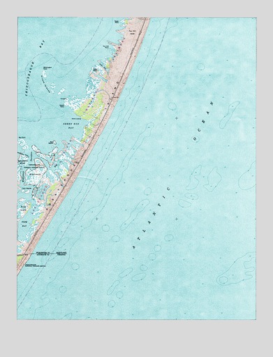
Whittington Point, MD USGS Topographic Map
Click on map above to begin viewing in our Map Viewer.

This topographic map contains these locations and features:
Feature Name Type Latitude Longitude GNIS ID View Map
Assateague IslandIslandN38.0918°W75.2038°1474224View Map
Assateague Island National SeashoreParkN38.0556°W75.2454°589056View Map
Bay CreekBayN38.0648°W75.2277°583062View Map
Bay IslandIslandN38.0735°W75.2299°583063View Map
Bay PointCapeN38.0746°W75.2471°583064View Map
Big LevelsAreaN38.1043°W75.1996°1853970View Map
Bounder PondLakeN38.0955°W75.2108°583333View Map
Chincoteague BayBayN38.1168°W75.2482°583758View Map
Fox Hill LevelLocaleN38.1190°W75.1888°584474View Map
Fox Hill PointCapeN38.1132°W75.1988°584475View Map
Green Run BayBayN38.0804°W75.2213°584750View Map
Green Run Inlet Life Saving StationBuildingN38.0833°W75.1917°2681397View Map
Jims GutGutN38.1048°W75.2046°585232View Map
Lone PondLakeN38.1035°W75.2088°585552View Map
MiddlemoorSwampN38.0593°W75.2399°585826View Map
Middlemoor DitchCanalN38.0682°W75.2460°585827View Map
Middlemoor ThorofareChannelN38.0626°W75.2469°585828View Map
Pirate IslandsIslandN38.0982°W75.2338°586576View Map
Pope BayBayN38.0418°W75.2441°588803View Map
Scotts LandingLocaleN38.0837°W75.2157°591242View Map
Scotts PointCapeN38.0893°W75.2244°587258View Map
Sugar PointCapeN38.1235°W75.1949°587622View Map
Twin IslandsIslandN38.0526°W75.2446°587932View Map
Whittington PointCapeN38.1029°W75.2357°588822View Map

Note: Coordinates in the location and feature list above are referenced to NAD83 datum.


Copyright (C) 2008-2024 Ryan Niemi / Sunset Dynamics ... All Rights Reserved